09/13/17 1:30pm

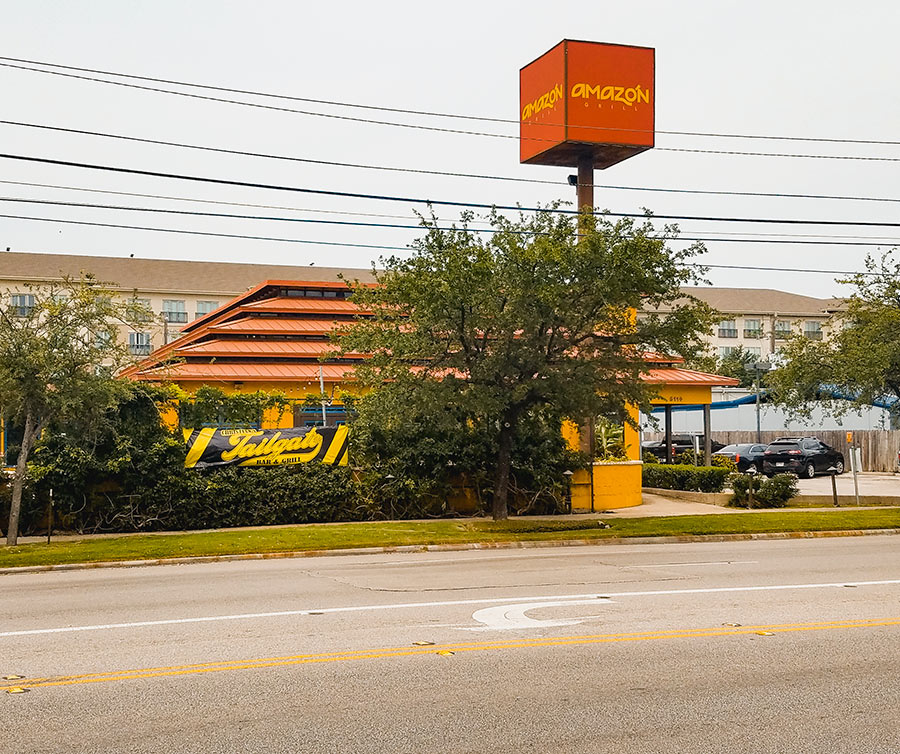
A new banner advertising a Christian’s Tailgate (pictured above) went up today on the vine-covered fence in front of the Amazón Grill at 5114 Kirby Dr., directly across from the Burger King between North Blvd. and Bissonnet St. The Cordúa Restaurants fast-casual outlet shut down yesterday after 15 years in the same location. The restaurants’ parent company, which also operates Américas, Artista, and Churrascos, plans to continue Amazón Grill as a delivery-only business.

As of today, the space is being renovated — with plans for a quick turnover and reopening as a fifth location of Christian’s Tailgate Bar & Grill on October 1st.

CONTINUE READING THIS STORY

Lower Upper Kirby
09/12/17 12:45pm

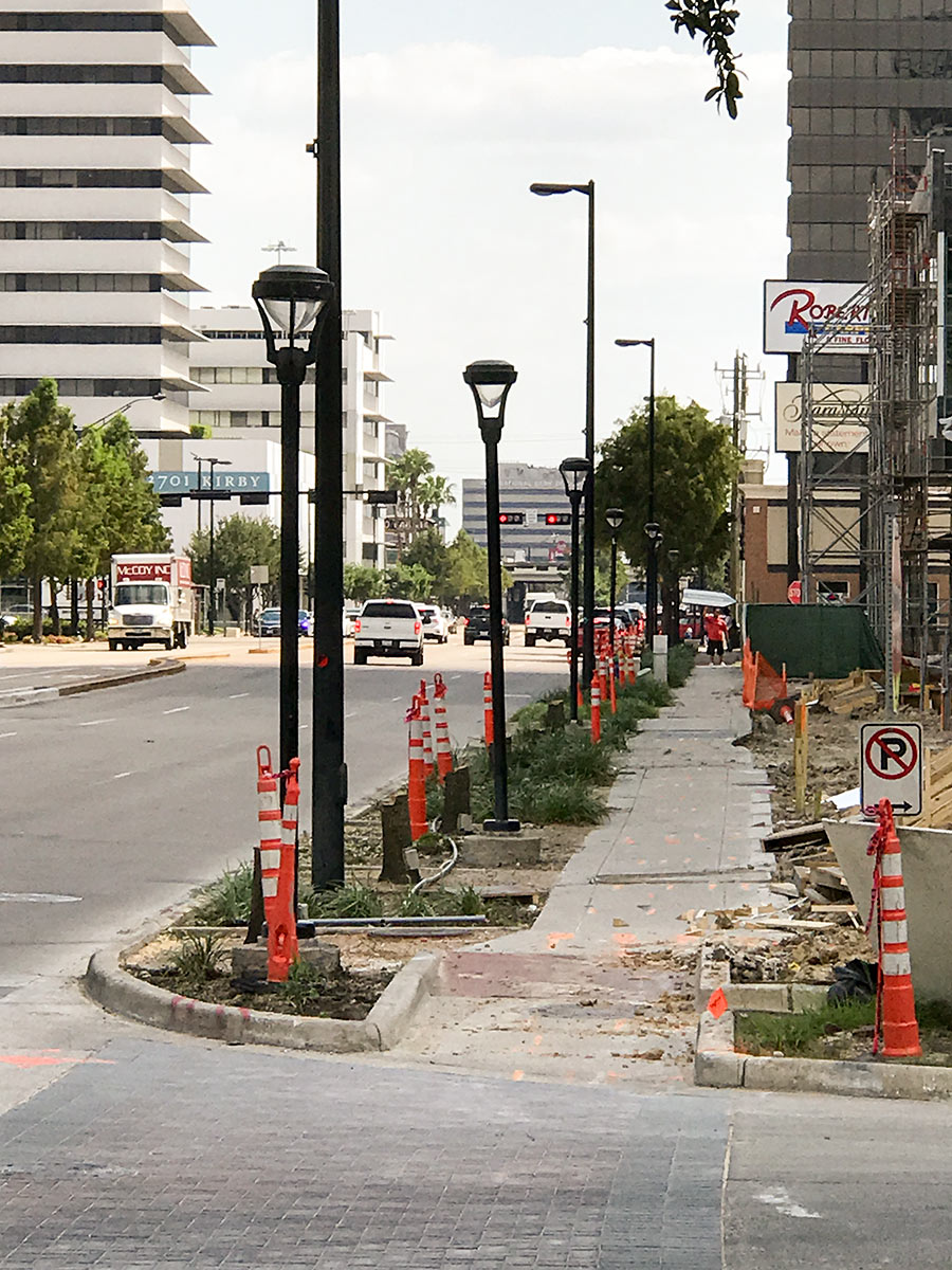
Sometime over the weekend the row of a dozen-plus street trees lining the west side of Kirby Dr. between W. Main St. and Colquitt got cut down, a Swamplot reader reports. This leaves the eastern front of the Kirby Collection construction site fronted by an alternating pattern of high and low streetlights and stumps. The wooden construction fence that stood for about a year just inside of the sidewalk in front of the mixed-use project is now gone. The photo above shows the view looking south now from the corner of W. Main St.

The removed “highrise” oaks had been installed 9 years ago with the reconstruction of Kirby Dr. — replacing the larger 20-year-old oaks that had been there earlier.

Photo: Swamplot inbox

Upper Kirby
09/12/17 10:30am

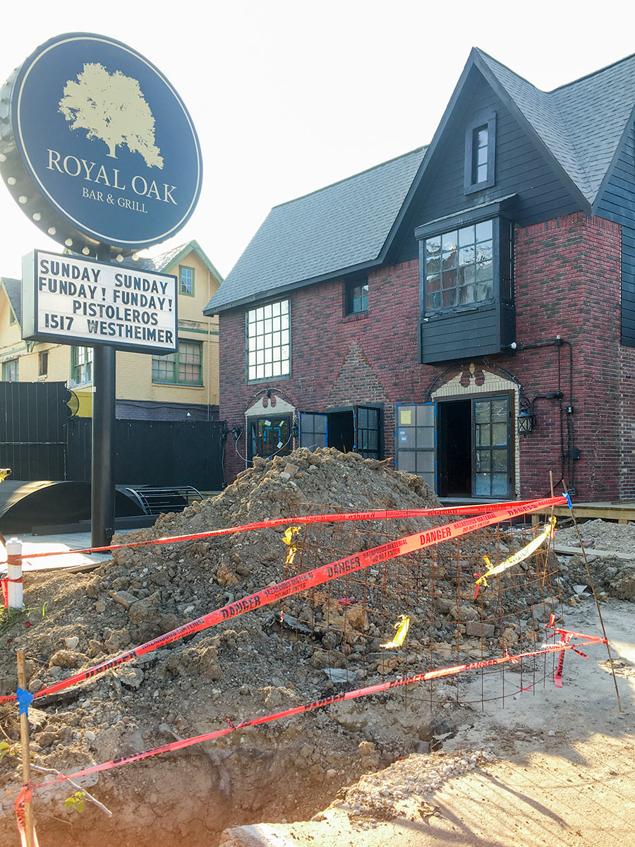
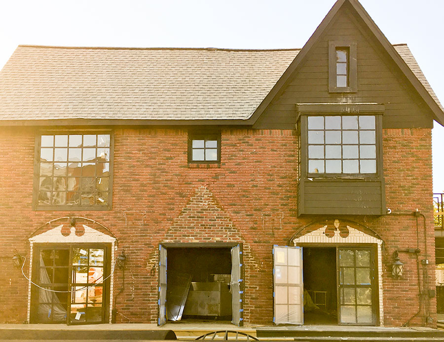
Here, courtesy of a Swamplot reader, are a few exterior views of the building at 1318 Westheimer after its weekend fire. “The damage is pretty severe,” Shawn Bermudez wrote on Facebook Saturday evening. The owner of Royal Oak Bar & Grill, which shut down in this location last September, had been renovating the property in order to reopen it as a bar named Present Company. That work was a month from completion, Bermudez estimates. Among the additions to the former 1950s home: new steel doors and windows. And here’s a view showing the current state of the new piggyback patio added in back:

CONTINUE READING THIS STORY

Bar and Grill
09/08/17 5:00pm

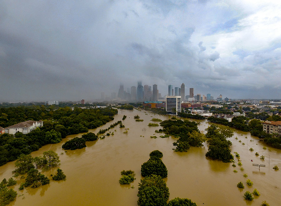
WHAT THE HARVEY FLOODING DID TO BUFFALO BAYOU PARK “Please know that Buffalo Bayou Park was designed to flood, although we did not anticipate three historic flooding events in 1-1/2 years,” Buffalo Bayou Partnership president Anne Olson remarks drily in an email update this afternoon. So what’s the damage? “The bottom two thirds of the park are still under water, and we expect that they will remain so for several more weeks as water is released from the Addicks and Barker reservoirs. Due to these circumstances, it is difficult for our staff to assess the impact the flowing water has had on the footpaths and landscape in these areas. We do know that the Johnny Steele Dog Park, which is still submerged, will be closed for two or three months.” Water and sediment that flooded the Buffalo Bayou Cistern is still draining, slowly, but the electrical system installed when the long-hidden underground space was made available for tours and art installations appears to be working. The Wortham Fountain and the trail lighting system have been damaged, Olson reports. The Bayou City Adventures kayak kiosk at Lost Lake and the Bike Barn at Sabine St. has been shut down for the remainder of the year at least; areas east of the Sabine St. bridge are mostly still underwater. But Olson reports landscaped areas in the upper areas of the park, where trails have already reopened, survived with only a small amount of damage: “We are extremely fortunate that the Lost Lake and Wortham Insurance Visitor Centers did not take on water. Both facilities are open and the Kitchen at The Dunlavy is operating with normal hours. Food trucks also are back in the entry court at Sabine Street from Thursday-Sunday.” Update: The Bike Barn at Sabine St. has resumed normal hours as of September 9. [Buffalo Bayou Partnership] Photo: Adam Brackman.  
09/08/17 1:15pm

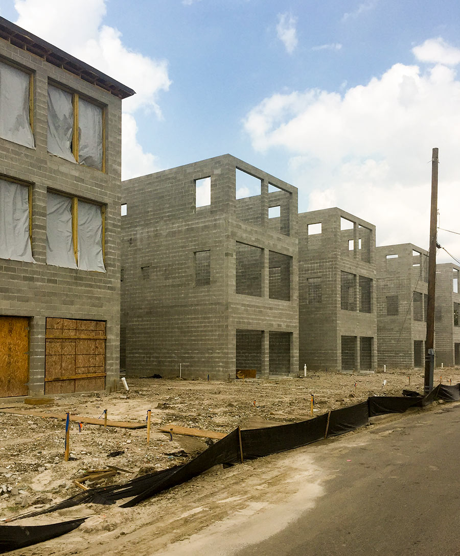
Going up along Rawley St. just east of Gregg St. in the Fifth Ward: A row of five 3-story freestanding concrete-block townhomes from a company called Castro Novum. The photos were taken earlier this week — after Harvey storms had cleared out of the area. The homes are 2 blocks north of Lyons Ave. and back up to Union Pacific’s Terminal Subdivision freight-rail line. This one is furthest along:

CONTINUE READING THIS STORY

5 in a Row
09/08/17 11:15am

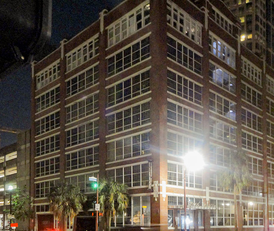
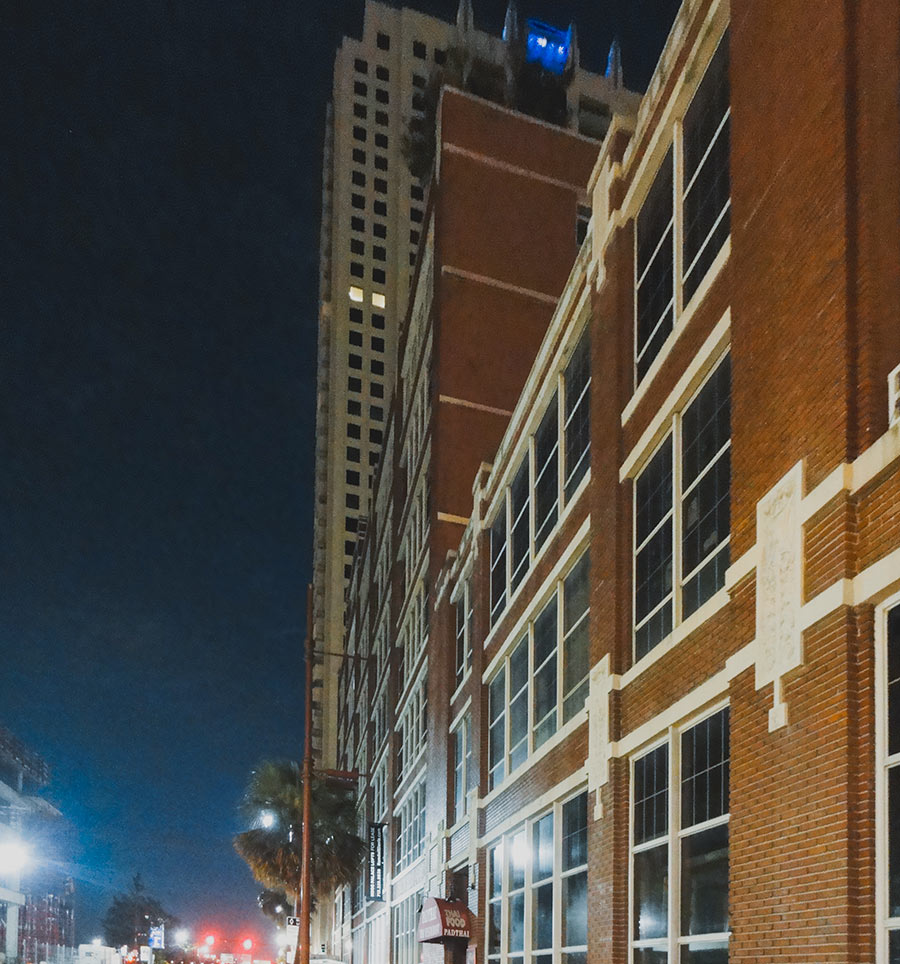
Today’s the day a 48-ft.-long trailer-mounted 1MW Aggreko generator is expected to park on the Louisiana St. side of the Hogg Palace Lofts, a Randall Davis Companies rep tells residents. The goal: Power restored in all 79 units by the end of the day. But generator power won’t be going to elevators, corridors, or the building’s retail tenants (which include the Pad Thai restaurant on Louisiana). Those areas will have to wait until replacement electrical equipment arrives and is installed to restore permanent power in the building. References to a series of so-far-unsuccessful efforts to repair existing equipment are included in a series of emails sent to residents by the building’s management over the last 2 weeks.

The 8-story building at the corner of Louisiana and Preston has been without power since around 8 am on August 27th. “What we as tenants have been able to piece together is sub-level parking levels of the Lyric Center and the new Lyric Center garage became flooded as the bayou took a short cut down Prairie and took a left on Louisiana,” a tenant tells Swamplot. Water coursed into those parking garages down entrance ramps, then “made it under the street through vaults or conduits or whatever into the basement of the Hogg where it shorted out the electrical equipment.”

CONTINUE READING THIS STORY

Harvey Outages
09/07/17 3:45pm

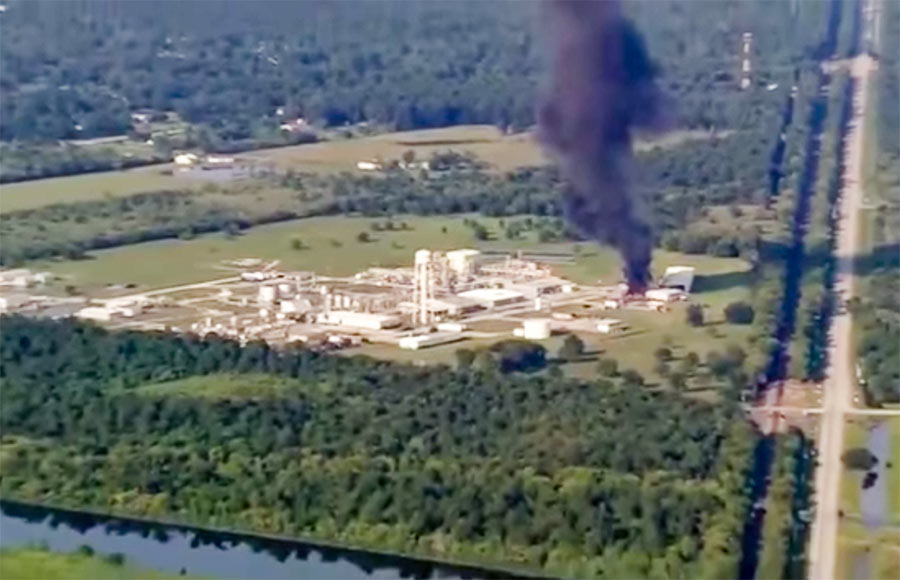
SOMETHING POWERFUL IN THE CROSBY AIR This vivid description is included in the original petition of a lawsuit filed today against Arkema, operators of the chemical plant off the Beaumont Hwy. in Crosby — by 7 first responders injured after incidents there last week: “In the early morning hours of August 31, 2017, the first of several explosions occurred as a result of the abandoned chemicals heating up and igniting. Although the explosions had occurred, no one from Arkema alerted the first responders who were manning the perimeter of the arbitrary mandatory evacuation area. Immediately upon being exposed to the fumes from the explosion. and one by one. the police officers and first responders began to fall ill in the middle of the road. Calls for medics were made, but still no one from Arkema warned of the toxic fumes in the air. Emergency medical personnel arrived on scene. and even before exiting their vehicle, they became overcome by the fumes as well. The scene was nothing less than chaos. Police officers were doubled over vomiting, unable to breathe. Medical personnel, in their attempts to provide assistance to the officers became overwhelmed and they too began to vomit and gasp for air. Some of the police officers. unable to abandon their vehicles due to their weapons being present, jumped in their vehicles and drove themselves to the nearest hospital. The other officers and medical personnel were all placed in an ambulance, and were driven to the hospital.” [Houston Chronicle; International Business Times] Still image of smoke from fire after Thursday’s explosion: abc13
09/06/17 9:30am

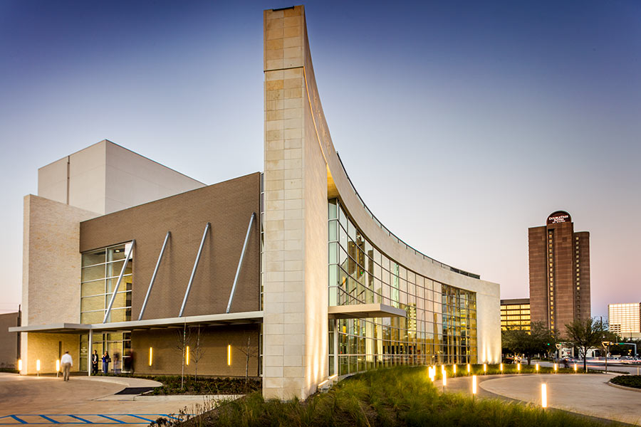
HARVEY NOW READY TO HIT GALLERIA THEATER A WEEK LATER THAN EXPECTED Opening night for Mary Chase’s 1945 Pulitzer Prize–winning play Harvey at the Jeannette and L.M. George Theater is now set for September 15th — just a week after its originally scheduled opening date was preempted by a downgraded Hurricane bearing the same name. The A.D. Players‘ brand-new playhouse at 5420 Westheimer, just west of the Galleria, did not flood and suffered only “minor leaks” from the storm, but in the immediate aftermath of Hurricane Harvey the theater-ministry group announced a decision to postpone its season-opening production, which stars an invisible rabbit named Harvey. New executive director Jake Speck says some new “arts-access and fundraising initiatives” will be announced soon. [A.D. Players; American Theatre; previously on Swamplot] Photo of George Theater: A.D. Players
09/05/17 4:15pm

By late afternoon on Sunday, August 27th, there were 2 ways out of several of the 3-story buildings at the Meyergrove Apartments at 4605 N. Braeswood — which back up to Brays Bayou in the southwest corner of the 610 Loop. There was rescue by boat (above) — from which you’d arrive to safety on a dry portion of the freeway:

CONTINUE READING THIS STORY

Harvey Ops
09/05/17 11:30am

After Harvey hit, 2 and a half ft. of water coursed through the Adams family’s single-story home off Stella Link just north of Brays Bayou. In the video above, Tony Adams gives a tour of what was left after a dozen volunteers from Redemption Church on Timberside Dr. spent 4 hours last Thursday clearing it out and depositing the family’s ruined possessions by the curb.

Then on Sunday, more visitors came by:

CONTINUE READING THIS STORY

Clean Break
09/04/17 2:00pm

Here’s an inside view of the aftermath and cleanup inside the Pool family’s 1964 Meyerland Mod on the south bank of Brays Bayou near S. Rice Ave. — from the point of view of the owners’ son-in-law, October Popular Mechanics coverboy Casey Neistat. Includes a few signature Neistat drone shots of recovering areas (he only arrived on Thursday), a view of damage in Friendswood, and a focus on the cleanup work of Team Rubicon.

Video: Casey Neistat

Meyerland Goes YouTube
09/01/17 7:00pm

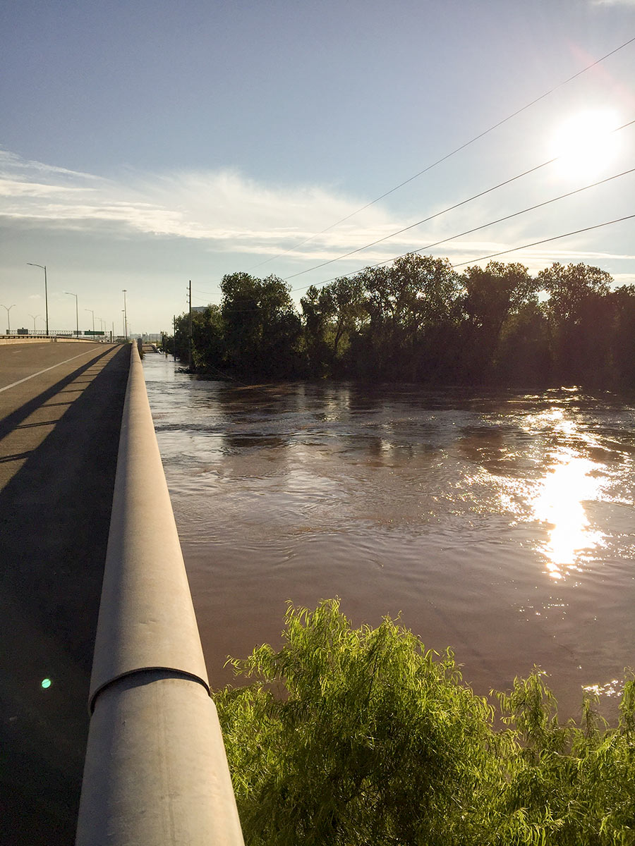
7 DAYS OF HARVEY BEFORE THE BRAZOS RIVER REACHES ITS SUGAR LAND PEAK It wasn’t until early this morning that the Brazos River in Sugar Land and Richmond reached its highest level since area flooding triggered by Hurricane Harvey began. And it was a new record, reached at 5:15 am: 55.19 ft., according to the National Weather Service. The previous record, 54.7 ft. — surpassed Thursday at 1:30 am — was set by a flood last year on Tax Day June 2nd. The photo here shows the river during a rare moment of sunshine a day earlier than that — from Hwy. 59 where Greatwood, Riverpark, Telfair, and Sugar Land Memorial Park meet. [Houston Chronicle] Photo: Grace Carlson
09/01/17 6:30pm

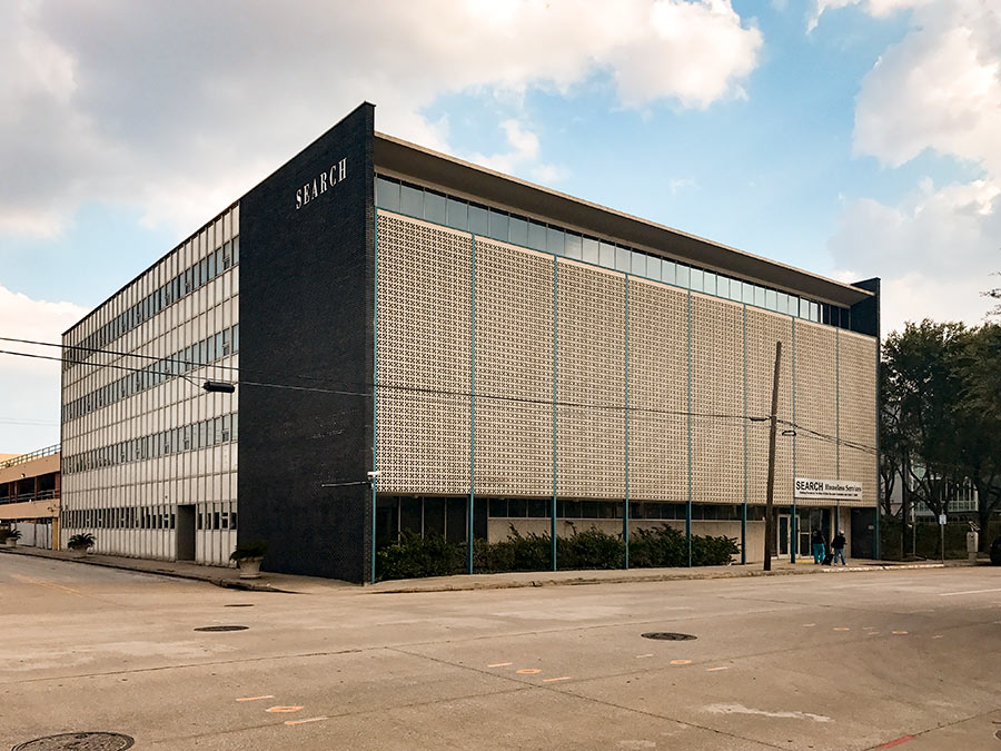
The ground floor of the former SEARCH Homeless Services building at 2505 Fannin St. in Midtown (above), spared from flooding damage, has been pressed into active emergency food service over the past week: New occupants tell Swamplot that in the kitchen that served SEARCH’s homeless clientele until the organization moved Downtown last year, former Feast and Hunky Dory chef Richard Knight and Carrie Knight have been leading a team preparing meals for first responders and other emergency workers; in the connected adjacent space, former Mark’s and El Meson sommelier Cat Nguyen now runs a food storehouse; she’s working with a team that moved in yesterday to share the space as well — one set up to match groups that can donate large quantities of food with groups that need them.

Offers of food and requests for food come to this team through a website it launched on Thursday as well, appropriately called I Have Food I Need Food. Led by a group including Amy Kavalewitz, Jonathan Beitler, Matthew Wettergreen, and Claudia Solis, the operation takes in donations of prepared or unprepared food from commercial kitchens, food supply companies, and licensed caterers, and sends it out to shelters or other service groups that need to serve hundreds of portions.

Photo: Matthew Wettergreen

Have Food Need Food
09/01/17 3:30pm

Here’s the latest publicly available high-resolution aerial imagery of Houston-area flooding, in an interactive map you can use to zoom in and examine in detail and by address. The imagery in the map above comes from the National Oceanic and Atmospheric Administration, and was taken this past Wednesday and Thursday, August 29th and 30th — as floodwaters subsided in many areas of the city but continued to build in a few parts west.

Included in the portions of the city photographed by NOAA: the sections of Memorial south of I-10, west of Gessner Rd., north of Briar Forest Dr. (that’s below Buffalo Bayou), and east of the Addicks and Barker reservoirs. That’s the area where Mayor Turner earlier today said residents who already have water in their homes should probably leave their homes now if they haven’t already — because water is likely to remain in them for the next 10 to 15 days as releases from the dams continue.

To zoom in on the latest aerial imagery from that area, you can click on the search box in the map above and type “Memorial, Houston,” then click on the first option that appears below where you’re typing. Then zoom in further to see where the floodwaters are and aren’t. You can identify the date of the imagery and turn on and off various layers if you click on the lower of the 2 icons on the top right of the map. To view the map larger in your browser window, navigate directly to NOAA’s Harvey site.

CONTINUE READING THIS STORY

Harvey Flooding from Above