COMMENT OF THE DAY: HOW ANOTHER KIDDIE TRAIN COULD PRESERVE HERMANN PARK’S PARKING HERITAGE 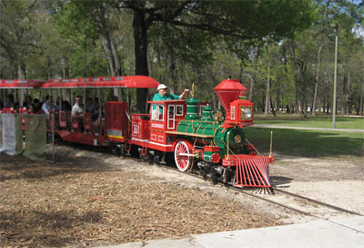 “Right now is a bad time to be predicting parking lot requirements for the next 20 years. Driverless cars may make them obsolete. If that happens, they can turn the parking lot into a ‘parking lot museum’ — kids of the future can visit it to get a feel for what life in the 20th century was like. They could even ride the Vulture Express, a 2mph trip up and down row after row of filled parking spaces that goes on for hours.” [Memebag, commenting on Grassy Knolls, Children’s Swamp Part of Possible Hermann Park Parking Coverup] Photo of Hermann Park kiddie train: Lou Minatti
Sign up for the Newsletter
Tag: Parking

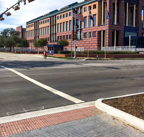
Courtesy of a stripe-skeptical reader, here’s a partial walkthrough tour of the new parking scheme along Allen Pkwy. west of Downtown — these days looking a lot more like the flyover videos released of the planned changes last year. Those changes, including a lower speed limit for the rest of the roadway and and some strategic tree deployment, are intended to make the pseudo-highway into a “more urban environment” and to slow traffic down to next-to-a-park speeds. Also included in the deal: a series of crosswalks, like the over-then-over-again setup now striped into place at Gillette St. (seen above posing with the Federal Reserve Bank building, with the former city garbage incinerator site out of the frame to the left).
The new setup divvies up much of the turf formerly occupied by Allen Pkwy.’s westbound traffic lane into angled spaces — some almost long enough to “put 2 normal sized cars in each spot,” the reader claims:
Stripe Scrutiny

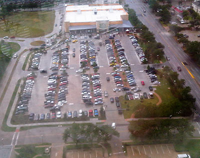
CITY PLANNING APP TO REDUCE USELESS DOWNTOWN CIRCLING, $80 PARKING FEES 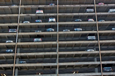 The city approved $9,600 yesterday toward planning a system to help drivers (particularly out-of-towners) find parking Downtown, Dug Begley writes. The system would be designed to display prices and current space availability for 7-or-so to-be-finalized private parking vendors on a smartphone app, along with a series of electronic signs like the ones installed around the city’s airports. The city would pay for about 20 percent of the $4.1-ish million project, which would be mostly funded by federal money aimed at reducing air pollution (in this case, extra emissions from excessively long and looping parking space searches). Begley also writes that city leaders think the system could cut down on price gouging, noting that prices for recent special events, “especially near Minute Maid Park, have spiked to $80 as demand increased.” [Houston Chronicle; previously on Swamplot] Photo of downtown parking garage: Bill Barfield via Swamplot Flickr Pool

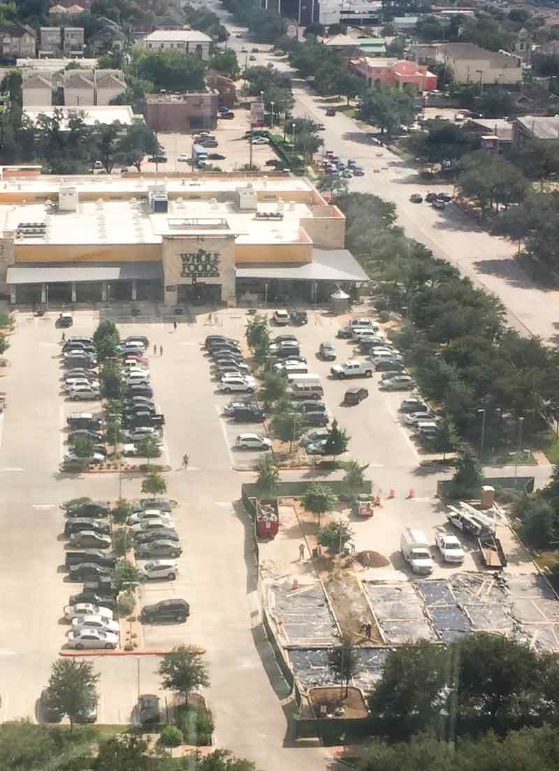
 From the AIG tower neighboring to the north, a reader peers down behind the construction fencing now up at the corner of Waugh Dr. and D’Amico St., in an effort to figure out what might be gettin’ real in the Whole Foods Montrose parking lot. An employee tells Swamplot over the phone that the store is planting additional parking spaces on top of what was previously a walkway lined with grass and picnic tables, adding parking has been a squeeze on the weekends (which lines up pretty well with earlier reports from the scene). The rep also says that the tables (positioned across Waugh from BMW service garage Bavarian Machine Specialties and catty-corner to the health-and-beauty-shop-laden strip center across D’amico), were almost never used. Permits for the pave-over were issued at the end of May.
- Previously on Swamplot: Later on Opening Day: Whole Foods Montrose Afternoon Parking Report; Opening Day: It’s Getting Real Crowded at the Montrose Whole Foods Parking Lot, Beer, Wine, Art, and BBQ on Tap: Here’s Your New Whole Foods Market, Montrose, This Kind of Whole Foods Thing, Getting Real on Waugh at West Dallas This Weekend,
Photos: Randy Saad (top), Swamplot inbox (bottom photo showing opening day, 2011)
Leaner Green

COMMENT OF THE DAY: SAVE-THE-DOME SAGA’S PARKING GARAGE ENDING LEAVES ROOM FOR A SEQUEL 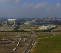 “I think people are missing the larger view here. Of course there is plenty of current surface parking — but putting parking beneath the Dome begins to open up the possibility of densification on this site and on the old Astroworld site. This is the first, and necessary, step in transforming this entire area. I am betting that in 20 years or so this site will barely resemble the vast wasteland of parking lots and open space that it is today.” [SH, commenting on County Approves First $10.5 Million for Astrodome Basement Parking Garage Plan] Photo: Russell Hancock via Swamplot Flickr Pool

COMMENT OF THE DAY: HOW HOUSTON’S PARK(ING) PROPONENTS SHOULD TAKE IT TO THE STREETS 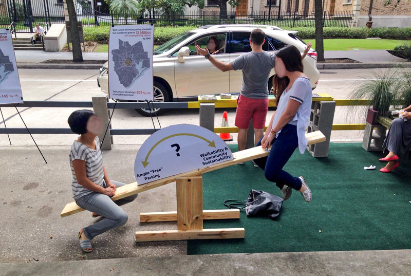 “While I understand, generally, the sentiment behind this initiative, I think in Houston it may be a little misguided. If we want a more walkable environment, with fewer buildings set back behind parking lots, we actually need more on-street parking spaces (to both accommodate business patrons arriving by car and help buffer pedestrians on the sidewalk), and fewer off-street ones.” [LocalPlanner, commenting on The SUV-Sized Parks Parked By City Hall Will Expire in About An Hour] Photo of Park(ing) Day: Allyn West
 Proponents Should Take It to the Streets... "Pin It")
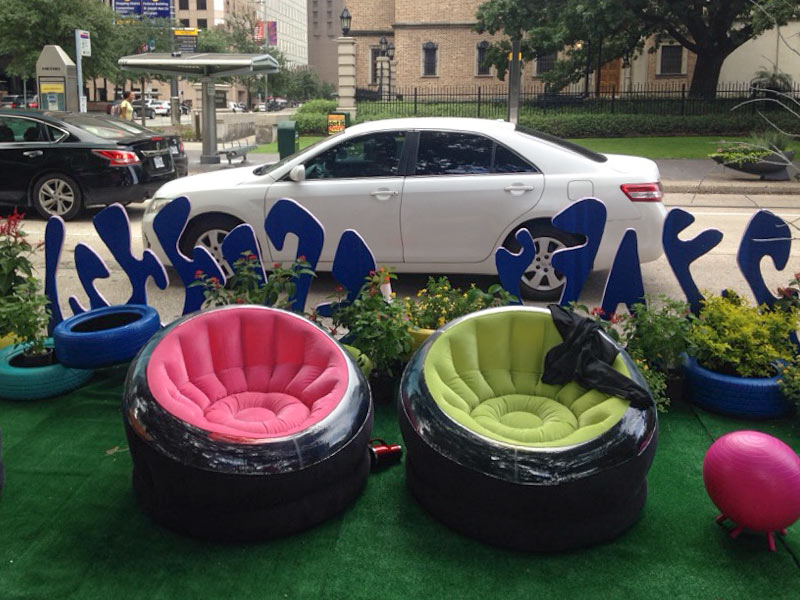
What’s all this sitting by the meters on the 500 block of McKinney St. today? Allyn West sends over some shots of the parking-spot-sized pocket parks currently occupying a few of Downtown’s on-street spaces. And you, too, can sit there, but only if you hustle: The ephemeral parklets are open for communal use until about 3 PM as part of the annual Park(ing) Day affair, now in its 12th year of instigating fleeting streetscape conversions in hundreds of cities around the world.
One of this year’s parks has its very own ideologically-conflicted seesaw:
Metered Park(ing)

COMMENT OF THE DAY: WHAT’S REALLY STALLING HOUSTON’S DRIVE FOR SMOG REDUCTION  “ . . . The serious ways to improve air quality in Houston are 1) to pass California emission standards for all vehicles, and 2) to install traffic light road sensors at intersections. I can’t believe how long we sit at intersections with no one moving.” [KB, commenting on Building for Baby Boomers; Revamping the Briar Club in Upper Kirby] Illustration: Lulu

Experimental ice cream shop Cloud 10 Creamery looks to be collecting building permits for a space at 711 Heights Blvd., one of the 1920s bungalows prepping for a second career in retail (as shown above) as part of the Heights Mercantile development. The project, which straddles 7th St. and its bike trail companion between Yale St. and Heights Blvd., hit a potential snag last year when the city didn’t approve a variance request that would have lowered the number of required new parking spaces. But the updated site plan below shows the workaround — the Golden Eagle Binder & Tab Co.’s former spots at 717 and 724 Heights, which were purchased by the developers last May, are depicted as additional parking lots:
7th at Yale

COUNTY WANTS TO FILL IN THE ASTRODOME’S FLOOD LEVELS WITH PARKING 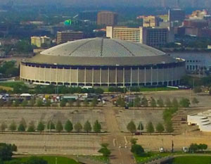 There are still no set plans for what will eventually happen to the Astrodome, but the county is already gearing up to work on the parking situation. Tomorrow the county commissioners court will look over an engineering report on plans to raise the main floor of the structure (which currently sits some 30 feet below the surrounding grade) and stick a 2-story 1,400-space parking garage beneath it. The meeting’s agenda indicates that approvals on specifics for the roughly $105 million plan won’t be put to a vote until September; a spokesman for county judge Ed Emmett also tells Mihir Zaveri that no construction would start until after the Super Bowl, regardless of approval. [Houston Chronicle; previously on Swamplot] Photo: Russell Hancock via Swamplot Flickr Pool

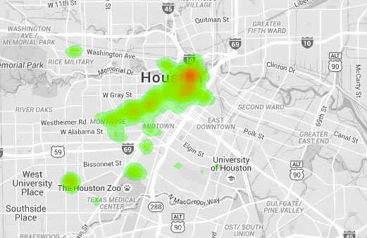
The above heatmap showing where city parking tickets are most frequently issued is one result of an in-progress project by biology major and urban data enthusiast Jordan Poles. Areas shaded red mark where the tickets fall heaviest, while green areas see a lighter citation rain. Grey areas are not ticket-free — rather, the colored regions represent notable clusters of ticket activity (including Downtown, Montrose, Fourth Ward, Midtown, the Museum District, and the Rice Village).
Fine Maps

COMMENT OF THE DAY: WHAT ’THERE’S NOWHERE TO PARK’ REALLY MEANS  “People would rather circle for hours for a spot that is 3 ft. from the door they wish to enter than to: A) pay to park B) walk.
So please keep in mind, when someone says ‘there’s nowhere to park in the village’ what they mean is:
There’s nowhere within 3 ft. of my destination to park.
Of course, everyone knows where they can park, but the last thing they want to do is walk from their car to their destination.” [toasty, commenting on Shake Shack Will Take Over La Madeleine’s Rice Village Space] Illustration: Lulu
“People would rather circle for hours for a spot that is 3 ft. from the door they wish to enter than to: A) pay to park B) walk.
So please keep in mind, when someone says ‘there’s nowhere to park in the village’ what they mean is:
There’s nowhere within 3 ft. of my destination to park.
Of course, everyone knows where they can park, but the last thing they want to do is walk from their car to their destination.” [toasty, commenting on Shake Shack Will Take Over La Madeleine’s Rice Village Space] Illustration: Lulu

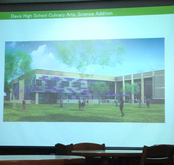
Cast in projector blue above: a snapshot of renderings for the remodel of Jefferson Davis High School, which is planning to expand. The Northside school, one of 8 in HISD changing names to drop references to Confederate figures, is getting some shiny new teaching facilities, including upgraded spaces for its culinary arts and management students (as shown in the projection above). The campus on Quitman St. is also staking out new parking lot territory across Tackaberry St.
Hungry for the details? HISD is hosting a community meeting on April 7th at the school to talk design plans. Until then, here’s a preview of the planned new exterior for the performing arts space:
Northside Remake

COMMENT OF THE DAY: TOP WITH ASPHALT, ADD PARKING STRIPES TO TASTE  “Amazing how that works – we demolish houses and businesses next to schools to make way for parking, meaning there will be fewer homes and errand stops within walking distance of the school. Meanwhile, the Red Line is only a few blocks away, which could’ve meant fewer employees and students needing to drive there. So now we have HISD paying more money it doesn’t have on acquiring land and building parking infrastructure while simultaneously devaluing a public transit asset and decreasing the school’s user base in the area. Great recipe for success, here!” [Derek, commenting on Former Bakery Razed as Jefferson Davis Claims New Territory in Northside] Illustration: Lulu

COMMENT OF THE DAY: WHERE TO GO TO AVOID A BAR FIGHT IN THE HEIGHTS  “I remember well the battles between restaurants/bars and residents as the Montrose started to gentrify in the late 1990s. It never ceased to amaze me that someone would buy a pricey townhome right next to a long-established ice house, and then complain vociferously and try to run the business off. Mark my words, the Heights will reach that same tipping point, if it hasn’t already. As SuperDave said, those who fail to check out their prospective neighborhood at all times of day and night have only themselves to blame. But of course, they’d rather blame the business and try to turn the Heights into some ridiculous suburban ‘paradise.’ That’s what Katy is for, people!” [roadchick, commenting on Jilted Heights Post Office Spot To Move On as a New Mixed-Use Lowrise Complex] Illustration: Lulu
