09/24/13 12:05pm

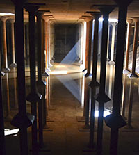
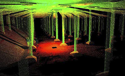
Now have at it: SmartGeometrics has made available for free on a website launched yesterday the data from 3D scans of the allegedly leaky, 87,500-sq.-ft. 1927 underground water reservoir near Sabine St. along Buffalo Bayou. Though the Buffalo Bayou Partnership would like to do something cool with the “accidental cathedral,” as Houston Chronicle columnist and cistern sympathizer Lisa Gray has called it, there’s no more funding available. Thus, the partnership is hoping some smart cookie who knows her way around AutoCAD (and programs like it) will use this free data to come up with an idea that woos someone or something else — like, say, Bud Light — to pay to make it happen.

Image: Buffalo Bayou Park

09/20/13 12:00pm

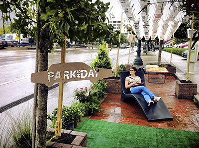
Rolled-in brick planters, some fake grass, a place to sit to sip your Starbucks: You’ve got yourself a park! Or, in this case, a seat-of-your-pants impromptu parklet, a li’l green gesture toward leisure and recreation where before there had been only the cool impersonality of curbs and the business of parking meters. All this stuff was set up first thing this morning — which just so happens to be National Park(ing) Day, devoted to pop-up experiments like this one — atop those 3 parallel parking spots in front of Frank’s near the corner of Travis and Prairie in Downtown, creating a like outlier just catty-corner from Market Square Park.

This is how it went down:

CONTINUE READING THIS STORY

09/18/13 11:05am

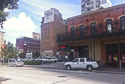
All day Friday these 3 parking spots in Market Square in front of Frank’s — and where Hines wants to build that 33-story residential tower — will be unavailable. Why? Well, Gensler and the Houston chapter of the American Society of Landscape Architects (including firms Asakura Robinson, SWA Group, M2L, and Elizabeth Austin Landscapes) are gonna be using ’em to set up a parkette for National Park(ing) Day.

Just as the similarly hopeful Better Block project attempts to reproduce pedestrian-friendly street life for a few hours in a controlled environment, these wee pop-up parks work like dioramas of urban leisure: A rep tells Swamplot that a shade structure, trees, shrubs, and board games (checkers and Jenga, yo!) will be rolled in and set up here at 417 Travis from 8 a.m. to 5 p.m. for anyone who wants to park it and stay awhile.

Additionally, a group of architecture students from Texas Tech are trying to stimulate the same simulation at the corner of Leeland and St. Emanuel in East Downtown, near the food trucks at the Houston Food Park.

Photo: Barbara Novoa

09/12/13 2:00pm

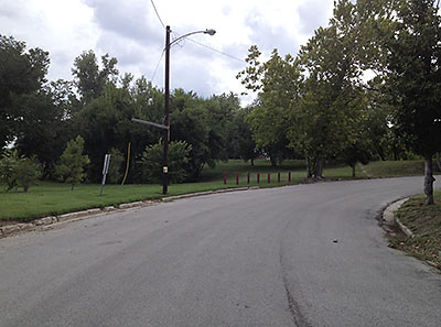
At a meeting yesterday, reps from the Houston Parks Board told reps from the Idylwood Civic Club that the HPB would agree to let alone that grassy knoll, shown here, where a trailhead providing access to the Brays Bayou hike and bike was to have been installed. Described in 2009 documents as “Sylvan Dell Parking Lot,” it appears that the proposed trailhead would have provided 19 off-street parking spaces, benches, lighting, a gazebo, and exercise equipment. Though those specs don’t really matter now: Houston Parks Board rep Jen Powis tells Swamplot that the Idylwood residents “chose to eliminate” the project.

CONTINUE READING THIS STORY

09/12/13 10:00am

Update, 5:45 p.m.: A rep from Midway tells Swamplot that these plans are “nearly a year old” and “conceptual in nature” and writes in an email: “We should have a better idea in the next 60 days of what the project will actually entail.”

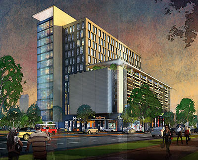
Marketing materials on the website of Midway Cos. — developers of CityCentre and GreenStreet — include this rendering of a 16-story office building standing at the corner of Richmond and Wakeforest in Upper Kirby. The materials show the building as part of a “mixed-use pedestrian-focused transit node,” with additional restaurants and retail, that Midway appears to be planning with the Upper Kirby Redevelopment Authority here to jazz up Levy Park. An application to reduce the setback on this site along Richmond was approved in July.

Also included in the materials are renderings of a 300-unit loft building facing the Southwest Fwy. and flanking a greenspace:

CONTINUE READING THIS STORY

09/09/13 12:30pm

WHAT’S BEST FOR BUFFALO BAYOU? Let it flow, or let it be? Environmentalists and the Harris County Flood Control District disagree — at least when it comes to the 1.5-mile stretch that contributes to the “jungly ecosystem” of the Hogg Bird Sanctuary in Memorial Park, reports the Houston Chronicle’s Lisa Gray. A “restoration” plan proposed by the flood controllers, explains Gray, “would change the bayou’s course in places, fill in an oxbow here, reinforce banks there, widen the bayou’s channel, raising and lowering landmasses and generally move an enormous amount of dirt. [They argue] that the proposed measures are desperately needed to reduce erosion and improve water quality.” They’d do it here as they did it at Meyer Park along Spring Creek, reports Gray. But the environmentalists don’t seem to consider that to have been a “restoration” project, really: “‘Look at that!” [Memorial Park Conservancy board member Katy Emde] told me, outraged, showing me a picture of Meyer Park on her phone. ‘There’s no diversity! It’s not natural! It’s not habitat! It’s horrifying.'” [Houston Chronicle ($); previously on Swamplot] Photo of Hogg Bird Sanctuary: Bayou Shuttle
09/03/13 10:00am

Dude! Got a snazzy idea for that 1927 underground water reservoir near Sabine St. on Buffalo Bayou, but you just can’t picture what’s down there? Well, grab the potato chips and crank up Pink Floyd, because now you can. The Buffalo Bayou Partnership is reaching out in the hope that entrepreneurs, artists, and visionaries the city over will use the above video, created by SmartGeometrics, for inspiration. (And more 3D images are forthcoming on the partnership’s website.)

CONTINUE READING THIS STORY

08/30/13 11:15am

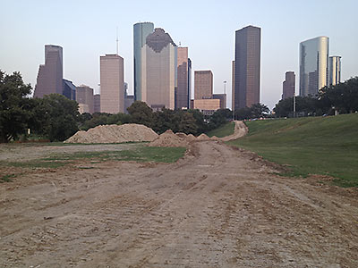
The dirty work continues: Here are some photos of the progress, as of last night, of the Buffalo Bayou Partnership’s big plan to soup up the soupy waterway.

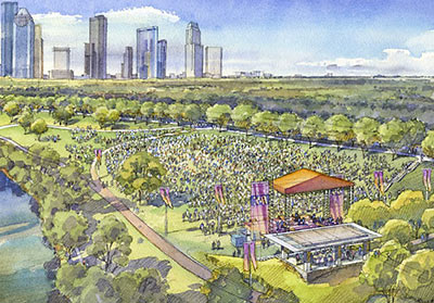
Above, you can see the new view from Eleanor Tinsley Park, where site work is underway for the Bud Light Amphitheater. Picnic tables, a volleyball court, playground equipment, and a few pine trees are all long gone.

After the jump, you can see more photos of dirt. And photos of the newest pedestrian bridge, inserted between the Houston Police Memorial and the rear of Glenwood Cemetery.

CONTINUE READING THIS STORY

08/21/13 10:05am

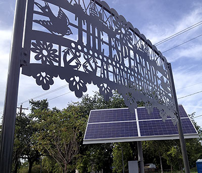
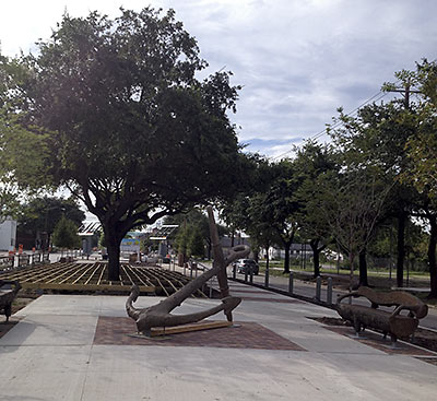
A 3-block stretch of the median along Navigation Blvd. was outfitted yesterday with some functional swag — bike racks, bus stops, solar panels and LED string lights, shade screens, benches — designed to perk up the East End streetscape into a shaded little walkable market dubbed The Esplanade. The stretch in question spans N. St. Charles and Delano, running alongside the Original Ninfa’s and the recently opened El Tiempo Cantina.

CONTINUE READING THIS STORY

08/20/13 11:15am

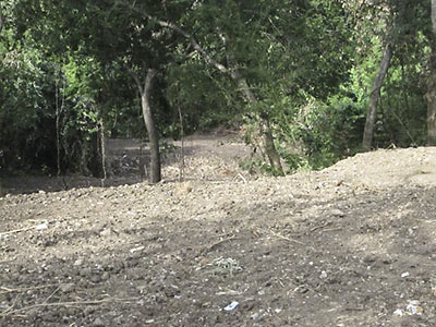
Yep, it was a costly mistake: A $300,000 fine was paid to the city on Friday with a cashier’s check signed by Bill Workman, the first-time developer who says a miscommunication with a subcontractor led to the clearing of almost an acre of trees and stuff near Little White Oak Bayou in Woodland Park.

Though neighbors accused Workman of ordering the slashing to improve the view of the 8 townhouses he is building on Wrightwood St., he denied those accusations, telling Swamplot in June that one of the reasons he chose the site for development was its proximity to the park. Seeing what happened, he says, left him “devastated.”

Apparently, the fine isn’t quite enough to satisfy Andrea Greer, who originally reported what she called “egregious clear-cutting” on her blog:

CONTINUE READING THIS STORY

08/19/13 2:15pm

USING PICTURES TO PICTURE USES FOR BUFFALO BAYOU’S BASEMENT There’s still no real plan for that 1927 underground reservoir along Buffalo Bayou near Sabine St. But, reports the Houston Chronicle’s Lisa Gray — one devoted parishioner of this “accidental cathedral” — there’s now a new technology in place that might help would-be entrepreneurs visualize the possibilities: “SmartGeometrics, a company whose main business is creating super-precise 3-D digital models of real places . . . will show video-game-like digital models to the public . . . and will explain how, soon, the data will be available to anyone who wants to plug it into his design software. . . . ‘This is a starting point for us,’ [Buffalo Bayou Partnership’s Guy Hagstette] says. ‘We’re trying to decide on the big picture. What should the concept be? Is it environmental art? A giant nightclub? A parking garage?” [Houston Chronicle ($); previously on Swamplot] Photo: SWA Group
08/19/13 10:00am

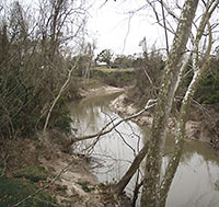
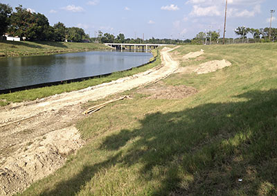
Across town from the molten-zinc-dipped pedestrian bridges and Bud Light Amphitheaters going up along Buffalo Bayou, site prep is underway to build a new section of hike and bike trail along Brays Bayou in Mason Park. Paid for by the same federal scratch that will fund a yet-to-be-designed pedestrian bridge spanning the bayou on the south side of 75th St. (or behind that bridge in the photo), this section will connect 75th to Forest Hill Blvd., where the trail picks up and splits, running west to Lawndale and east to Capitol near the Magnolia Transit Center.

CONTINUE READING THIS STORY

08/07/13 5:00pm

Thanks to $2 million from Silver Eagle Distributors, which is also putting up that new beer dispensary in Pasadena, the Buffalo Bayou Partnership might to be able to afford to turn Eleanor Tinsley Park into something as purty as what you see in the rendering above. That means the existing “event meadow” down below there along Allen Pkwy. will be scooped out and rid of the volleyball court, playground equipment, picnic shelters, and some of the pine trees, then re-landscaped and rechristened the Bud Light Amphitheater; more parking and stairs will be introduced; and a new “Skyline Overlook” pavilion will be built and named in honor of Silver Eagle prez and CEO John Nau.

The dirty work began earlier this month, says the BBP, part of the overall project to install new swag like pedestrian bridges and remove invasive species, transforming the 2.3-mile stretch, BBP prez Anne Olson explained a few months ago to Free Press Houston, into an “11 acre urban prairie.”

Rendering: SWA Group

07/01/13 4:00pm

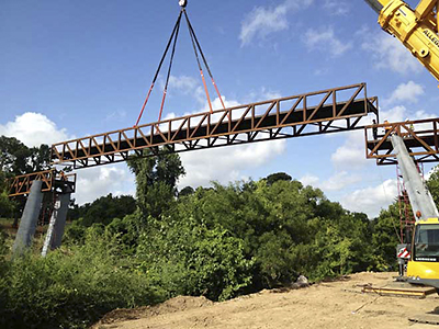
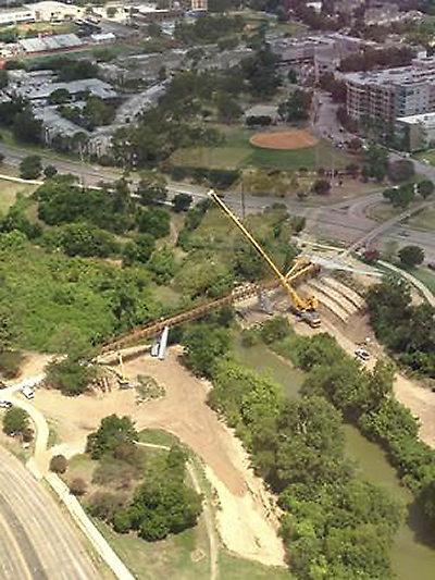
The latest pedestrian bridge to span Buffalo Bayou was craned into place this past Thursday. The 345-ft. bridge almost hooks up with the skinnier chain-linked one that spans Memorial Dr. from Jackson Jackson Hill St. on the north. The Buffalo Bayou Partnership’s master plan shows that this bridge will serve the so-called Lost Lake — a space for which is being cleared of all kinds of vegetation just west of this site. You could say that the bridge might also encourage Rosie Ruiz-inspired joggers to take a shortcut and avoid going the extra mile around the Shepherd Dr. bridge-under-a-bridge just a bit farther west.

CONTINUE READING THIS STORY