COMMENT OF THE DAY: THE WATER WILL ALWAYS COME AND MOVE STUFF AROUND  “I hope these detention pools make a difference but I doubt they will: Less likely since the rooted greenery is being removed. Flood events will always tear up a riverbed and its plants. The best thing to do is to let the vegetation grow up until the next flood event — that’s the cheapest most efficient tactic. If a future flood event takes people’s back yards away then that’s just tough for those homeowners. In spots, Buffalo Bayou is a lovely, primeval place to take a canoe trip. In spots it’s a trash heap. It’s always interesting though!” [movocelot, commenting on New Overflow Pools Coming To Clear Out Trees, Anthills from the South Side of Buffalo Bayou] Illustration: Lulu
Tag: Flooding

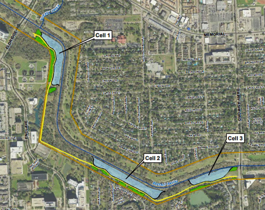
Time’s almost up for a whole mess of trees lining the south side of Buffalo Bayou between Eldridge Pkwy. and Dairy Ashford (pictured at top), where the Harris County Flood Control District plans to construct the first 3 of a series of overflow basins. Removal of vegetation across the bayou from Nottingham Forest’s southern border is scheduled to begin within a few weeks; construction company Lecon has the $1.8 million contract to build the “linear stormwater detention compartments,” which are meant to accommodate a temporary visit of up to 90 acre-ft. of bayou water during a flood.
The trees and basins will be carved out of Terry Hershey Park. The district notes that some trees and vegetation may be preserved — forming a buffer “where possible” between the basins and private property to the south. Large sections of the popular Anthills Mountain Bike Trail, which the district notes “were built on publicly-owned land without written permission and without compensation to the public” will be cleared, though a portion that sits between the 2 westernmost basins will remain.
NEW TEXAS SENATE BILL: IF HOME LIES IN ANY FLOOD ZONE, SELLER MUST SAY SO 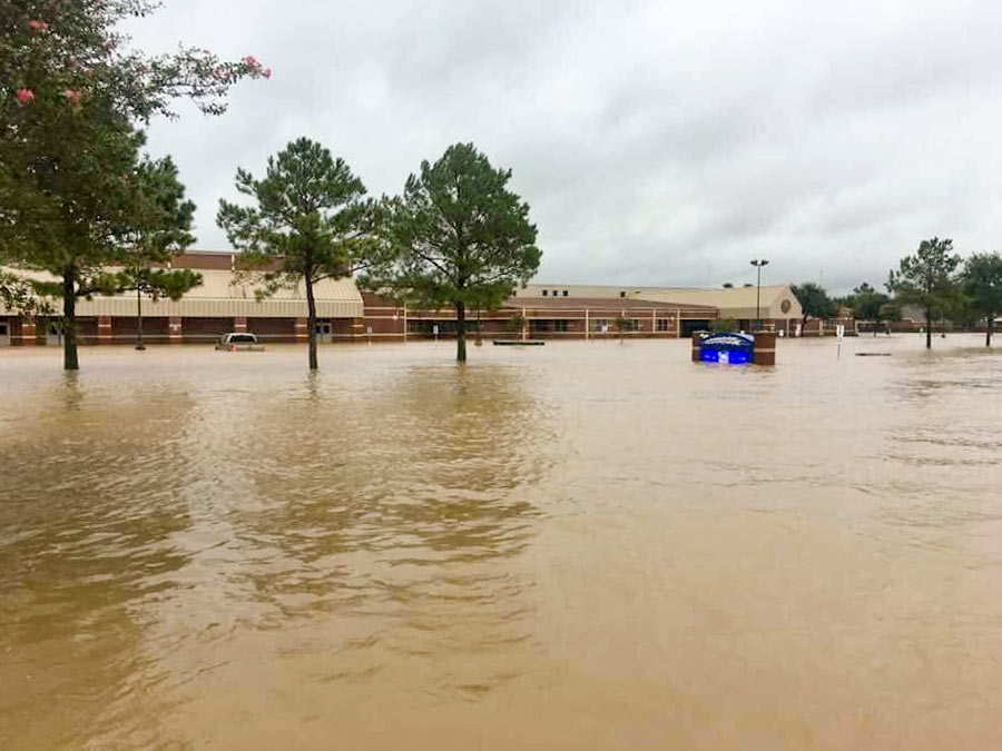 State Senator Joan Huffman filed a bill last Friday that, if passed, would require sellers to tell buyers if their homes are located in a 100- or 500-year floodplain, a reservoir, or a flood pool — the area next to a reservoir that’s expected to fill up with water during major flooding events (but that most were unaware of until reporters blew the lid on their existence in late 2017). The bill, S.B. 339, would also force owners to disclose whether the home they’re listing has flooded before, whether it might flood under “catastrophic circumstances,” and if it’s located less than 5 miles downstream from a reservoir. “If a seller doesn’t disclose the information,” reports the Texas Tribune’s Kiah Collier, “the law would allow buyers to terminate the contract — or sue.” [Texas Tribune] Photo of flooding at Creech Elementary School, Katy, near Barker Reservoir: Breta Gatlin
LEAGUE CITY’S LONGHORN CATTLE MUSEUM REOPENS 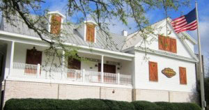 All bovine exhibits at the house-turned-museum-and-events-venue at 1220 Coryell St. are now back on view following months of renovations to address flood damage, reports the Chronicle’s Jennifer Bolton. Opened in 2009, The Butler Longhorn Museum, focuses specifically on the iconic cattle breed and the 19th century efforts of the Butler family, members of which helped save the animals from extinction through work on their land in what’s now League City, Kemah, Friendswood, and a few mainland portions of Galveston County. “While most of the exhibits could be — and were — redone, there were murals painted on the downstairs walls of the museum that had to be torn apart,” reports Bolton. Also out of commission: a separate education building that sits on the same 10 acres as the museum itself. [Houston Chronicle] Photo: Butler Longhorn Museum
COUNTY COMMISSIONERS HOLD OFF ON REPAIRS TO DOWNTOWN’S SOGGY CRIMINAL JUSTICE SKYSCRAPER  The County Commissioners were set to approve repairs to the chronically wet Harris County Criminal Justice Center on Tuesday when District Attorney Kim Ogg — who occupies the building along with her 735 employees — convinced them to tap the brakes, calling it “unseemly . . . that we would be spending $14 million when we still don’t know the cause of the flooding.” Writing in November, the Houston Chronicle‘s Brian Rogers blamed it on: “unprecedented amounts of standing water,” that “seeped into the underground walls” of the building even though its flood gates remained secure. But he noted that some county officials believe there were “multiple sources,” of water and remained unsure about how it all got in. The 18-year-old building at 1201 Franklin St. partly reopened in June. The repairs that the commissioners had planned to authorize this week included fixes to its elevator shafts and parts of floors 2 through 20. (They suffered damage when the electronics in the basement — dampened by floodwaters — malfunctioned, sending gallons of water through the building’s anti-flood pumping system, which ironically, burst pipes and flooded the upper stories.) Following up on Ogg’s remarks, County Engineer John Blount raised the possibility of building a new criminal justice building from scratch. The estimated cost he gave for doing so: $430 million. [Houston Chronicle] Photo: Harris County
COASTAL DEFENSE EXPERTS SAY IKE DIKE WON’T BE ENOUGH WITHOUT A BACKUP WALL 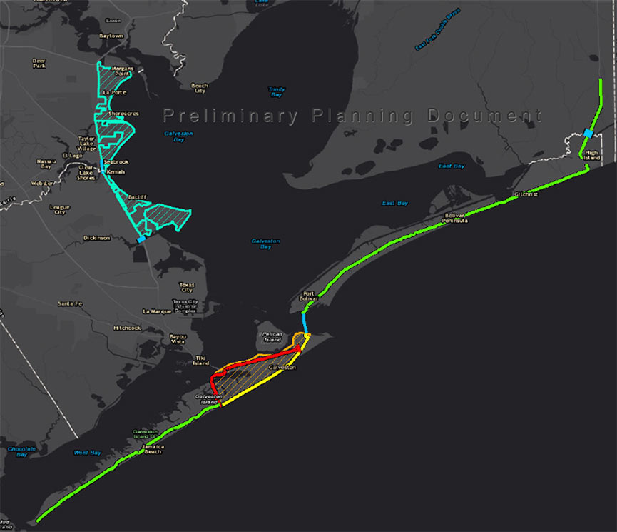 With the public comment period underway on the Ike Dike proposal the Army Corps issued last month, Rice University scientist Jim Blackburn weighs in on the project: “We think that there is too much remaining surge exposure,” he tells the Chronicle‘s Nick Powell on behalf of the research team he heads. Why’s that? “The storms that are being analyzed by the Corps are, in my opinion, too small,†Blackburn says. “They’re just not making landfall at the worst locations, with the type of wind fields and characteristics we’re seeing.” Had the Corps’ methodology accounted for a worst-case storm, says Blackburn, its analysts would’ve seen that the projects they proposed — 70 miles worth of walls and gates between High Island and San Luis Pass — are inadequate without a key addition: an upstream gate that’d run across the middle of Galveston Bay, further shielding the Ship Channel and its adjacencies from floodwaters. “We are going to argue that to any governmental entity that is interested,” says Blackburn, adding, “I think we need options. If all of our eggs are in a $30 billion federal appropriation, that just sounds too risky to me.†One key selling point for the gate: It could be built in about half the time the other proposals would take and at a fraction of their cost, says Blackburn, between $3 billion to $5 billion. [Houston Chronicle ($); previously on Swamplot] Map of Ike Dike proposal: U.S. Army Corps of Engineers
SNEAKING A PEEK AT THE BIG WALLS, BIG GATES ARMY CORPS COULD PROPOSE FOR THE COAST LATER THIS MONTH  On October 26, the agency will single out one of the 4 big proposals it’s been pondering for the Texas coast as the chosen one, reports the Texas Tribune’s Kiah Collier. One of them “calls for the construction of a 17-foot-high levee along the entirety of Galveston Island,” as well as Bolivar Peninsula. Ring any bells? It’s the so-called Ike Dike (also known as the “coastal spine”) that A&M scientists dreamed up about a decade ago in response to the disaster and hypothetically-even-worse disaster that could’ve occurred if Ike had struck 30 miles further west. Another defense against that doomsday scenario that could make it into the proposal: a giant gate structure adapted from Rice’s Jim Blackburn and Philip Bedient’s 2011 idea for a mechanism that’d close before storms to block surge. (They wanted to put it just upstream from the Fred Hartman Bridge; the Corps has number of different spots in mind.) All the plans in the running include a so-called ring levee around Galveston’s bay side to protect it from reverse storm surge, a helping of smaller levees and gates, upgrades to existing flood control structures, and ecosystem restoration projects geared toward creating natural floodwater-fighting barriers. [Texas Tribune; previously on Swamplot] Map indicating proposed Alternative A plan: U.S. Army Corps of Engineers
- 4415 Belle Hollow Dr. [HAR]
COMMENT OF THE DAY: HOUSTON’S POPULATION FORECAST DOESN’T ACCOUNT FOR THE WEATHER  “These studies always miss the boat on the climate change; I’d be surprised if population growth in Houston and the surrounding area hasn’t plateaued and maybe even begun to decrease by 2040. Let me put it this way: If even the most conservative projections are correct, I wouldn’t want to be living here then. If you think the flooding and the summer temperatures are bad now . . .” [Christian, commenting on Houston’s Population Will Break 10M by 2040, Says METRO Study] Illustration: Lulu
NEARLY 100 MEYERLAND HOUSES WILL SOON BE UP OFF THE GROUND 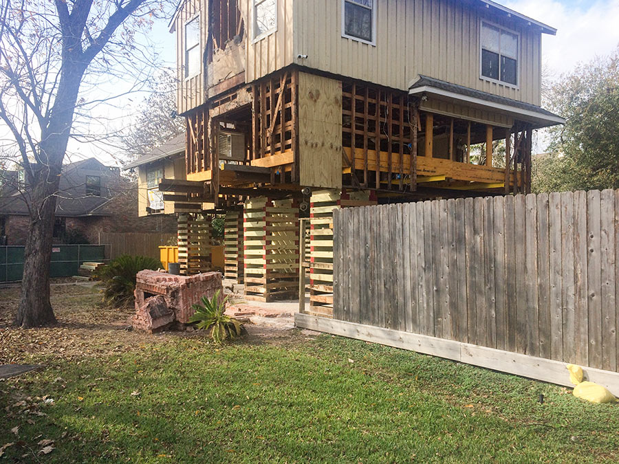 Forty homes total have now been elevated in Meyerland and 57 are currently on the way up, reports Nancy Sarnoff. Their boosters are seeking the same degree of flood protection enjoyed by the 29 percent of Meyerland homeowners whose houses have never flooded in the past. A few elevations have been paid for by the City of Houston; others were self-funded. [Houston Chronicle ($); previously on Swamplot] Photo of 4718 N. Braeswood Blvd.: Christine Gerbode
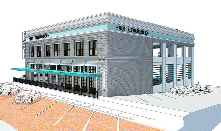
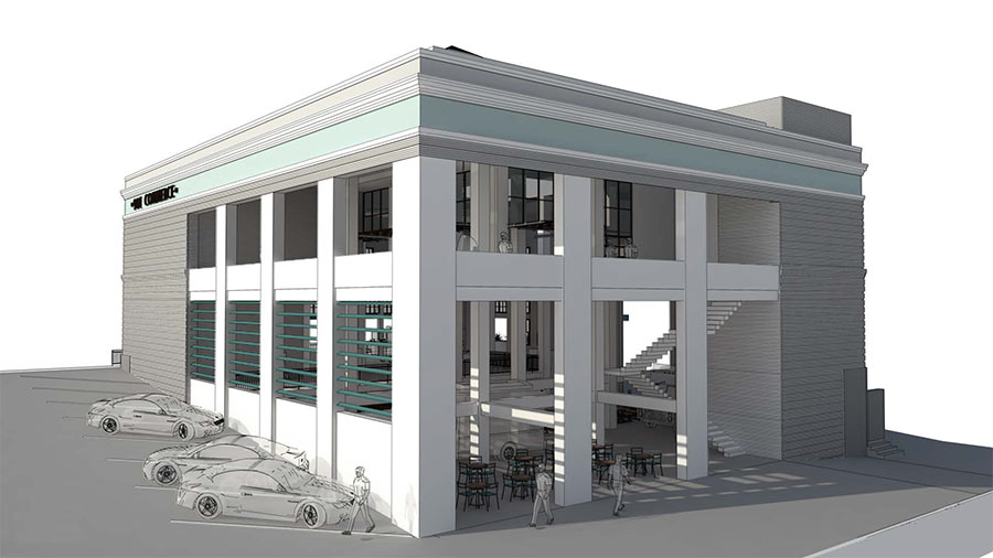
The new owner of the floody Spaghetti Warehouse building downtown has cooked up a novel idea for how to deal with its proximity to Buffalo Bayou: crack open its lower stories and fill them with a floodable dining area that sits below an upper-story bar. Renderings from Diamond Development show how they’re hoping to pull it all off by removing several doors and windows from the back of the 15,000-sq.-ft. building (which an application to Houston’s historic commission notes will be stored away for potential future use) and adding louvers to the building’s east side.
The slats would go in place of the parking-lot-fronting wall shown missing part of its face during Harvey:
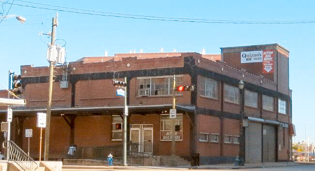
Harris County and the trailblazing Buffalo Bayou Partnership will soon clear the way for a new trail segment on the south side of the bayou by demolishing the vacant 1119 Commerce Building warehouse along with portions of the inmate processing center to its east. Pictured above, 1119 Commerce St. spans the width between San Jacinto St. and the Fannin St. bridge at which the existing trail terminates. Harris County Flood Control district bought the building in 2010 as part of its efforts to smooth out that sharp oxbow where White Oak and Buffalo bayous meet and allow more water to flow through Downtown.
But a lot of that water ended up flowing through the building itself, dampening its below-street levels on at least 4 occasions since the county’s purchase. The year after a 2015 checkup found that the structure’s lower-level steel columns were “95 percent rusted,” the flood control district axed its lease with former tenant Quiznos in preparation to bring down the 94-year-old house, originally built for the Texas Packing Company.
After the trail takes over the lot occupied by the not-yet-demolished building, it’ll butt up next against the adjacent Harris County Inmate Processing Center at 1201 Commerce:
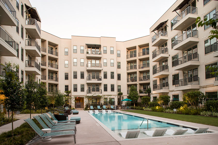
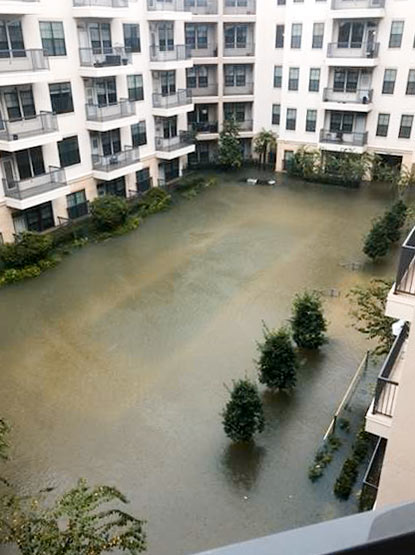
See that faint watermark in the aerial photo taken from up on the balcony? That’s the lap pool at the Parkside at Memorial Apartments just south of Memorial Dr., buried under more water than it’s designed to hold after the release of the Addicks and Barker reservoirs last August. Throughout the first floor of the surrounding buildings, the tide peaked at over 5-and-a-half ft. Workers spent the last 9 months helping the 4-year-old complex make a comeback; its leasing center officially reopened late last month — and on-site amenities now look less divey and more like the refurbished lap pool shown in the photo at top.
Other aquatic areas that took on more than they could handle include the complex’s other pool:
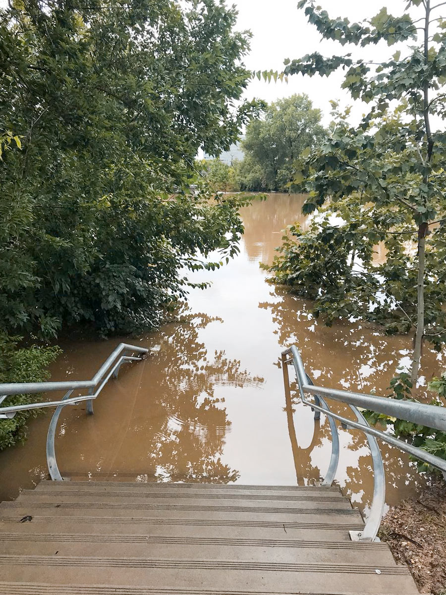
On-the-ground footage from KHOU reporter David Gonzalez shows just how much water the Johnny Steele Dog Park — redone and reopened 3 weeks ago following its last flood — took on yesterday. By the end of the downpour, floodwaters had risen up a few steps from where the park begins at the foot of the staircase leading to Allen Pkwy., as shown in the photo above.
That left these 2 out of luck:
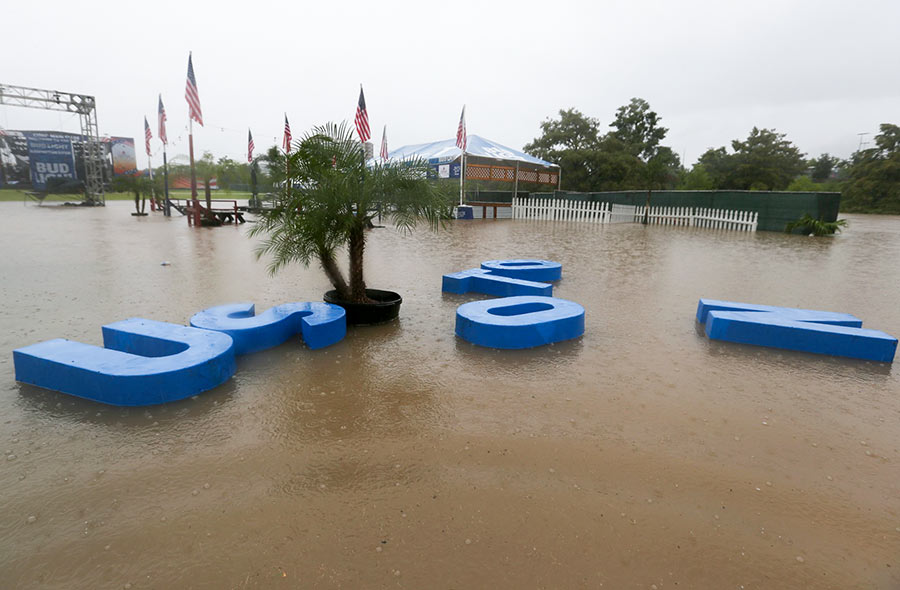
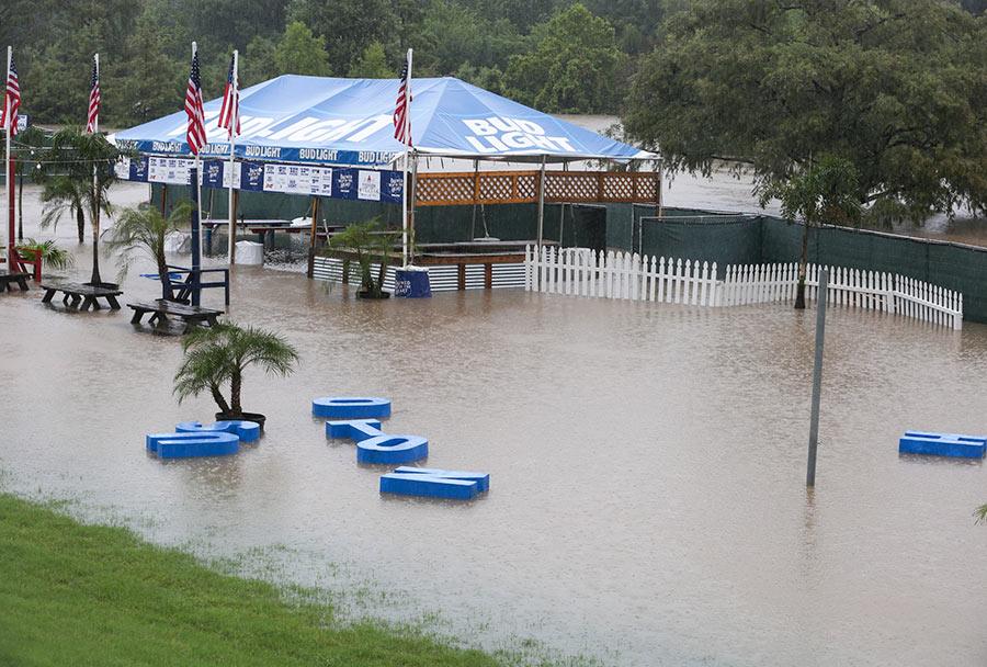
Mayor Turner had already cancelled all Freedom Over Texas events yesterday — save for the fireworks — by the time the HOUSTON sign planted in Eleanor Tinsley Park got caught up in the flow of things and began drifting downstream, away from the Bud Light Beer Garden that it originally fronted. Despite the disorder, the letters managed to stay afloat during their time on the water, captured by Chronicle photographer Yi-Chin Lee.
They ended up making landfall in the middle of the lawn:

