COMMENT OF THE DAY: A BIG BLOW TO BAYOU BIKING  “. . . Have been riding Ant Hills since 1994. People who do not frequent this stretch of bayou may not know its beauty or usefulness but will be an irreplaceable loss of being able to enjoy the outdoors in Houston if allowed to go forward.” [Turning_Basin, commenting on New Overflow Pools Coming To Clear Out Trees, Anthills from the South Side of Buffalo Bayou] Photo of Terry Hershey Park: Save Buffalo Bayou
Bayous and Waterways
COMMENT OF THE DAY: THE WATER WILL ALWAYS COME AND MOVE STUFF AROUND  “I hope these detention pools make a difference but I doubt they will: Less likely since the rooted greenery is being removed. Flood events will always tear up a riverbed and its plants. The best thing to do is to let the vegetation grow up until the next flood event — that’s the cheapest most efficient tactic. If a future flood event takes people’s back yards away then that’s just tough for those homeowners. In spots, Buffalo Bayou is a lovely, primeval place to take a canoe trip. In spots it’s a trash heap. It’s always interesting though!” [movocelot, commenting on New Overflow Pools Coming To Clear Out Trees, Anthills from the South Side of Buffalo Bayou] Illustration: Lulu

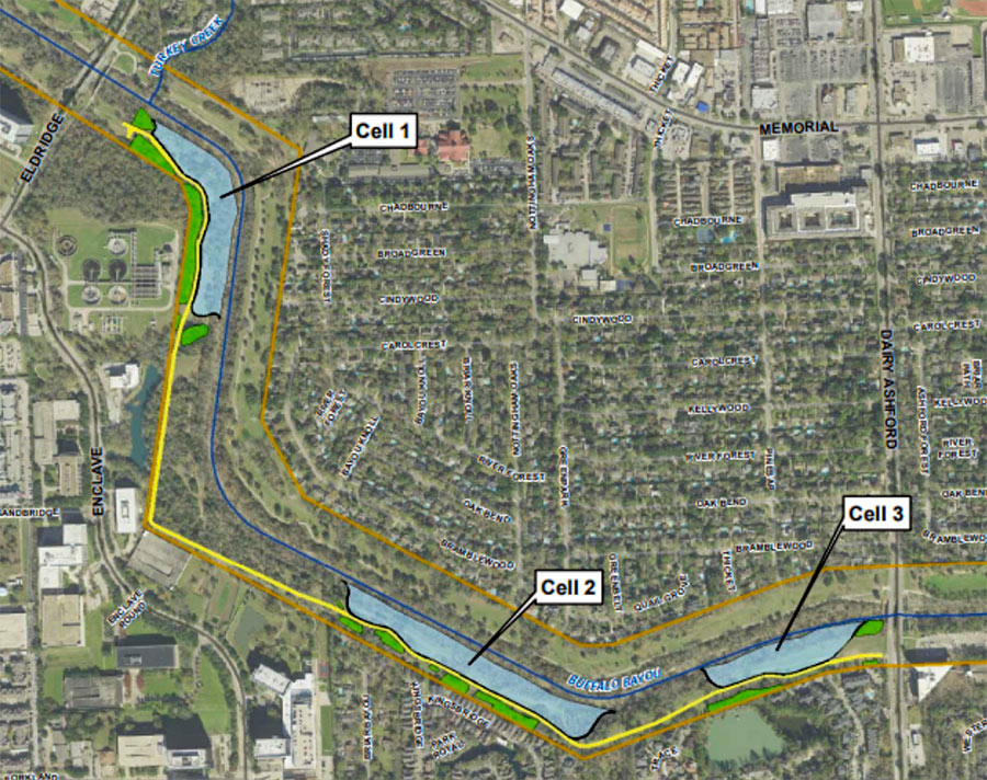
Time’s almost up for a whole mess of trees lining the south side of Buffalo Bayou between Eldridge Pkwy. and Dairy Ashford (pictured at top), where the Harris County Flood Control District plans to construct the first 3 of a series of overflow basins. Removal of vegetation across the bayou from Nottingham Forest’s southern border is scheduled to begin within a few weeks; construction company Lecon has the $1.8 million contract to build the “linear stormwater detention compartments,” which are meant to accommodate a temporary visit of up to 90 acre-ft. of bayou water during a flood.
The trees and basins will be carved out of Terry Hershey Park. The district notes that some trees and vegetation may be preserved — forming a buffer “where possible” between the basins and private property to the south. Large sections of the popular Anthills Mountain Bike Trail, which the district notes “were built on publicly-owned land without written permission and without compensation to the public” will be cleared, though a portion that sits between the 2 westernmost basins will remain.
NEW BIRD-SHAPED BOATS PUT FORMER WOODLANDS CRUISER PASSENGERS IN THE DRIVER’S SEAT  A flock of 10 swan-shaped boats has now picked up where The Woodlands’ 6 Waterway Cruisers left off when they were destroyed by Harvey last year — reports the Villager’s Marialuisa Rincon — rendering the township’s shipping channels unnavigable by public transit. (One Cruiser survived, but town officials decommissioned it anyway when they terminated their contract with the boat service’s operator in February.) Now, their “long-necked replacements” have former passengers taking water travel into their own hands through the use of a rudder — and their feet, by pedaling — to get where they want to go. Lake Robbins and anything past the Anadarko Bridge along the north edge of Lake Woodlands are off-limits — but aside from that, it’s pretty much free swim in the rest of the lake, as well as the upper and lower waterways. After hours, all bird boats rest in the Riva Row Boat House opposite The Pavilion. [Houston Chronicle; more info] Photo: The Woodlands Township
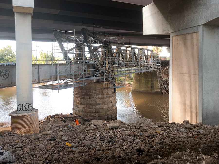
Here’s one of Houston’s latest walkable undertakings: converting the former railroad bridge beneath 59 to a pedestrian bridge that’ll link the trail along the bayou’s north bank to planned pedestrian segments south of waterway. It’s now overshadowed by the tangle of overpasses directly above it, but might not be once TxDOT starts straightening out 59 by nudging it east (and pairing it with a parallel segment of I-45) as part of its grand plan for north Houston highway improvement.
No southern trail segments are in place yet to greet the bridge upon its landfall just east of Downtown, but they will be soon: TxDOT’s already broken ground on a trail that’ll skirt the bayou as it crosses through the Houston Housing Authority’s Clayton Homes Neighborhood east of 59.
It’ll link up with the southern trail segment that does exist and runs east toward Lockwood Dr., as indicated by the gray line in the map below:
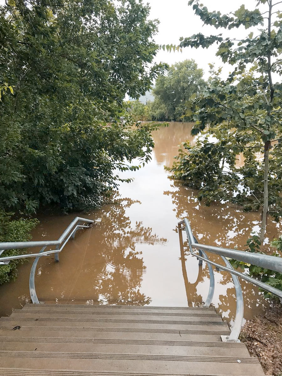
On-the-ground footage from KHOU reporter David Gonzalez shows just how much water the Johnny Steele Dog Park — redone and reopened 3 weeks ago following its last flood — took on yesterday. By the end of the downpour, floodwaters had risen up a few steps from where the park begins at the foot of the staircase leading to Allen Pkwy., as shown in the photo above.
That left these 2 out of luck:
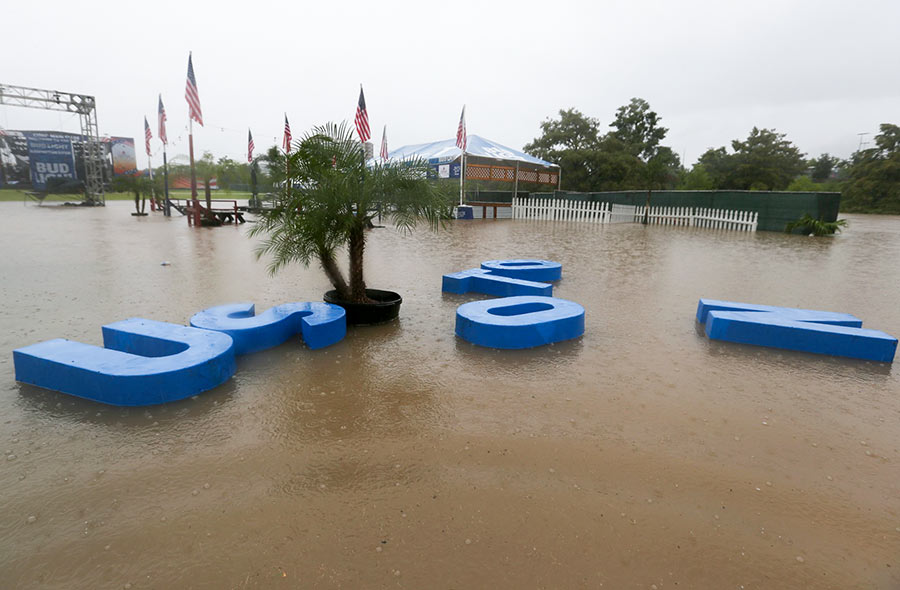
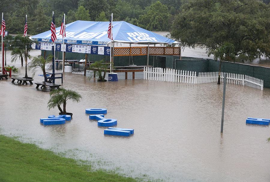
Mayor Turner had already cancelled all Freedom Over Texas events yesterday — save for the fireworks — by the time the HOUSTON sign planted in Eleanor Tinsley Park got caught up in the flow of things and began drifting downstream, away from the Bud Light Beer Garden that it originally fronted. Despite the disorder, the letters managed to stay afloat during their time on the water, captured by Chronicle photographer Yi-Chin Lee.
They ended up making landfall in the middle of the lawn:
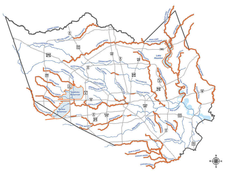
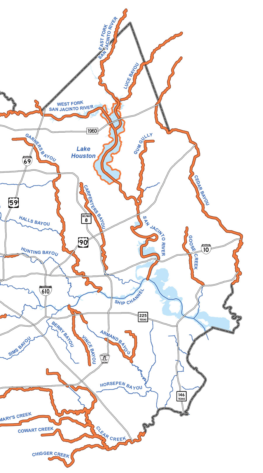
The final page of the Harris County Flood Control District’s final report on Hurricane Harvey includes the map above, with orange indicating where bayous, rivers, creeks, and gullies set new high water marks between August 25 and 29. Aside from Sims Bayou and a handful of smaller waterways, every other liquid landmark in the county outdid itself along some portion during the storm. Several — such as Cypress Creek and Carpenters Bayou (shown in detail above) — set new flood records along their entire lengths.
Less distinguished are White Oak and Little White Oak bayous, which broke records along only tiny stretches near Buffalo Bayou:
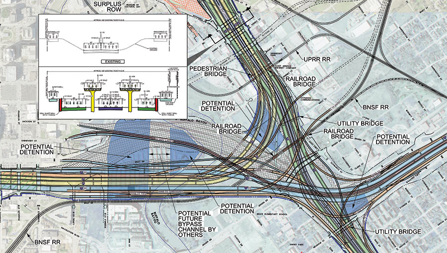
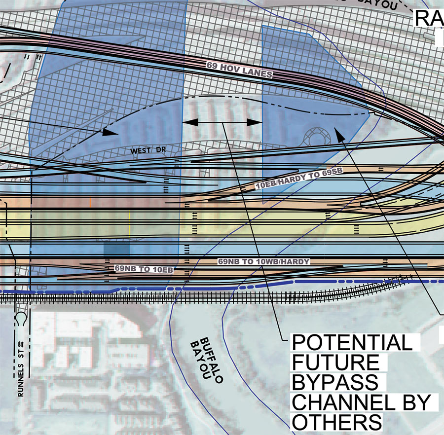
Remember that North Canal that showed up in Plan Downtown’s maps and drawing last year and included a island in Buffalo Bayou? Well, TxDOT’s latest schematics for its planned I-45 reroute include a bypass and island as well — but in an entirely different location. The highway agency’s map above — with west facing up — indicates a new waterway draining into Buffalo Bayou right underneath the section of I-45 it plans to build in place of a portion of the Houston Housing Authority’s Clayton Homes neighborhood. How the canal gets there is obscured, but a straight course northwest appears to shoot the gap between 2 planned detention ponds and cross under the existing section of 59 (shaded gray), before linking up with the bayou again east of Elysian St. Marooned on TxDOT’s version of the make-believe, bayou-banked island the canal would create: a few of the houses in Clayton Homes.
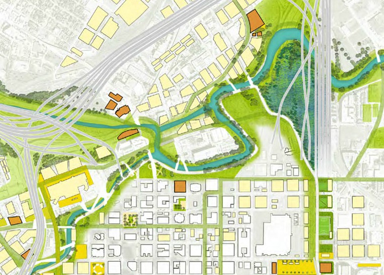
As TxDOT’s caption makes clear, it’d be up to someone else to actually build the waterway. Doing so wouldn’t preclude the previously proposed North Canal from being dug further upstream. Plan Downtown’s less technical map at top shows that waterway beginning at White Oak Bayou and emptying into a bend of Buffalo Bayou just west of Elysian. In doing so, its course creates an exclusive new landmass home to the Harris County jail.
- Conceptual Roadway Layouts and Typical Sections [TxDOT]
- Previously on Swamplot: Funding for Downtown Houston’s New Island; The North Canal, a New Downtown Island, and Other Secret Plans for Downtown Houston’s Future; Latest Mindboggling TxDOT Video Shows Off Rainbow Tangles of Spaghetti-tastic Downtown Freeway Redo Plans in Simulated Drone View; Big I-45 Downtown Rerouting, Grand Parkway Expansion Get Go-Aheads; TxDOT To Pierce Elevated: Your Years Are Numbered, Probably; TxDOT’s Plans for Freeway Expansion Around and Below the Newly Protected Cheek-Neal Coffee Building; Wacky TxDOT I-45 Redo Renderings Now Available in Mind-Boggling Video Format; The 5 Wackiest Images from TxDOT’s Plans To Reroute I-45 and Abandon the Pierce Elevated
Road map: TxDOT. Downtown map: Plan Downtown
FUNDING FOR DOWNTOWN HOUSTON’S NEW ISLAND  Houston’s flood czar Steve Costello tells the Chronicle’s Mike Morris that the city plans to apply for FEMA resiliency grants in order to build the North Canal Bypass — the long-whispered diversion channel that would relink White Oak and Buffalo bayous between Main and Elysian streets. The waterway concept bubbled up last year in Plan Downtown where its course formed an island northwest of Allen’s Landing indicated in the imagined map above. By bypassing the bayou’s oxbow, the channel is expected not only to reduce flooding downtown — it could also “help lower the water level in White Oak Bayou all the way to the 610 Loop and in Buffalo Bayou as far west as Gessner,” according to a county study. The result: “A little more than half of the 854 structures in the 100-year floodplain along White Oak and an adjacent tributary, Turkey Gully, would be removed from the floodplain.” [Houston Chronicle; previously on Swamplot] Map: Plan Downtown
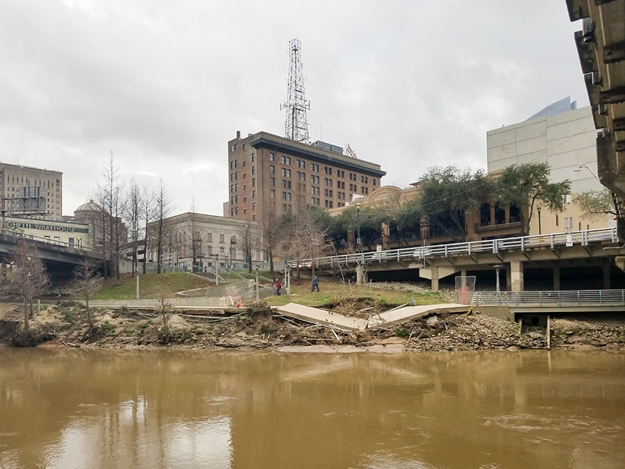
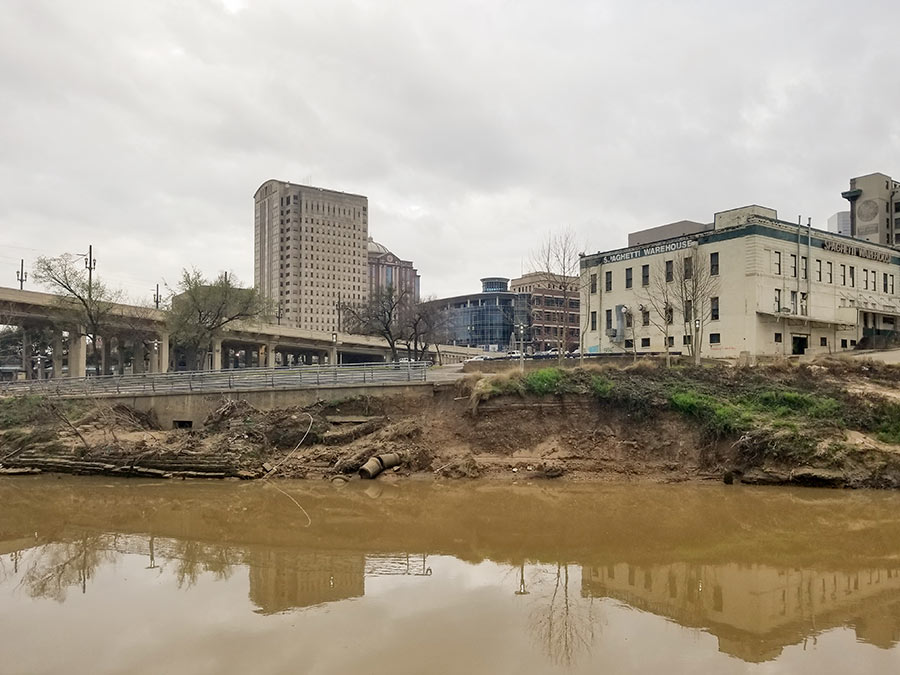
There’s more damage to the areas along Buffalo Bayou than just the collapsed segment of trail pictured at top between the Travis and Milam street bridges. The photo above taken east of Travis shows where Spaghetti Warehouse’s former parking lot is eroding as well and transforming into a new set of cliffs on the water.
Heading west down the trail, more obstacles appear near Montrose Blvd. where the northern trail cuts past the closed Johnny Steele Dog Park:
COMMENT OF THE DAY RUNNER-UP: WHY YOU SHOULD TRY BOATING ON THE BAYOU  “. . . Buffalo Bayou looks really nice from a kayak or canoe, and you can see the houses from the water. I’ve encountered all sorts of wildlife including many different bird species, turtles, and an alligator. There are maps online locating the put-in / take-out spots, if you’re so inclined. Pro tip: if you’re paddling by yourself and wish to take out at the same spot you put in, paddle upstream first, and save the easier downstream half for when you’re tired and just want to go home.” [GoogleMaster, commenting on Comment of the Day: The Real Reason Why Buffalo Bayou Smells and Looks the Way It Does]
COMMENT OF THE DAY: THE REAL REASON WHY BUFFALO BAYOU SMELLS AND LOOKS THE WAY IT DOES 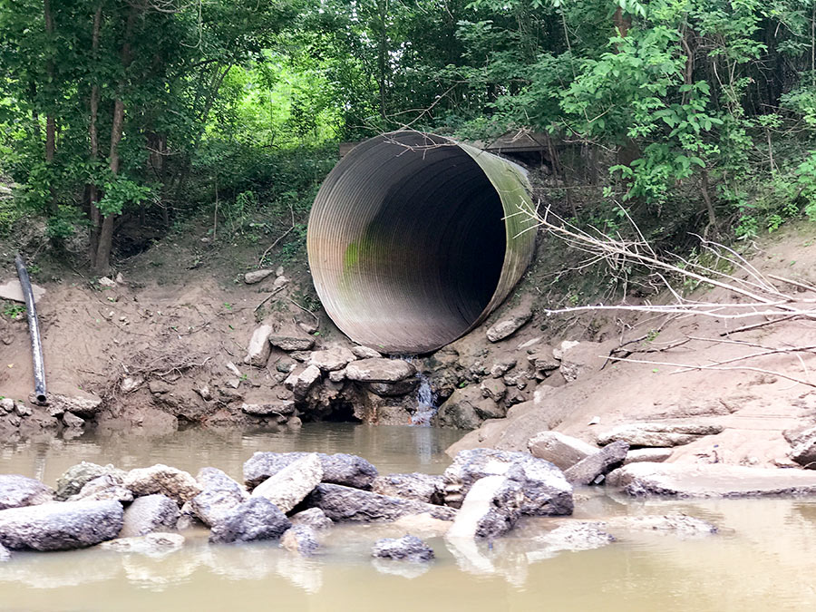 “If Buffalo Bayou stunk so much, then no one would have built a bunch of expensive homes all along it (west of downtown). Most of the Houston area’s waste water effluent flows into the Bayou east of downtown anyways. The Clinton/69th plant (the largest in the city) is just east of downtown, and the Sims and Braes plants don’t enter until well past downtown. With that said, I don’t think the treatment plants are the big contributors to the overall unpleasantness of the Buffalo Bayou water (flood events not withstanding). Most of the effluent (when the plants are properly operating) is nearly clear and usually only has an ‘earthy’ odor to it if any at all. I think the big issue with the bayou’s water quality is the regular runoff and trash that flows into it and eventually lines the shores of it all along downtown.” [nmj, commenting on The North Canal, a New Downtown Island, and Other Secret Plans for Downtown Houston’s Future] Photo: Swamplot inbox
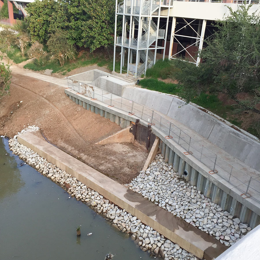
Construction is almost complete on a missing link between the bike paths lining Buffalo Bayou Park and the Heights Hike and Bike Trail, according to passer-by Christopher Andrews — who snapped the above photo from the southern span of the Main St. bridge, looking towards the back of the UH–Downtown campus. The purple curve just north of Allen’s Landing marked on the map below is the segment of the bayou trail that’s in the works. You can see where that portion will intersect the Heights trail, marked below in gray, after it crosses White Oak Bayou’s southerly meander to the east of UHD:

More new features are imagined for the center of Houston than just the new Green Loop highlighted in the just-released Plan Downtown proposal. There’s also a mysterious new Downtown island. Where did it come from?
It’s the result of digging the long-whispered North Canal Channel Bypass, a re-linking of White Oak and Buffalo Bayous north of Downtown. Existing bends and narrow banks along the 2 bayous just east of Main St. restrict the flow of stormwater during flooding events. According to reports, engineering studies have estimated that cutting a straighter diversion channel to bypass the oxbow could reduce flooding Downtown by 3.5 ft.
But digging a new canal while maintaining the existing path of the bayou would create an island out of the area just north of Commerce St. An imagined map of the area in Plan Downtown’s report (rotated so North is aimed down and to the right) shows what car and pedestrian bridges might link it to the mainland:

