11/09/17 3:30pm

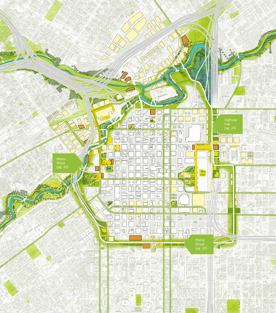
Is Houston ready for yet another loop road? Here’s the proposed Green Loop, a 5-mile network of parks, trails, and other public spaces that the neighborhood supergroups behind Plan Downtown imagine ringing in Houston’s bicentennial — if it’s completed by 2036. One of 10 separate proposals in the plan, the city’s littlest loop is meant to take advantage of TxDOT’s proposed rerouting of I-45 to the east side of Downtown — by wrapping the district tightly with a transportation and recreation circuit that could attract adjacent development and help link the city center to adjacent neighborhoods.

Plan Houston’s new report flags ideas and renderings for 3 spots along Downtown’s proposed Emerald Choker: At Buffalo Bayou, on top of I-69 and I-45 once they’re sunk behind the George R. Brown, and on Pierce St. at the Midtown border.

New buildings at the northwest corner of Downtown would face Buffalo Bayou as well as the surrounding streets, lining the waterfront with flood-worthy attractions:

CONTINUE READING THIS STORY

It’s a Wrap!
10/30/17 12:30pm

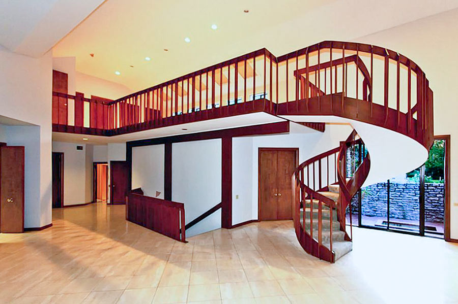
A LAKESIDE ESTATES HOME NOW WORTH ITS WEIGHT IN WATER Before the Army Corps of Engineers straightened the section of Buffalo Bayou between Hwy. 6 and Beltway 8 in the mid 1960s, the cul-de-sac at the end of Riverview Dr. in Lakeside Estates wasn’t just near the waterway, it was in it. But the “view” and “side” in the names the subdivision’s developers later attached to the property east of Wilcrest Dr. as they built on it didn’t hold: “When [Allen] Wuescher says he had 17 feet of water inside his house, it’s one of those things you have to see to believe. It is the fifth time in 26 months that his house flooded, and the third time his entire first story was destroyed by water deep enough for a diving board,” writes Meagan Flynn. “Since the home was built in 1979, homeowners at this address have recouped more than $850,000 in flood damage losses through FEMA’s National Flood Insurance Program, at this point making the home more expensive to taxpayers just to exist than for the government to buy it and destroy it. It was appraised at $825,000 by the Harris County Appraisal District. The FEMA flood insurance loss payments so far don’t even include the extraordinary damage wrought by Harvey. And when we enter the home through Wuescher’s garage — which looks like a scene out of The Texas Chainsaw Massacre but with the lights on and with mold instead of blood — it’s immediately clear that the house really is not a house anymore.” [Houston Press] Photo of 10807 River View Dr. living room: Realtor.com  
10/11/17 5:00pm

EPA: YEAH, BETTER CLEAN OUT THE DIOXIN PITS FROM THE SAN JACINTO RIVER NOW THAT THEY’VE LEAKED A bit later than had been urged by those alarmed by the longterm presence of pits full of toxic waste sealed only with a tarp on top hanging out in the San Jacinto River, the EPA has now approved a plan to remove most of the dioxin stored within them. “As exemplified today, EPA is prioritizing Superfund clean-up by making decisions in a decisive, timely manner,” reads a statement from administrator Scott Pruitt released this afternoon. “The San Jacinto Waste Pits site was added to the National Priority List nearly a decade ago.” What’s the rush? As predicted by EPA studies and many a casual observer, the pits appeared to have leaked extensively after Hurricane Harvey flooding. Under the new $115 million plan, cofferdams will be installed around the pits and almost 212,000 cubic yards of dioxin-contaminated material will be excavated — leaving just enough behind that the agency can, it says, ensure controls that will “prevent access, eliminate off-site migration, and monitor the natural recovery into the future.” [EPA; more info; Houston Chronicle; previously on Swamplot] Video of waste pits after Harvey flooding: Greg Moss

09/20/17 12:00pm

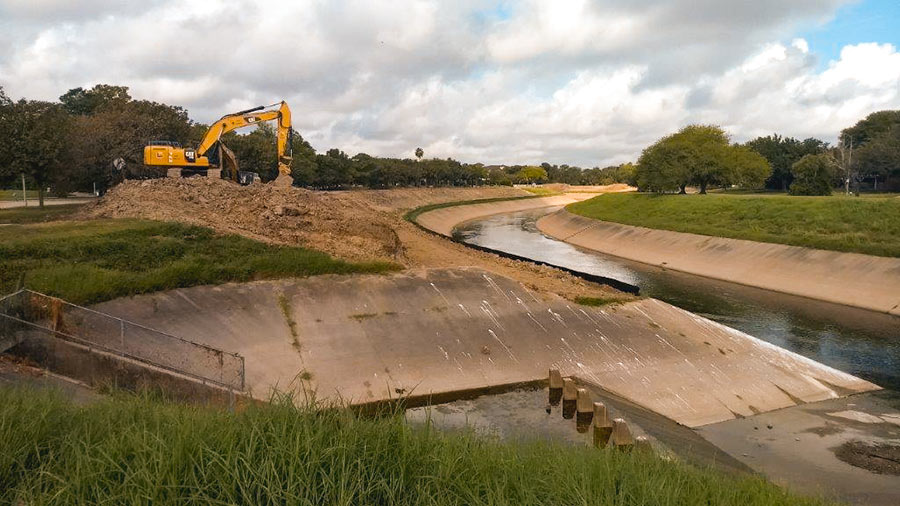
It’s coming a little late for many homes in Meyerland, but excavation crews are once again at work widening the segment of Brays Bayou just downstream of that flooded neighborhood. Work on the segment between Buffalo Speedway and S. Rice Ave. began this past summer. The widening is a part of the decade-plus-old Project Brays, begun before but accelerated as a result of flooding during Tropical Storm Allison in 2001.

Water levels on the bayou have returned to a manageable level; this photo, sent in by a Swamplot reader, shows an excavator at work on its south bank just west of the inlet between Timberside Dr. and Bevlyn Dr.

Photo: Swamplot inbox

Braeswood Place
09/18/17 11:15am

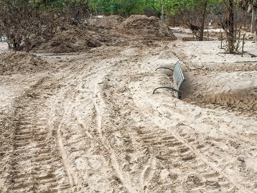
The retreat of floodwaters has revealed the extent of the silt that Harvey-triggered flooding deposited along Buffalo Bayou. A beachgoing reader sends Swamplot these pics of the new dust-colored landscapes that have taken shape along Buffalo Bayou Park and adjacent former green spaces.

The silt-covered bench shown above sits across Buffalo Bayou from the Houston Police Officers Memorial, near Glenwood Cemetery. Here’s a view from further back:

CONTINUE READING THIS STORY

Silt Deposits
09/14/17 1:30pm

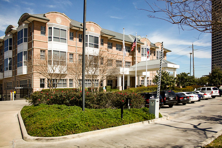
Construction began in June, but the new administration of Houston’s Ronald McDonald House chose this past Tuesday — 2 and a half weeks after water spilling over the banks of adjacent Brays Bayou made Holcombe Ave. in front of the property difficult to pass — to hold an official groundbreaking ceremony for its new 3-phase expansion and renovation project. The facility at 1907 Holcombe Blvd., which sits across the Texas Medical Center’s official southern border between Holcombe and the bayou just west of Cambridge St., serves as a temporary home for families with children receiving treatment for serious illnesses.

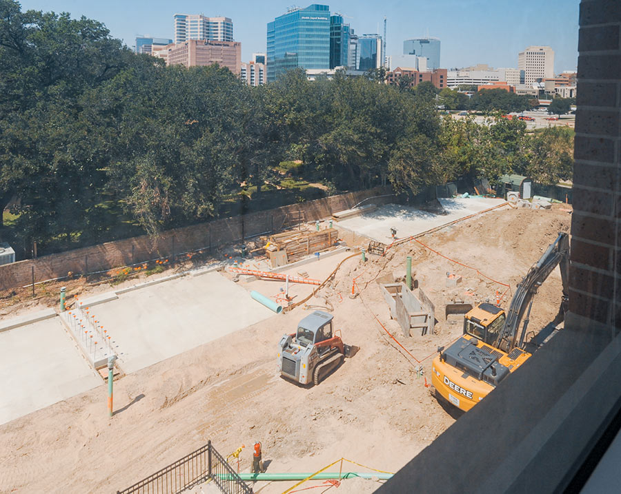
Now going up: a new 2-story bedroom wing directly to the west of the main building. A complete renovation of the 50-bedroom existing building — dubbed Holcombe House — will follow. The photo immediately above, taken from the third floor of that building, shows the construction site as it looked earlier this week.

The official rendering below is still being used to raise the $22.5 million needed for the project; it shows the new bedroom wing on the left and the existing building on the right:

CONTINUE READING THIS STORY

Bedrooms Above
09/12/17 3:00pm

COMMENT OF THE DAY SECOND RUNNER-UP: THE CANAL PLAN FOR HOUSTON “Build canals everywhere. Become the American Amsterdam. Rather than a Pierce Elevated park . . . have a canal that can take on additional water from Buffalo Bayou. Canals throughout Montrose, Midtown, Downtown and around Washington. Canals on the East End and through EaDo. Canals near the Med Center to relieve Brays Bayou, and on and on and on again. Give water new dedicated places to go that we can call amenities, and make Houston a more interesting and attractive place to recruit new companies and tourists, because our canals are unique and cool places to hang out. The Dutch know water, so why not copy them. Then release a ton of GMO mosquitos to kill off the rest of them.” [Canalguy, commenting on How About We Don’t Sell People Homes in Areas That Keep Flooding, and Other Crazy Ideas for Houstonians To Discuss Amongst Themselves] Illustration: Lulu
09/08/17 5:00pm

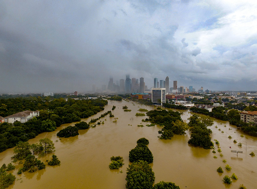
WHAT THE HARVEY FLOODING DID TO BUFFALO BAYOU PARK “Please know that Buffalo Bayou Park was designed to flood, although we did not anticipate three historic flooding events in 1-1/2 years,” Buffalo Bayou Partnership president Anne Olson remarks drily in an email update this afternoon. So what’s the damage? “The bottom two thirds of the park are still under water, and we expect that they will remain so for several more weeks as water is released from the Addicks and Barker reservoirs. Due to these circumstances, it is difficult for our staff to assess the impact the flowing water has had on the footpaths and landscape in these areas. We do know that the Johnny Steele Dog Park, which is still submerged, will be closed for two or three months.” Water and sediment that flooded the Buffalo Bayou Cistern is still draining, slowly, but the electrical system installed when the long-hidden underground space was made available for tours and art installations appears to be working. The Wortham Fountain and the trail lighting system have been damaged, Olson reports. The Bayou City Adventures kayak kiosk at Lost Lake and the Bike Barn at Sabine St. has been shut down for the remainder of the year at least; areas east of the Sabine St. bridge are mostly still underwater. But Olson reports landscaped areas in the upper areas of the park, where trails have already reopened, survived with only a small amount of damage: “We are extremely fortunate that the Lost Lake and Wortham Insurance Visitor Centers did not take on water. Both facilities are open and the Kitchen at The Dunlavy is operating with normal hours. Food trucks also are back in the entry court at Sabine Street from Thursday-Sunday.” Update: The Bike Barn at Sabine St. has resumed normal hours as of September 9. [Buffalo Bayou Partnership] Photo: Adam Brackman.  
09/07/17 4:30pm

The Galveston District of the U.S. Army Corps of Engineers has made public a set of interactive maps — normally used by emergency personnel — that show which areas along the length of Buffalo Bayou are predicted to remain under water or emerge from it as officials continue to release water from the Addicks and Barker reservoirs upstream. Individual interactive map panels cover each day from September 5th through the 16th, but as of this date all rely on data developed on Tuesday, when the maps were created.

The embedded version above mimics the view from a mobile browser; you can zoom in to view the projected water line on any street. To switch days, click on one side or the other of the panel at the bottom of the frame — or choose the date directly from the menu that appears after you click on the icon in the top left corner.

To view the map in its own browser window, click here.

Map: USACE Galveston District

Inundation Levels, Day by Day
09/06/17 4:30pm

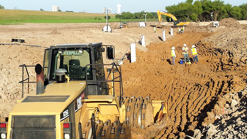
COMMENT OF THE DAY: COULD WE BORROW BRAYS BAYOU RIGHT AFTER YOUR NEXT FLOOD, PLEASE? “. . . An undergound aqueduct probably won’t resolve the situation. However, this storm has made it pretty clear that having both Barker AND Addicks draining 100 percent into Buffalo Bayou may not be ideal. An addition channel that would allow USACE to divert some of the Barker outflow to Brays Bayou would allow for some flexibility. While Brays DID flood during Harvey, the water receded very quickly, with the water back within its banks and falling quickly while Buffalo Bayou was still rising.” [Angostura, commenting on Clearing Out the Mold; Houston’s Drinking Water Close Call; The Floodeds and the Flooded-Nots] Photo of construction at Addicks and Barker Dams: U.S. Army Corps of Engineers [license]
09/01/17 7:00pm

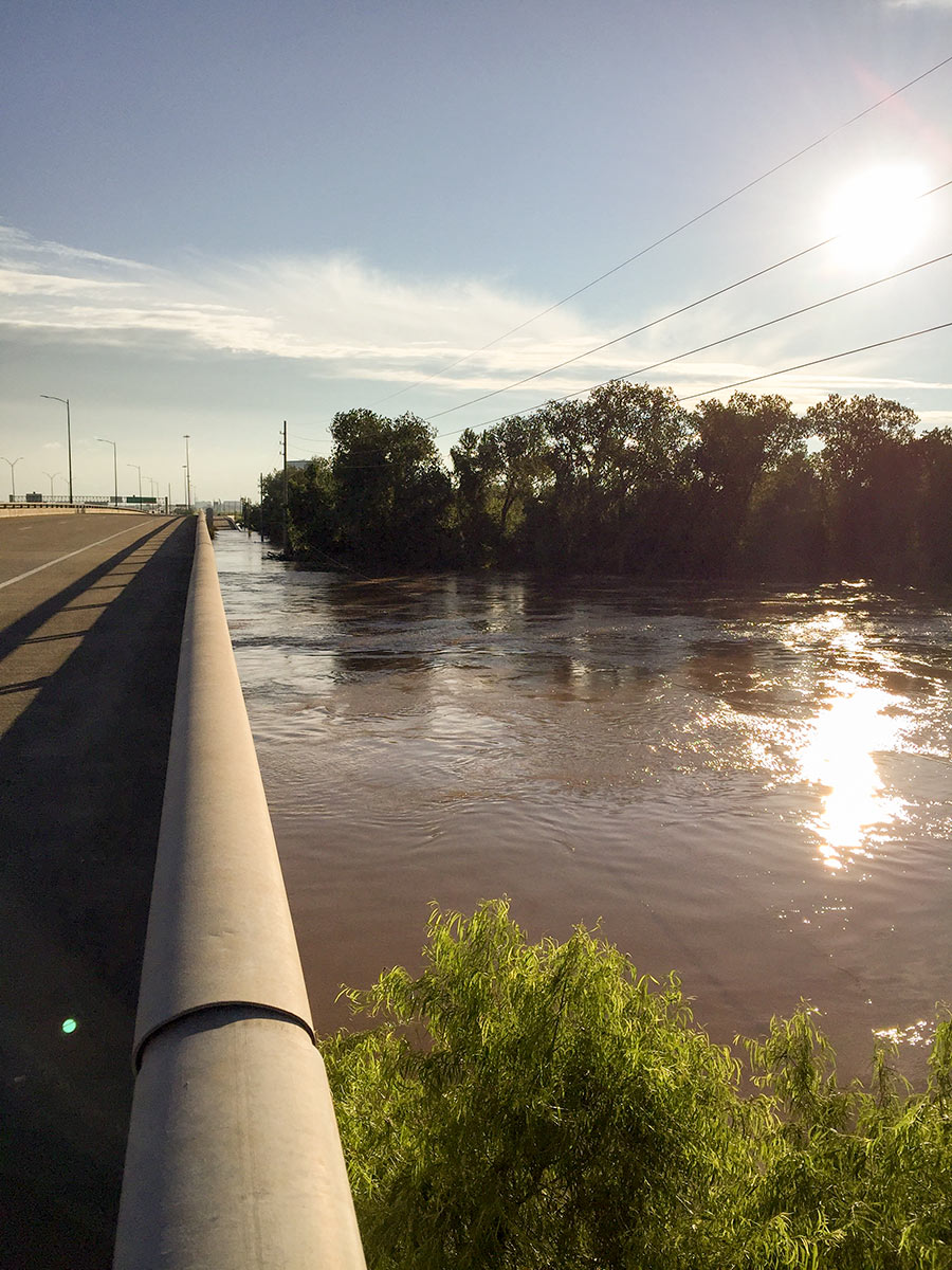
7 DAYS OF HARVEY BEFORE THE BRAZOS RIVER REACHES ITS SUGAR LAND PEAK It wasn’t until early this morning that the Brazos River in Sugar Land and Richmond reached its highest level since area flooding triggered by Hurricane Harvey began. And it was a new record, reached at 5:15 am: 55.19 ft., according to the National Weather Service. The previous record, 54.7 ft. — surpassed Thursday at 1:30 am — was set by a flood last year on Tax Day June 2nd. The photo here shows the river during a rare moment of sunshine a day earlier than that — from Hwy. 59 where Greatwood, Riverpark, Telfair, and Sugar Land Memorial Park meet. [Houston Chronicle] Photo: Grace Carlson
08/30/17 4:45pm

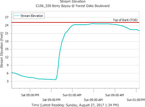
HOW IT LOOKS FROM THE DRY SIDE OF THE BAYOU Chronicle features editor Lisa Gray says her Meadowcreek Village home escaped water damage during the flood, but it was close — and many others weren’t so lucky: “Berry Bayou — the middle of which forms my back property line,” she writes, “received more than 45 in. I’ve seen it in national weather-nerd articles where people are marveling how fast a bayou can rise. My husband says we were half an inch away from the bayou coming out of its bank in our back yard. He sent a graph, showing that on Saturday night, at the monitor I can see from my back yard, it was literally at bank level. But the water broke first on the other bank, into the yard of one of my favorite people in the neighborhood, and up and down the yards on that side. Lots of houses flooded. ‘Dry privilege’: That’s the headline of the essay I ought to write.” [Previously on Swamplot] Graph of Berry Bayou water levels at Forest Oaks Blvd. on August 26th and 27th: Harris County Flood Control District
08/28/17 11:00am

With water levels on Buffalo Bayou around Shepherd Dr. now forecast to recede, this drone video of one stretch of the waterway — taken yesterday during a lull in the rains — may turn out to be one of the best views available of the extent of flooding at the northwest corner of Montrose. A few video highlights, still visible above the floodwaters: The top floor of The Dunlavy, high above the now-complete-subsumed Lost Lake; the fuzzy treetop semi-circles formed by the twin stands of crape myrtles at Waugh Dr.; the Waugh Dr. bridge itself, now looking like a causeway; and the patterned grounds of the Beth Yeshurun Cemetery.

Video: Evan Mallett

Dunlavy to Waugh
08/18/17 12:30pm

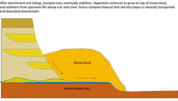
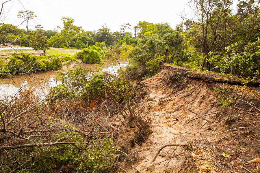
The folks fighting a longstanding battle to prevent the reconfiguration of a section of Buffalo Bayou fronting the southeast corner of Memorial Park and the River Oaks Country Club have posted a remarkable series of images showing how a section of the bayou’s bank at the Hogg Bird Sanctuary responded on its own over the course of 2 years to a soil collapse suffered during the 2015 Memorial Day flood. The geologists behind Save Buffalo Bayou claim that the promoters of the Harris County Flood Control District’s proposed $12 million Memorial Park Demonstration Project they’re trying to stop have mistaken a natural bayou-bank process called vertical slumping (or sloughing) for erosion, and that attempting to stabilize the bayou banks to fix the supposed erosion will leave the area “a wasteland of denuded and weakened banks.”

But you don’t have to buy or even follow the riverine logic the organization steps through in a lengthy article posted to its website earlier this week to appreciate one of the examples of waterway-bank adaptation exhibited there. The first image (at top) shows the immediate aftermath of the Memorial Day storm or 2 years ago on the high bluff facing the bayou at the Hogg Bird Sanctuary in Memorial Park, which stands at the downstream end of the proposed project area. According to the organization, an HCFCD consultant claims that this is one of 4 spots within the bayou area that suffers from severe lateral erosion. But to Save Buffalo Bayou, this isn’t erosion; it’s just a slump, which is what bayous do naturally, and which on their own create the distinctive bluffs on the bayou’s banks. There’s no way to fix a slump, the organization’s geologists say — if left alone it’ll restore itself.

Here’s their photo evidence. The second photo, also from June 2015, shows the slumping — and downed trees:

CONTINUE READING THIS STORY

A Bayou Demonstration Project