COMMENT OF THE DAY: WHY HOUSTON FREEWAYS SHOULD BE BUILT TO FLOOD  “. . . Why would you NOT want a massive freeway that would otherwise be empty in the event of a true emergency to flood? Spend the money on barriers/signage for flooding, throw in some pumps and you have a perfect deterrent for neighborhood flooding in the event of an emergency. I don’t remember any of the surrounding areas along 59 complaining about it being a great place to store flood water during Allison.” [joel, commenting on What Could Go Under When I-45 Moves Underground and East of Downtown] Illustration: Lulu
Flooding
WHAT COULD GO UNDER WHEN I-45 MOVES UNDERGROUND AND EAST OF DOWNTOWN 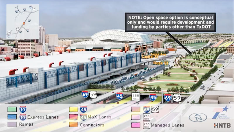 Jeff Balke tallies some of the expected carnage just east of Downtown should TXDoT proceed with its planned rerouting of I-45 from the west side to the east side of Downtown, widening the path of that stretch of Hwy. 59 (aka I-69) to Saint Emanuel St. Among the establishments expecting to have to shut down or relocate as a result of the expansion: the Bayou City Barber Shop, Vietnamese restaurant Huynh, Ahh Coffee, Tout Suite, one building of the Ballpark Lofts, low-income housing development Clayton Homes, a couple of nonprofits, SEARCH Homeless Services’ new building, the Loaves and Fishes soup kitchen — plus other assorted bars, barbecue joints, artist spaces, and office space. Among the questions Balke keeps hearing in reference to plans to put this portion of a new I-45-69 combo below grade, possibly (only if separate funding can be found) with a greenspace “cap” planted on top of it: “why [would] a freeway would be constructed lower than street level in a city that floods with seeming regularity, particularly when the highway in question is a hurricane evacuation route? TxDOT is quick to point out that we already have roadways below grade throughout the city that have not suffered major flooding problems since Tropical Storm Allison in 2001, which broke records and is widely considered a 500-year flood. Still, flooding is something the agency appears to have taken seriously. ‘No matter the situation, there’s a potential for flooding,‘ [TXDoT spokesperson] Perez explains, ‘but with anything below grade, additional pumps and detention ponds come into play.’ [Houston Press; previously on Swamplot] Rendering showing possible park behind GRB: HNTB and TxDOT
COMMENT OF THE DAY: WHAT FLOOD INSURANCE FLOWS FROM  “The NFIP is a creation of Congress meant to insure against a peril which the private insurance industry refuses to insure against. The reason private insurance refuses is because there is no actuarially sound method to do so. Effectively, federal flood insurance is not pure risk insurance but actually a type of social insurance. To move the conversation forward on flood insurance reform, that fact has to be acknowledged first. By properly characterizing it as social insurance, we can start talking about how much more people in flood prone areas should pay.” [Jardinero1, commenting on The Limits of Mapping Flood Risk; Original Beaver’s Takes a Summer Vacation] Illustration: Lulu
COMMENT OF THE DAY RUNNER-UP: WATCH FOR TOMORROW’S FLOODING TODAY! “ Homeowners in the area would be wise to keep a keen eye as to the elevation of the current Fiesta property, document with photos and watch as the builders elevate the ground of the property two or more feet above existing grade. This elevation of property will push water off the commercial property and onto lower lying homeowners and existing small businesses. I attended a talk this week with a flooding expert from Texas A and M who pinpointed development as the primary driving cause of Houston’s flooding. This was a highly intelligent and well regarded college professor and researcher. He says he gets phone calls from first time flood victims and always asks if anything was recently built in the area. Often they will say that a Wal-Mart or something similar was built immediately before their flooding problem started. This is real, everyone. Document your lawsuit evidence today.” [Tired of flooding, commenting on H-E-B To Scoot Groundbreaking Back to End of Summer Break, Scoot Building Up Toward N. Shepherd] Illustration: Lulu
HOUSTON’S PREMIER FLOATING TOURIST ATTRACTION SHUT DOWN AGAIN AFTER MORE LEAKS  A 6-by-8-in. hole 15 inches below the water line discovered yesterday on the starboard side of the Battleship Texas caused the San Jacinto Battleground tourist attraction to tilt a “pretty serious” 6 degrees overnight, KPRC’s Cathy Hernandez reports this morning. The battleship — which was built long after the Battle of San Jacinto, but is a veteran of 2 world wars and a whole lot of 21st Century rust — has now been closed to the public until further notice. At last report, approximately 2,000 gallons of water per minute had been pumped out of the ship for more than 15 hours. Funds originally allocated to move the retired sea vessel to a dry berth were used instead to repair previous leaks. [Click2Houston; Texas Parks & Wildlife; previously on Swamplot] Photo: Coast Guard News [license]
COMMENT OF THE DAY: LAY OFF THOSE FLOODED UNDERGROUND FREEWAYS, THEY’RE JUST DOING THEIR JOB  “Trenched roads include sumps that are capable of keeping the roadways from flooding from ordinary rain events, but are designed to become flooded in an emergency, acting as additional stormwater detention. Every cubic foot of stormwater that goes in there is a cubic foot that isn’t at the same elevation as city streets, businesses, and houses. It is a feature, not a bug.” [TheNiche, commenting on Watch as Unfunded Parks Appear on Top of Houston Freeways Before Your Very Eyes!]
COULD HARRIS COUNTY SAVE UP SOME FLOODWATER FOR WHEN IT’S REALLY NEEDED? 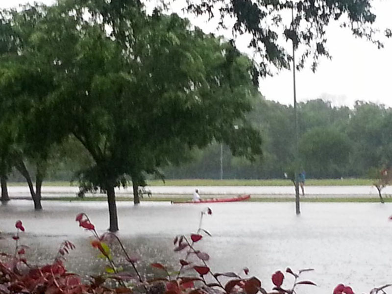 Finding a way to stockpile floodwater during years of plenty, commissioner Jack Cagle tells Mihir Zaveri this week, might not only help to make more water available for use during Houston’s drought years. It might also be a way to check the Houston region’s tendency for subsidence (that slow, permanent sinking that can happen when groundwater is pulled out of Houston’s soft clay layers too quickly). Or maybe, Zaveri adds, it could be used to help keep seawater from being sucked into aquifers as fresh water gets sucked out the other side — as long as doing so didn’t accidentally contaminate those same aquifers with junk from the surface. Who knows? Nobody, yet — but the county commissioners have given the $160,000 okay to a study team to shed light on whether it would be possible, feasible, or advisible for Harris County to pump floodwater underground for storage during major storms. [Houston Chronicle; previously on Swamplot] Photo of Meyerland flooding on Tax Day 2016: Tamara Fish
FLOODED-OUT FLOODING SYMPOSIUM TO TRY AGAIN IN APRIL 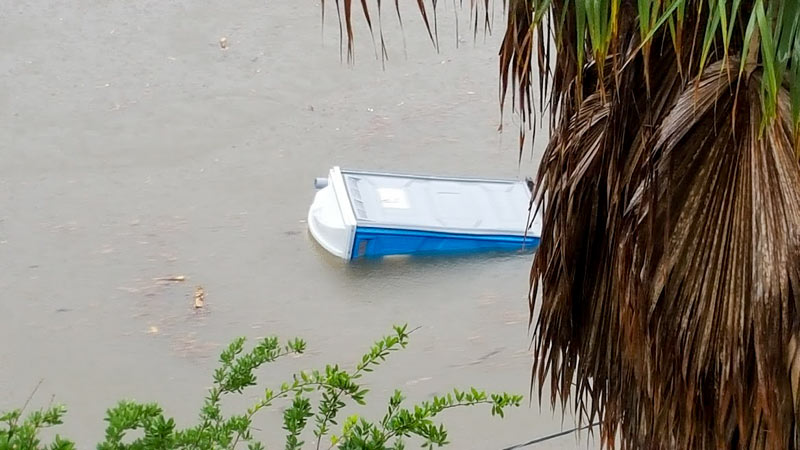 That January meeting of city officials, scientists, urban planners, business folks, engineers, conservationists, architects, and other flood-minded citizens — the one that was cancelled due to flash flooding — has now been rescheduled for April 5th. The symposium is still slated to take place at the George R. Brown Convention Center, and the same panelists appear to be on the docket. The event is free and open to all high water spectators, but you’ll need to register online by March 29th.  [Previously on Swamplot] Photo of flooding along Brays Bayou on April 17th, 2016: Chris Klesch
CITY LOSES LATEST APPEAL ON 2010 DRAINAGE FEE ELECTION 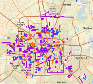 This week the state’s Fourteenth Court of Appeals upheld a 2015 ruling calling for a new election on the ReBuild Houston drainage and road-fixup fee. As in another local case involving charter invalidation and large sums of collected assessment money, the city is mulling over further appeal options, though the case’s last trip to the Texas Supreme Court didn’t go in the city’s favor. The Chronicle‘s Katherine Driessen also writes that the fund’s future is now murky: the decision doesn’t stop the city from collecting the fee for now, since that collection was authorized through another city ordinance — it may, however, remove restrictions on how the money can be used. [Houston Chronicle; previously on Swamplot] Map of past, ongoing, and planned drainage and street projects: ReBuild Houston interactive map
CITY HOPES TO CHOP A DECADE OR 2 OFF THE BRAYS BAYOU FLOOD CONTROL TIMELINE 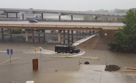 At the current rate of federal funding trickling in for the completion of the Project Brays flood control project, the work could take another 20 years or so to complete, Mike Morris writes this week — noting that the Harris County Flood Control District originally expected about $50 million in federal reimbursement every year, but has been getting an average of $11 million annually in recent years. The city is now planning to speed the project up by asking to borrow $46 million from state-level funds to give to the county, potentially helping it meet or beat a 2021 completion deadline. And “yes,” says city flood czar Steve Costello, “the city is going to be taking [a] risk because we’re going to be waiting for the money, but we’re confident that this is the start of a long-term relationship and we think it’s going to work very well.” (If it does work well, the city may do the same thing for work on White Oak and Hunting bayous.) [Houston Chronicle; previously on Swamplot] Photo of Tax Day flooding at Brays Bayou and 610: Chris Klesch
TONIGHT’S AREA FLOODING SYMPOSIUM CANCELLED BY AREA FLOODING 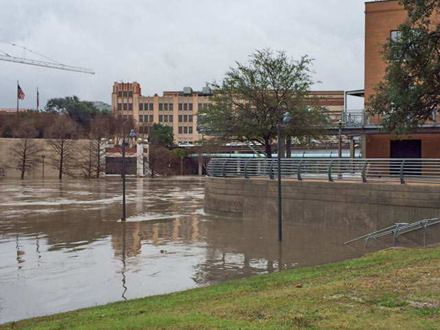 The free public Flooding and Storm Surge Symposium previously planned for this evening at the George R. Brown Convention Center is being postponed, on account of it’s flooding right now. The event would have included 2 panel discussions with flood-minded folks from a variety of public and private sectors and institutions, gathering to talk about the city’s flooding and storm surge issues and possible solutions; the Urban Design Committee of the Houston chapter of the AIA says the event will be rescheduled. [Houston AIA] Photo of this morning’s high water at Allen’s Landing: Christine Wilson

Most of the grassy banks and walking paths usually visible east of Main St. are obscured in this morning’s footage from semi-regular Allen’s Landing correspondent Christine Wilson, who captured some shots of high water (and a few street lamps shakin’ it in the current). This morning’s heavy rain has overtopped roads in some of the usual spots (check out Transtar’s list of water-related road closures here) west and north of Downtown, and the National Weather service has just issued a flood warning for parts of the city through 4:15 this afternoon (with more rain expected later today). The confluence of White Oak and Buffalo bayous, receiving much of that water as it runs toward the bay, appears to have been swept clean of trash and baby ducks for the time being, though some larger waterfowl were still spotted hanging around upslope on the southern shore:
CITY-WIDE DRAINAGE SWAT TEAM POSSIBLY BANKROLLED BY HEIGHTS WATERWORKS SALE 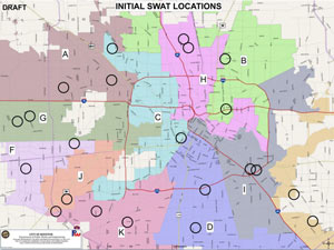 Mayor Turner announced plans for a dramatically monikered Storm Water Action Team at this week’s council meeting, along with 22 projects at the top the program’s initial list, based on metrics of urgency like frequency of 311 calls. The goal of the program is to deal with non-bayou-centric flooding issues like collapsed culverts and junk-clogged drainage ditches; flood czar Steve Costello said after the council meeting that the city wants to resolve the fixable issues at each site within 90 days of a site visit and initial drainage triage. Meagan Flynn writes this week that the $10 million currently budgeted for the program comes mostly from a one-time sale of city land; that land might well be the Heights Waterworks properties at W. 20th and Nicholson streets, which were sold to apartmenteer Alliance in mid-December for a reported $15.2 million. [Houston Press; previously on Swamplot] Draft map of 22 SWAT project locations: City of Houston SWAT program materials
JUST HOW MUCH FLOODING IS TOO MUCH FLOODING FOR HOUSTON?  We pretty much know what we would have to do to stop most Houston flooding, writes Dylan Baddour as the calendar flips to 2017.  Potential paths to drier ground for the city include a multitude of complex region-wide tasks, including changes to waterways across the county, adding thousands of acres of detention space, and potentially addressing the cumulative impacts of seemingly minor small-scale building practices.  The cost of upgrading the whole system, including buyouts, bayou widenings, and utility rerouting, is estimated by the county flood control folks at around $27 billion — and that’s just to get protection up to so-called 100-year storm levels; Houston has had 8 such storms in the past 27 years, and the Tax Day flood was fueled by a much larger event. “What needs to be decided,” Baddour writes, “is how far taxpayers are willing to go. Cars don’t have airbags to absorb a hit from a train. Should Houston have a drainage system to contain a biblical storm? Where does the city draw the line?” City flood czar Steve Costello tells Baddour that the city has to do something, however, to avoid passing on a “potentially insurmountable problem” to future Houstonians. [Houston Chronicle] Photo of N. Braeswood Dr. at 610 on April 17, 2016: Chris Klesch
COMMENT OF THE DAY: FURTHER READING INTO YOUR HOUSTON FLOOD AND FIRE CHANCES 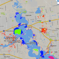 “Every home is susceptible to flooding. There are not ANY non-flood areas. There are only homes that are more likely to flood and homes that are less likely to flood. The likelihood is expressed, on flood maps, by the single-year probability of being flooded (with some other factors). This does not properly describe the likelihood of being flooded during the course of a longer time period — of, say, a 30-year mortgage. Homes eligible for NFIP preferred flood rates can have up to just less than a 1 percent chance of flooding annually. These ‘preferred areas’ are what the public thinks of, euphemistically, as non-flood areas. Assuming a .009 probability (just less than 1 percent), a home has a 20 percent chance of flooding, at least once, over the course of a 30-year mortgage (look up binomial probability). An alternative way to think about it is that 1 in 5 homes, in preferred flood zones, will flood over the course of a 30-year mortgage. [In that case,] you are actually more likely to experience a flood than a house fire in a ‘preferred flood area.'” [Jardinero1, commenting on Where Houston Floods Outside the Flood Zones] Image of recent flood map revisions: FEMA RiskMap6

