07/02/18 4:30pm

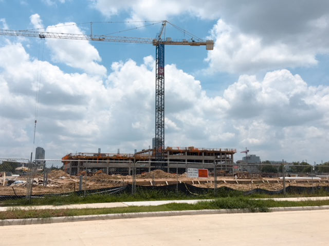
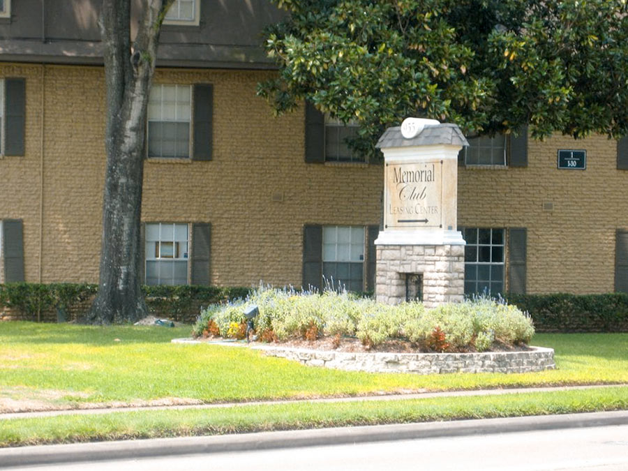
Residents of the Memorial Club apartments at 955 Westcott St. now have 5 months left to beat it from the complex in order to make way for a new residential building that’s set to rise in its place. According to a letter that landlord Greystar sent out on June 11, the deadline to vacate is December 31. Up until then, the company “is engaging a relocation specialist” to assist tenants with their moves.

The photo at top shows the apartment’s yard sign, with an arrow (since covered up) pointing across Westcott to where its leasing office once sat within the demolished eastern portion of the complex. Greystar tore that section down in 2014, about a year after buying both halves of the complex and announcing a 2-phase redevelopment plan for the land, to include 550 units spread across a pair of buildings.

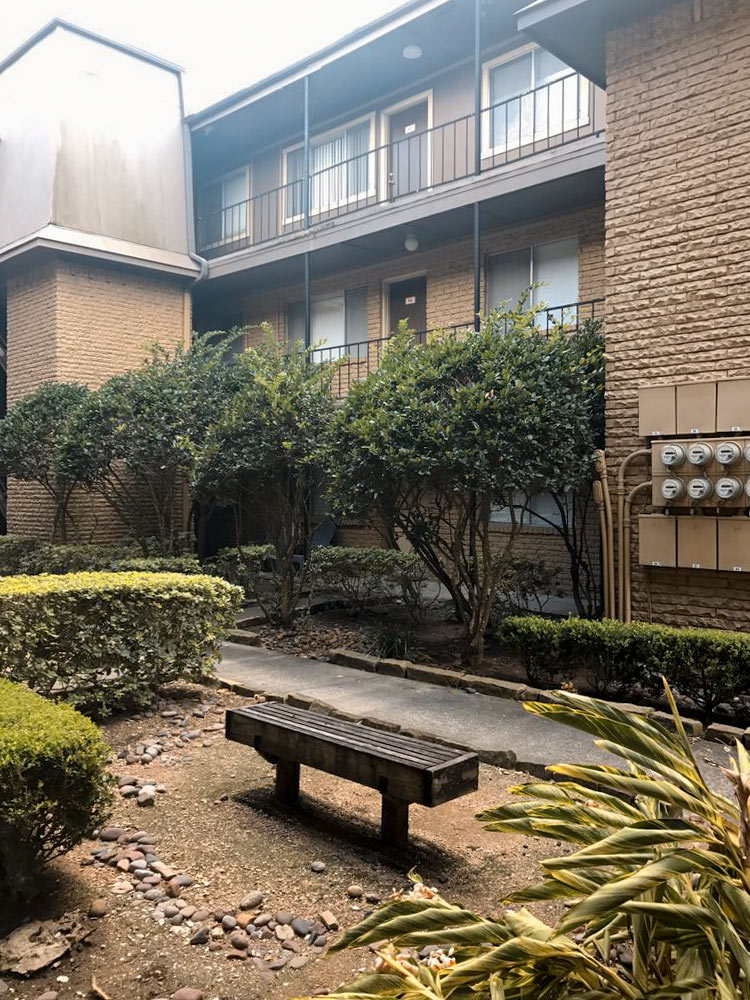
297 of them are already housed across the street in the 6-story Elan Memorial Park building — pictured below — that the developer put up in 2016:

CONTINUE READING THIS STORY

Exodus on Westcott St.
06/29/18 3:45pm

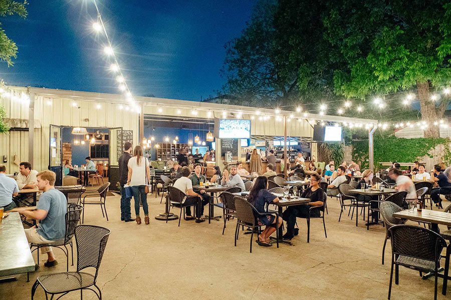
AN UNDERCOVER BARFLY’S REPORT FROM DOWN THE STREET From the report of former Texas peace office and expert bar witness Darren K. Coleman who recently performed an assessment of Cottage Grove bar Down the Street at 5746 Larkin St.: “On April 20, 2018, Mr. Coleman made an anonymous visit to the Bar to make personal observations. During his visit, Mr. Coleman observed numerous cars parked along the street, some being cars belonging to Bar patrons and some belonging to residents and/or residents’ guests. He observed that traffic was not impeded by cars parked along the street; however, two cars could not pass at the same time. He assessed that this was not uncommon for any neighborhood where cars are parked along the street. Mr. Coleman did not observe litter in the area. Additionally, he observed the patrons to be well-behaved and polite. No one was intoxicated or displayed belligerent, loud, aggressive, or lewd behavior. The indoor music was at a moderate volume and was not loud enough to interfere with normal conversation.” Coleman’s report was included in testimony presented to a state judge after a group of neighbors protested the bar’s request to renew its TABC license. Based in part on Coleman’s outside opinion, the judge found Wednesday that the bar wasn’t violating any TABC rules and recommended the TABC approve its requested renewal. [Texas Office of Administrative Hearings] Photo: Down the Street
06/26/18 4:30pm

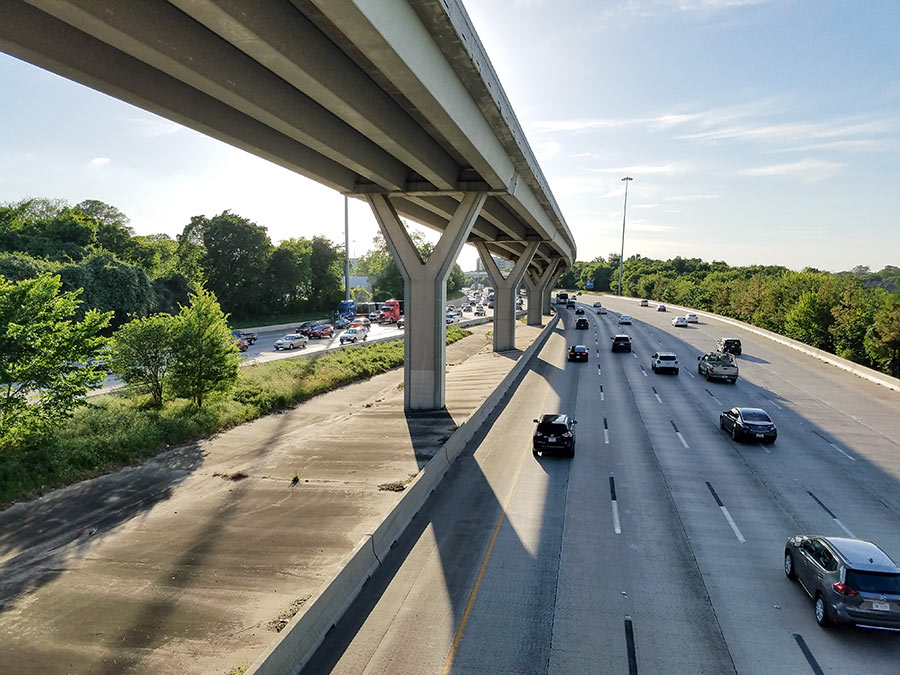
COMMENT OF THE DAY: I-10 LOW-BRIDGE ALERT SYSTEM ISN’T EYE-CATCHING TO PASSING TRUCKERS “The sign mentioned in the posting is a joke — it’s small, off to the side, partially obscured, and it is not readily apparent what it’s referring to. Worse than that, it is 2 miles ahead of the 610 interchange, and 7 miles ahead of the Houston Ave. overpass. It is nowhere close to a sufficient or effective system, and along with the new low clearance signs inside the Loop, has every appearance of a band-aid solution to something that needs a more comprehensive approach.” [TMR, commenting on How TxDOT Tries To Stop Trucks from Clipping the Houston Ave. Bridge] Photo of I-10 near Houston Ave. bridge: Marc Longoria via Swamplot Flickr Pool

06/26/18 11:30am

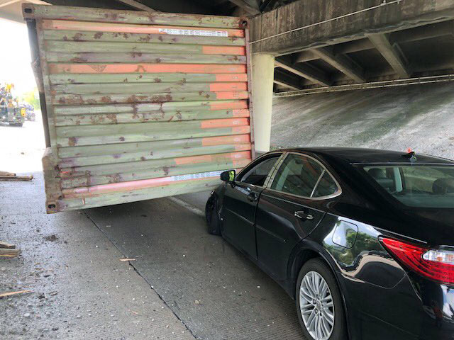
The latest 18-wheeler to drive into the Houston Ave. bridge didn’t make enough of an impact to force repairs yesterday, although it did stall I-10 traffic all the way to T.C. Jester while TxDOT closed 2 lanes to clear the debris (including the truckload pictured above pinning a sedan) and inspect the overpass to ensure its integrity. (The last round of bridge maintenance in March — to repair a strike in December — couldn’t have come at a better time: “Just as crews were putting barriers in place,” for an overnight closure to fix the damaged structure, another truck drove into itreported Houston Public Media’s Gail Delaughter.)

Over the last 4 years, the 14-ft.-3-in.-high bridge has been hit 22 timesreports Click2Houston; historically, it’s struck “more than any other bridge in the Houston area,” says a TxDOT spokesperson. Not a great track record — until you factor in how many trucks aren’t hitting it as a result of TxDOT’s high-tech warning system. In 2015, the agency installed infrared sensors at Mercury Dr. and Wirt Road that detect oversized vehicles and — if spotted — flash a warning message to get off the road on an electronic billboard. Between January and June 2 of this year alone, the sensors transmitted 13,477 warnings.

Photos: Emily Black

Chronic Drive-By Zone
06/25/18 9:30am

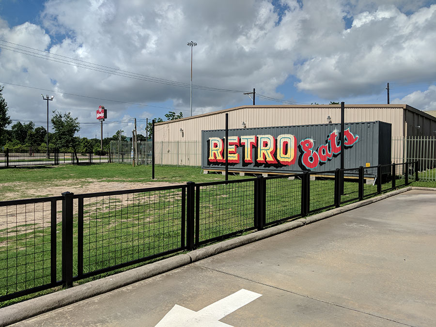
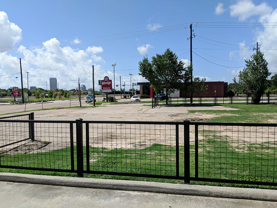
A Swamplot reader stopping by Nourish + Kalos’s coffee and juice venue this weekend sends a photo of a new shipping container that’s now filling in the food gap between the beverage spot and Wendy’s’s drive-thru, visible on the south side of Cornish St. above. The box landed recently in the western end zone of a third-acre field off Durham — adjacent to GH Leather’s tan warehouse — that’s been starved for attention, save for that of the occasional food truck. Another less recent and less visible development for the container-containing parcel: an electrical permit filed on it in late April.

While the property housing the container — as well as a 5,000-sq.-ft. vacant lot abutting it — have been owned by the same entity since 2012, the grass-less corner lot shown beyond newly-installed black fencing in the photo above is in the hands of a different party. Nothing’s been built on any of the flatlands in over a decade, even as the neighboring strip building home to Gumbo Jeaux’s, Vape HQ, and Nourish + Kalos went up to the north in 2014.

Photos: Jason Cockerell

Need a Box for That?
06/22/18 5:00pm

About 2-and-a-half floors of the soon-to-be-5-story Broadstone Studemont apartment building are now standing on a 4-acre parcel between Hicks and Summer streets. The shot above takes a look at the complex from an extension of Summer St. laid down west of Studemont — and Kroger — prior to the apartments’ groundbreaking in February.

The road segment cuts between the north side of the apartments and the planned Studemont Junction retail center opposite them, highlighted in the site plan below:

CONTINUE READING THIS STORY

Graveside Mid-Rise
06/19/18 5:15pm

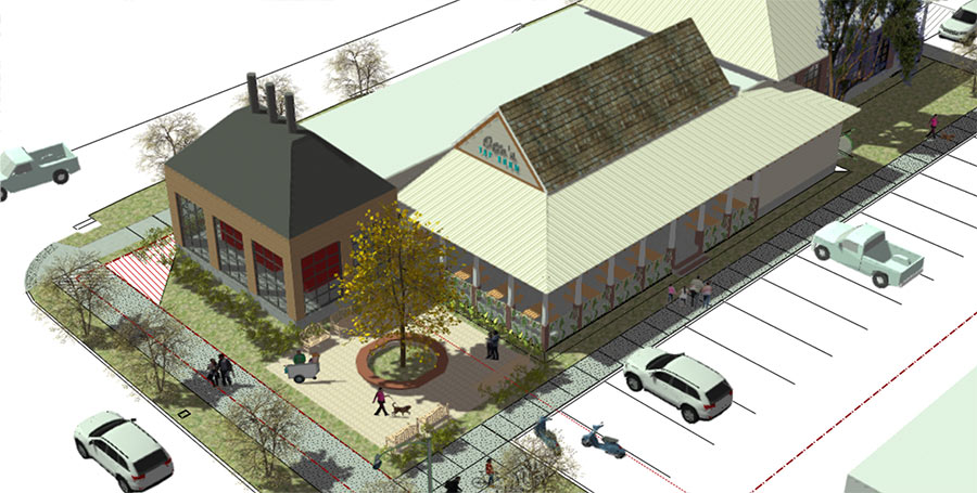
Coming soon to the block across Durham from W Grill, just south of Washington: Otto’s Barbecue & Catering. The 67-year-old chain has plans for its first standalone location since the original on Memorial Dr. was sold in 2009 (for less than its owners felt it should’ve been) and demolished to make way for a collection of strip buildings.

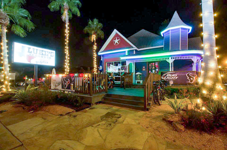
Until last November, Luke’s Icehouse (pictured above) was the only structure standing in the way of the planned new restaurant on the corner of Lillian St. and Durham — but after shuttering last June, its building was torn down 5 months later. The rendering above shows Otto’s taking over the site from the north above Durham, where a courtyard fronts a covered patio adjacent to a parking lot.

Inside, the site plan indicates that 3,293-sq.-ft. would be devoted to the restaurant, while 1,722 would make up an attached catering kitchen:

CONTINUE READING THIS STORY

Smoke Signals
06/18/18 10:45am

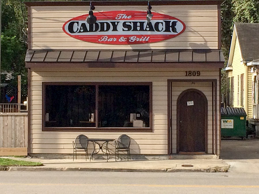
B&B Butchers owner Benjamin Berg has a new restaurant in the works for the former Caddy Shack Bar & Grill building pictured at top, across the street from his existing venue’s parking lot on Wash Ave and 2-doors down from the redone building now housing Gus’s Fried Chicken. An entity connected to Berg filed a permit last Friday to prep 1809 Washington for the new business it’ll host, dubbed Cafe Lemon.

Caddy Shack (not to be confused with Candy Shack, the drive-through daiquiri spot 2 miles west on Washington) debuted in the 1,968-sq.-ft. structure 6 years ago following the Broken Spoke Cafe’s shutdown and posthumous fire. After a brief stint as Turkey Leg Hut — a Cajun restaurant which brought hookahs to the patio pictured above — the space rebranded back to Caddy Shack before shuttering for good around the end of last year.

Photos: Gil G. (Caddy Shack); Te Y. (patio)

Cafe Lemon
06/14/18 1:15pm

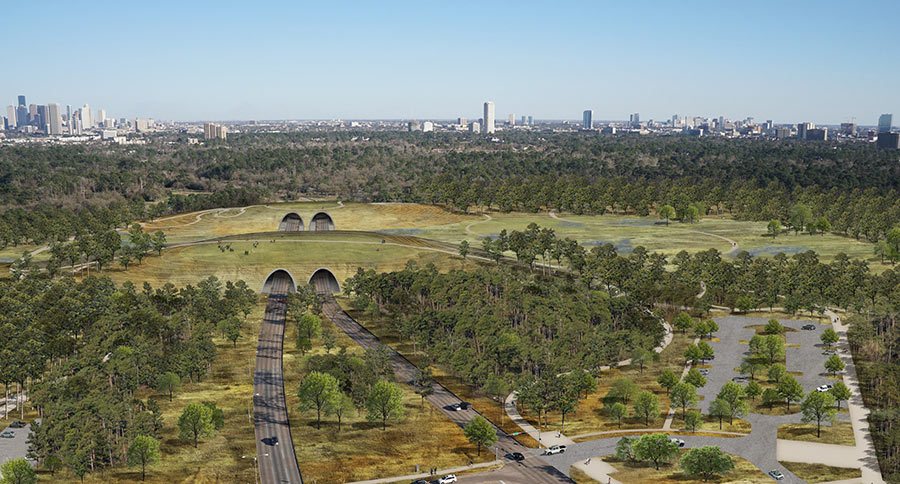
Among the many changes now slated for Memorial Park: parking meters. The $70 million gift the Kinder Foundation pledged in April to expedite park renovations came with a few spend-it-wisely stipulations, including one that the city won’t blow any of it on maintenance costs — which could rise as the redo adds new trails, drainage improvements, a running complex, and a land bridge (depicted in the rendering above) across Memorial Dr. to the green space over the next 10 years. Although the $1-per-3-hour-block meters will only crop up in certain sections of the park, the change they collect will help offset upkeep across the whole 1,500-acre area.

A consolation: the new trail system proposed for the park will be vast, according to a handout from the city’s Quality of Life Committee, “thereby reducing the need for car access” in the first place. But that workaround only helps if you’re arriving empty-handed, unlike golfers who’ll have top pay $1 per hour to park in the course and driving range lot — Mike Bailey notes in Golf Advisor — beginning sometime before the fall.

Rendering of planned Memorial Dr. tunnels beneath park: Memorial Park Conservancy

Upping the Ante
06/14/18 10:00am

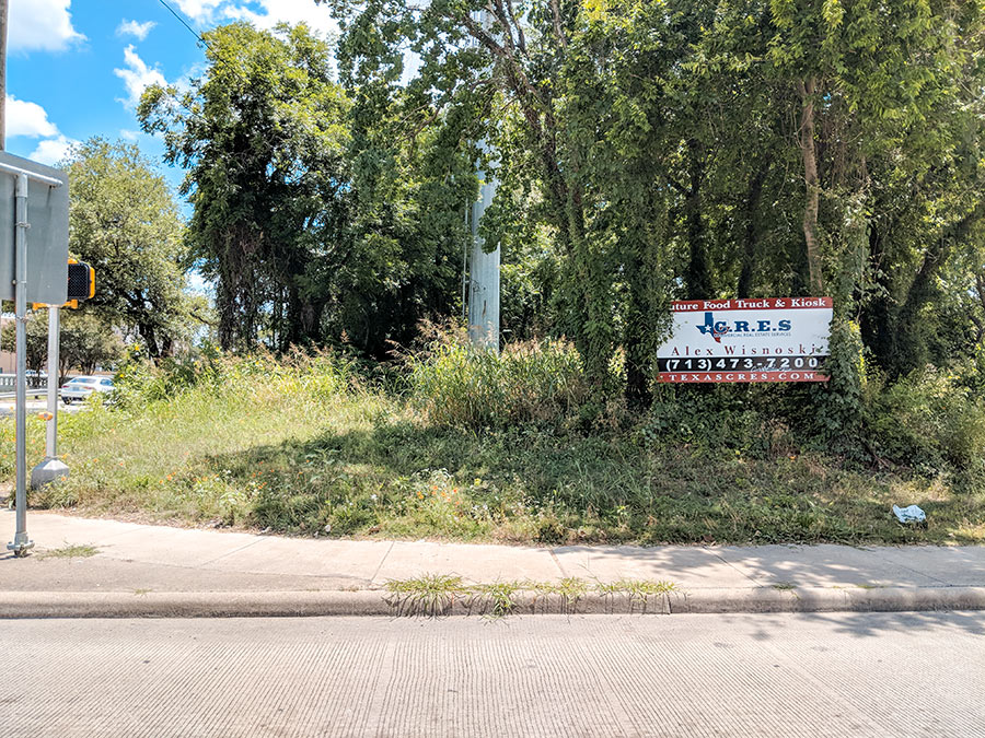
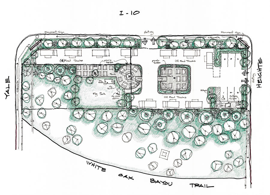
Only about 250 ft. separate I-10’s eastbound feeder from White Oak Bayou between Heights Blvd. and Yale — and within that never-developed span, Texas C.R.E.S. and an adjacent landowner are hoping to plant a food truck park, as advertised on the sign up near the southeast corner of the site. The conceptual plan above from architect Marshall Porterfield — not yet okayed by the city — indicates parking spaces for 10 vendors (and 6 patrons) accessible via entrances on the feeder and on Heights Blvd., across from the Heights Business and Mediation Center. A deck seating island in the middle of the parking lot provides some dining room within the third-acre site, owned by the current pair of developers since last year.

The rest of the land is devoted to park space for people and dogs. It backs up to an imagined spur of the White Oak Bayou Trail (currently only accessible on the other side of the bayou) that curves to the south.

Photos: Jason Cockerell. Site plan: Marshall Porterfield via Texas CRES and Delux Realty/Michel Coret

South of I-10
06/13/18 4:15pm

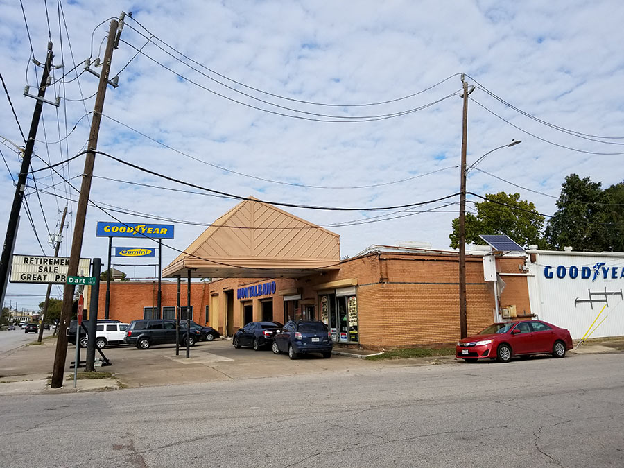
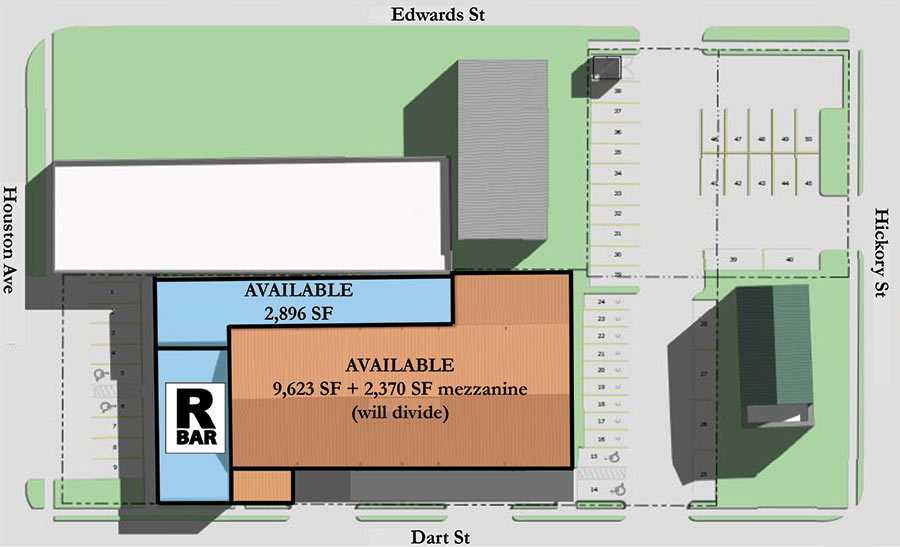
The mark of shuttered Rice Military drinking spot R Bar is now cropping up in the site plan for Kaldis Development’s planned redo of the former Montalbano Tire building (top photo) at 1302 Houston Ave.

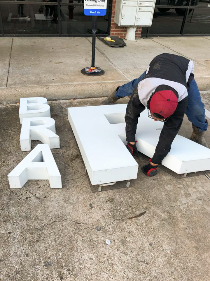
Back in March, the signage came down from the sports bar’s previous and now-shuttered location in the L-shaped Memorial Dr. strip center half a mile west of Shepherd, where it mediated between Memorial Park Vision and the dental office of Dr. Catalina C. Johnson:

CONTINUE READING THIS STORY

First Ward Redo
06/04/18 1:00pm

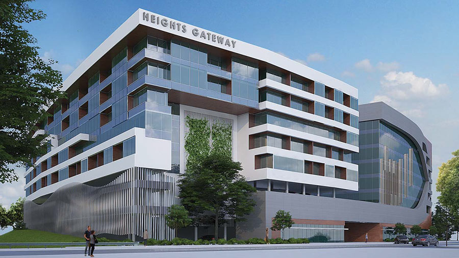
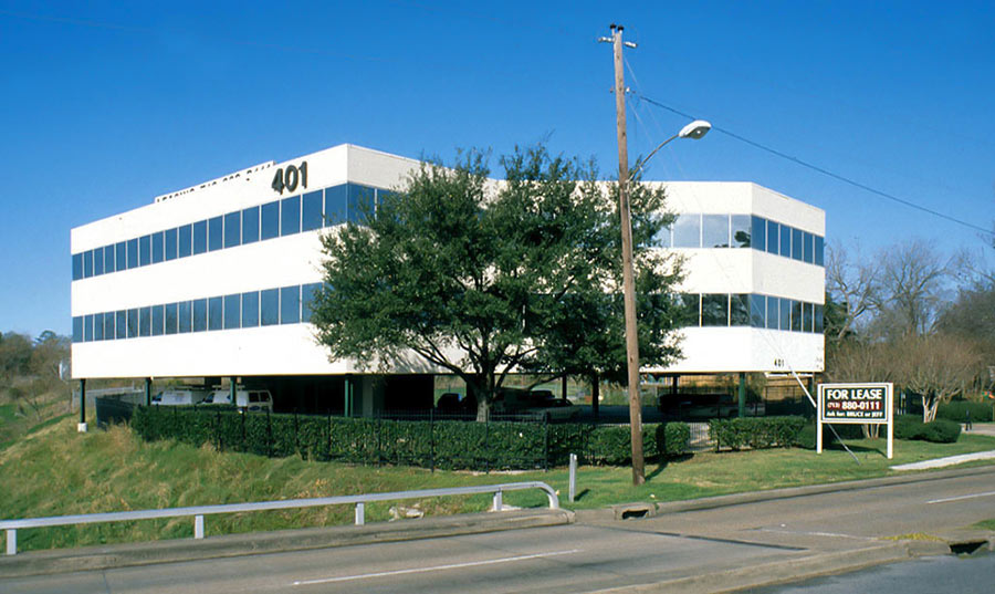
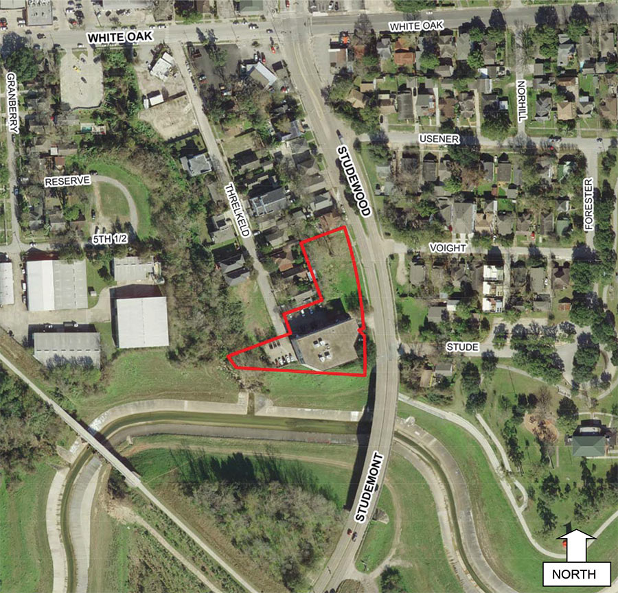
Engineering firm The Interfield Group is hoping to score a trio of variances that will allow it to swap out its existing dingbat office building (above) at the Heights landing point of the Studemont St. bridge for a much larger mixed-use development (depicted at top) dubbed Heights Gateway. The new 8-story complex rests on the stealth-bomber-shaped parcel at 401 Studewood outlined in the aerial above. It’s split between a residential portion (shown beneath the lettering in the rendering) and a glass curtain-walled office section to the north — all of which rests atop a floodable 2-story parking garage plinth.

Its lowest parking level — indicated in the site plan below — includes a main entrance off Studewood that runs between the work and live sections of the complex:

CONTINUE READING THIS STORY

Heights Gateway
04/30/18 1:30pm

Update, May 1: At the request of the copyright holder, images of the proposed development have been removed.

Michael Hsu designed a new 2-story structure (depicted in a rendering posted on HAIF) for a spot directly across Yale from the existing retail building (above) he created as part of the Heights Mercantile complex near 7th St. Like its neighbor — which went up not long ago in place of a Pappas Restaurants warehouse — the new building will replace a metal-sided structure, this one currently occupied by Urban Jungle Self Defense:

CONTINUE READING THIS STORY

Westward Expansion