FIGHTING THE INVADERS OF BUFFALO BAYOU 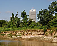 Though much of the Buffalo Bayou Partnership’s (BBP) plans for that eponymous waterway involve adding things — kayak rental shops, pedestrian bridges, etc. — there seems to be the need for subtraction, too: “‘People look at the park and see that it’s filled with trees and grass, what most people don’t realize is that most of those plants shouldn’t be there,'” BBP’s prez Anne Olson tells Alex Wukman of Free Press Houston. “A study of the park’s vegetation, which the Partnership filed with the Texas Forest Service, found Buffalo Bayou to be overrun with invasive species — primarily White Cedar and Chinese Tallow. . . . Olson explained that the Partnership plans to combat the invasive species problem by removing 50 percent of the park’s lawn, which is mostly made up of easily-maintained but non-native Bermuda grass, and replacing it with native grasses.” Adds Olson: “‘We’re going to create an 11 acre urban prairie.'” [Free Press Houston; previously on Swamplot] Photo: Flickr user barryDphotography
Tag: Bayous and Waterways
THE ART GUYS TO START UNRAVELING 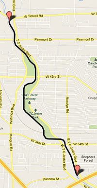 This is the route the Art Guys say they will be taking tomorrow morning when they stage the 5th of the yearlong series of monthly celebratory stunts they’re calling “12 Events:” Titling this one “A Length of String,” Jack Massing and Michael Galbreth will unwind a spool of thread they’ve had sitting around since 1983 while walking along White Oak Bayou between W. Tidwell and T.C. Jester, just north of the Loop, and then they’ll turn around . . . and wind it back up. Last month, you’ll remember, they donned tuxedos and conducted the sounds of the Ship Channel from the Santa Anna Capture Site in Pasadena. [Art Guys; previously on Swamplot] Map: Art Guys
ART GUYS WORKING WITH SHIP CHANNEL IN NEXT ‘EVENT’ 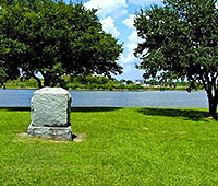 At the site shown here in Pasadena near the old Paper Mill and Washburn Tunnel, where General Antonio López de Santa Anna is said to have been captured during that historically succinct Battle of San Jacinto, the Art Guys are planning their next performance: They’ve announced they’ll crack out their batons and “conduct the sounds of the Houston Ship Channel.” (Not sure what that could look like? Go see it for yourself.) Jack Massing and Michael Galbreth, the helmsmen of “12 Events,” a yearlong series of monthly head-scratchers that commemorate their 30 years of Houston mischief, have so far in 2013 shrugged off their divorce from the Menil, signed their names for 8 hours at the Julia Ideson Library on National Handwriting Day, and walked all 29.6 miles of Little York Rd., the longest in Houston. Next up, once they’ve conducted the Ship Channel waters? The Art Guys unwind a spool of thread, and then — wait for it — wind it back up again. [The Art Guys; Culturemap; previously on Swamplot] Photo: JimmyEv via Waymarking
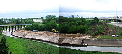
A reader sends this stitched-together panorama of the Heights bike trail spanning White Oak Bayou and wonders what’s going on with all the denuding: “This is kitty corner from where the proposed Emes Place condos will go. Mother nature swamped their work in the bayou with the recent rains. They appear to be taking revenge by bulldozing the nearby clump of forest. This is a larger piece of bird/homeless person sanctuary than the tract Emes Place is to be on, so I wonder what the story is. Harris County Flood Control comes by the site all the time, but I can’t find any mention of it on their website, or anywhere.”
- Previously on Swamplot: Comment of the Day: Who Dare Oppose, An End-Around at Emes Place, Viewpoint at the Heights: Back from the Dead?
Photo: Swamplot inbox
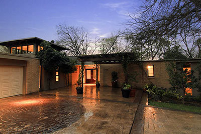
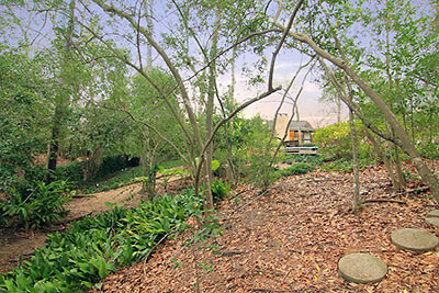
This remodded 1966 Mod in Charnwood was once featured in Southern Living magazine, its listing declares. The furnishings from that photo shoot are long gone, but a boatload of built-ins and some ravine views remain. Appearing in the market mid-month, the 4,077-sq.-ft. home has staked out an initial asking price of $939,000.
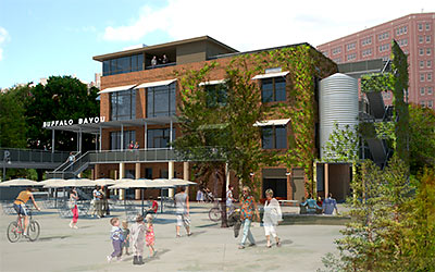
The same architecture firm that transformed Wilshire Village into the H-E-B Montrose Market across town has been pegged to redo 1910 International Coffee Company Building (aka Sunset Coffee Building), resuscitating the derelict shell on Allen’s Landing into use as a Downtown tourist attraction and kayak rental shop. San Antonio firm Lake Flato submitted this drawing of the building at the coffee-with-cream-colored confluence of White Oak and Buffalo Bayou underneath Main and Fannin to Buffalo Bayou Partnership, which plans to begin the project in April.
- Houston building steeped in history to get facelift [abc13]
- Plan to renovate city’s ‘front door’ to begin in April [Houston Chronicle]
- International Coffee Building [Buffalo Bayou Partnership]
Rendering: Buffalo Bayou Partnership
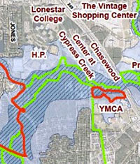 The director of the Bayou Land Conservancy announced yesterday that a 100-acre tract of flood-prone land surrounding Cypress Creek just south of the Hewlett-Packard campus between Hwy. 249 and Jones Rd. will now become a permanent conservation easement. (Segments of the waterway marked in dark and light blue in the map at right indicate the 100-year floodway and 100-year floodplain, respectively.) The land trust purchased the property with help from a $500,000 Houston Endowment grant; plans are to incorporate the tract into the planned Cypress Creek Greenway, extending the full length of the bayou from Spring Creek to the Katy Prairie:
COMMENT OF THE DAY: BUFFALO BAYOU WILDLIFE “Years ago I saw someone pull a snapping turtle out of that bayou, near the Shepherd bridge. Vicious-looking brute; the snapper was mean, too.” [Brian, commenting on Headlines: Americana Remodeling Plans; a Place for the Houston Blues Museum]
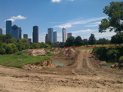
Reader Jeromy Murphy sends a couple pics of a temporary ford of Buffalo Bayou seen last week near the site of the Police Officers Memorial off Memorial Dr. just west of Downtown. Planned nearby: a new permanent pedestrian bridge that will make the memorial accessible to soulmates hanging about in Glenwood Cemetery to the north. The bridge will also open the memorial to visits from bikers on the recently updated trail on the bayou’s north side.
This map shows the plan:
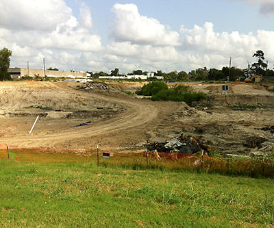
A Swamplot reader offers a trade: A few photos of the retention ponds going in north of White Oak Bayou where 6th St. was blocked between Yale and Shepherd (above and below) — in exchange for more details on the park that’s apparently planned for that location, including a scheduled completion date for the construction. “I have no ‘official’ information, only old data and hearsay,” reports the reader. Which includes this map dating from 2010:
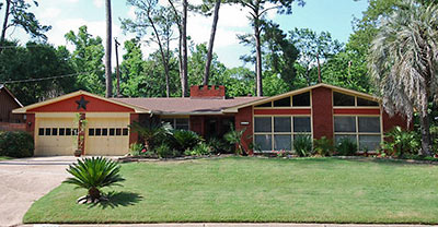
You might well expect a home on street named “Leafy Lane” to sport a woodsy setting. While this new Spring Oaks listing is on a 16,788-sq.-ft. lot more groomed than sylvan, it does back up to a ravine formed by a ribbon of Spring Branch Creek. The 3-2 window pattern beneath the low-slung gable in front is a tip-off that the front room is not one room at all. Rather, the street-facing space contains a family room and a bedroom. Both sides of that great divide at the roof ridge, however, have vaulted ceilings. Elsewhere inside, other unexpected treatments include a dual personality fireplace that features an ornately carved mantle tacked onto a plainer midcentury brick wall; a common room currently re-purposed as a dining room; and in the kitchen, wall paneling that matches the knob-free cabinets.
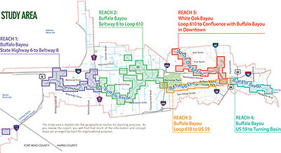
Looks like that Charting Buffalo (as in Buffalo and Lower White Oak Bayous) draft report might not have gone over so well. A popup note shown to first-time visitors to the project’s website, posted just last Friday, dryly notes the entire report has been pulled — only 2 days after it first went out for community feedback: “In light of compelling issues regarding the presentation of certain concepts in the Charting Buffalo draft report, the Harris County Flood Control District is in the process of modifying the report. The District is suspending the report’s distribution, review period and all scheduled community meetings until further notice,” it reads. The feedback period for the report, intended to form the foundation of a master plan for reducing flood damage along the entire Buffalo Bayou and lower White Oak watersheds from the Barker Reservoir to the Ship Channel Turning Basin, was originally scheduled to extend until April 1. Possible flashpoint: the “more than 40 options for reducing flooding risks and damages” spelled out in the report. The Charting Buffalo project was the flood control district’s response to a City of Houston request to “provide land” for stormwater detention.
- Draft Report [Charting Buffalo]
- About the Study [Charting Buffalo]
Map of Study Area: Charting Buffalo
COMMENT OF THE DAY: BEWARE THE ALLURING BAYOU PARK PLAN “This appears to be a banking scheme that would have the Federal Reserve Bank(s) finance and hold securities on these important lands in many large cities across the US. More scrutiny of the fine print and long-term ramifications is needed before yielding to the sensuous propaganda.” [Dana-X, commenting on Enormous Plan To Build Bayou-Side Parks: The Movie]
LOCAL WEBSITE MAKES BOOK 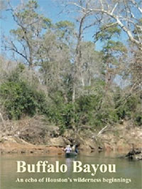 Does li’l ol’ Buffalo Bayou qualify for a river guide? It does now. Longtime bayou history boat tour guide Louis Aulbach — author of 5 river guides chronicling the courses and histories of a few West Texas waterways — has just published Buffalo Bayou: An Echo of Houston’s Wilderness Beginnings as a book. If you’re a bayou or local history buff and that title sounds familiar, it should: Aulbach has been posting extended excerpts from the project on his old-school HAL-PC website for years. [Memorial Examiner; Amazon link]
COMMENT OF THE DAY: LICKED CLEAN BY MILLIONS OF COCKROACHES “Roaches? I didn’t leave them out. I just didn’t see any — as in, not one. No living creatures at all, except us humans. The place smelled clean, like fresh water. I wonder where those roaches went…. and (ugh) what they were eating down there in the ’80s.” [Lisa Gray, commenting on Comment of the Day: The Cockroaches Found That Cistern First]

