06/23/16 2:45pm

Allen Center Skybridge Remodeling, 500 Dallas St., Downtown, Houston, 77002

Currently underway: the partial disassembly of 1 of the 2 skybridges connecting One and Two Allen Center at the corner of Dallas and Smith streets downtown. The bridge pictured above is expected to survive the planned 3-tower redevelopment — a permit to remodel it was issued on Monday with some other OKs on the work, which includes turning the rubble-filled space to the east into a Smith-St.-facing events lawn and concert space. Renderings previously released by Brookfield suggest that the other skybridge, from which the above photo was taken, won’t be so lucky:

CONTINUE READING THIS STORY

Last Days Downtown
04/29/16 5:00pm

Yale St. Bridge bricks being removed, Yale St. at I-10, Heights, Houston, 77007

An indiegogo page has just been launched to crowdfund the removal and reuse of an unexpectedly large group of well-preserved 1930s bricks from the now-under-deconstruction Yale St. bridge over White Oak Bayou. The group calling itself Friends of Houston’s Yale Bridge Bricks says the funds will be used to preserve the bricks for reuse both around the bridge and elsewhere around the city.

The fundraising effort shares some organizers with Friends of the Fountain, which launched the late-February campaign to crowdfund the de-restoration and subsequent repair of the Mecom Fountain following its short-lived experiment with limestone couture. That effort raised more than $50,000 toward a $60k goal in one month; Bill Baldwin (of both Friends groups) says it the fountain’s fundraiser received over $100k in total, including offline donations. This latest round of online crowdfunding the preservation of National Register of Historic Places structures is starting the bar higher, with a goal of $100,000 shown on the fundraising page.

Photo of work on Yale St. Bridge and Memorial Park Mattress Firm: Friends of Houston’s Yale Bridge Bricks

Follow the Yale Brick Road
04/21/16 10:30am

road-closures-4-21

Replacement work on the Yale St. bridge over White Oak Bayou now won’t start until the 25th, according to an update from TxDOT. The original planned construction start drifted past in the middle of Monday’s deluge; no changes have been mentioned yet for expected 2018 reopening date.

Meanwhile, TxDOT’s Yoakum office says it’s keeping an eye on US 59 in Wharton County to the southwest of town, though that highway is not closed at the moment according to the agency’s interactive mapping system (pictured above). The map shows areas of road closures, flooding, and construction, with written descriptions for each site clarifying which lanes are affected, by what, and how badly. Zooming in further gives a clearer picture of the extent of some of the closures — below is a view of west Houston, showing the stretch of Hwy. 6 near the Addicks reservoir that could be closed for the next 4 to 6 weeks: 

CONTINUE READING THIS STORY

What’s Under Water
04/06/16 10:45am

Yale St. Bridge over White Oak Bayou, Houston Heights, Houston, 77007

Yale St. Bridge over White Oak Bayou, Houston Heights, Houston, 77007 
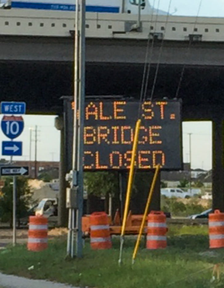
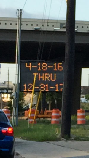
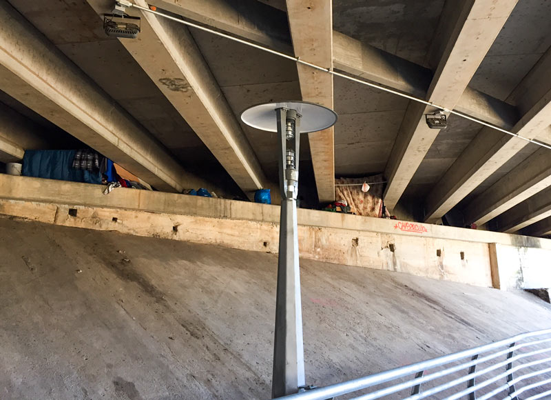
An orange and black construction marquee is now advertising the upcoming closure of the Yale St. bridge over White Oak Bayou just south of I-10, starting the Monday after next and running until the New Year’s Eve after next. The 1931 bridge, listed on the National Register of Historic Places, is slated for replacement after years of asking crossers to please watch their weight (with 10,000 pounds per axle being the most recent upper limit). The per-axle limit was at 8,000 pounds prior to a 2012 drop to 3,000 (which disqualified some SUVs and minivans). The addition of carbon strips to the structure caused TxDOT’s weight limit to yo-yo back up to 10,000.

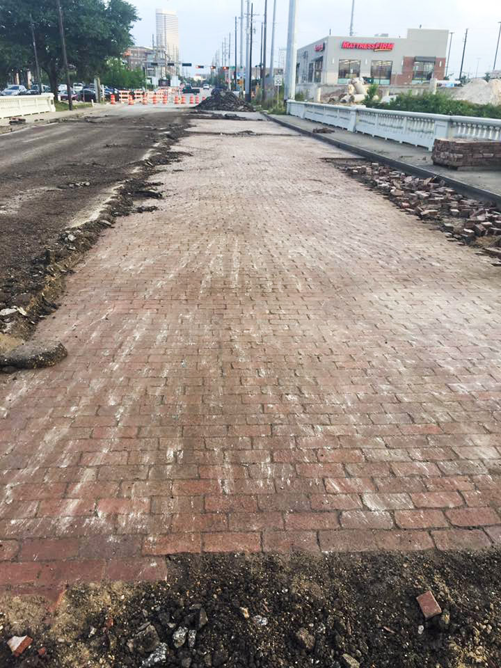
The plans for the new bridge floated by TxDOT in 2014 included wider outside vehicle lanes and slightly narrower sidewalks (down to 5 feet from 6). But summary and followup notes from the public meeting held at the end of July 2014 say the design has been updated to include 8-foot-wide shared bike and pedestrian pathways on either side of the bridge, in response to the public comments on the project.

The TxDOT meeting summary notes also documents the agency’s attempt to sell the bridge in the Houston Chronicle:

CONTINUE READING THIS STORY

Coming Back a New Bridge
01/19/16 4:30pm

Encampment removal at Louisiana St. and Congress Ave., Downtown, Houston, 77002

The encampment under Louisiana St. (shown above) was dismantled earlier today; a reader sends both now-you-see-it and now-you-don’t shots. The camp was previously tucked above the south bank of Buffalo Bayou, about halfway between Sesquicentennial Park and Allen’s Landing.

The removal appears to have been carried out by workers for Houston First, responsible for maintenance of public venues such as Miller Outdoor Theater and the George R. Brown Convention Center, along with a list of downtown parks that includes Sesquicentennial and the Sabine Promenade. Houston First also works on marketing and branding for the venues (and more generally for “the Houston product”) in partnership with the Greater Houston Convention & Visitors Bureau.

Here’s what the spot looked like after today’s clear-out:

CONTINUE READING THIS STORY

Gone Downtown
06/09/15 3:00pm

rosemont-bridge-downtown-locks

Last week in gay Paris, authorities removed panels from the Pont des Arts that had been weighted down by hundreds of thousands of attached padlocks — installed there since late 2008 by visiting couples (and sure, probably an obsessed stalker or 7) who sought to commemorate their passions with a lockup and a ritual toss of the key into the River Seine below. Meanwhile, hereabouts in North Montrose, the “Love Lock” scene on the Rosemont Bridge over Buffalo Bayou just west of Downtown appears to be just getting started — the Buffalo Bayou Park version appears to be well behind copycat venues in other cities. While crossing the longer section of the bridge yesterday, Twitter user marathonjohn found 20 to 30 locks attached to the pedestrian crossing’s supports. Here are pics of a few of the ritual lockups he spotted:

CONTINUE READING THIS STORY

The Keys Are in the Water
02/19/14 10:45am

Metro Bridge over Buffalo Bayou, West Downtown, Houston

A reader who’s been watching construction of the new bridge that’s gone up over Buffalo Bayou and fitted neatly under I-45 at the far western end of the new under-construction Southeast and East End light-rail lines wonders what its purpose is. The bridge is beyond the planned Theater District stations, the last shared rail stops for the 2 lines. Is it a bridge to nowhere, or the starting point for some later western expansion along Washington Ave?

CONTINUE READING THIS STORY

Heading West from Downtown
09/23/13 2:05pm

DITCH REPAIRS, BRIDGE REPLACEMENT TO CLOSE STRETCH OF SAN FELIPE FOR NEXT 2 WEEKS San Felipe St. near Mid Ln. and the Loop is going to be out of commission for about 2 weeks, according to the Harris County Flood Control District: After tonight’s rush hour subsides, workers will move in to remove concrete from the sides of the eroding and underperforming drainage ditch, shown here, and install closed culverts. And that means the 50-year-old bridge on San Felipe will need to be demolished and replaced. The area to be closed is near the new Liberty Kitchen spot and the luxury apartments under construction on Briar Hollow Ln. [HCFCD; previously on Swamplot] Photo: HCFCD

09/11/13 11:10am

Just about a mile as the trash floats along Brays Bayou from that sylvan site in Idylwood where the Houston Parks Board is considering building a parking lot, more work of the flood-mitigating Project Brays is underway. Here, near the intersection of Wheeler and Old Spanish Trail, the Harris County Flood Control District is widening the channel to help the bayou along, an act that will necessitate spending about $4.2 million to build a new 2-lane bridge.

According to the HCFCD, the existing bridge on Wheeler — shown in the photo here — isn’t nearly big enough and will need to be demolished. The new bridge, to be built during the next year or so, will extend Lidstone St. up and over the bayou to O.S.T., connecting the Gulfgate and Fonde Park neighborhoods just southeast of the Orange Show. Once the bridge is complete, more hike and bike trails will be installed.

You can see a project map and more photos after the jump:

CONTINUE READING THIS STORY

08/21/13 4:15pm

FEARING THE YOGA DADS THE NEW HEIGHTS HIKE AND BIKE LINK WILL BRING The Houston Chronicle reports that the Bayou Greenways project is paying for a new 1.35-mile section hooking up the existing White Oak Bayou and Heights hike and bike trails. Part of completing this stretch will require replacing the bridge shown here, a burned-out trestle that butts up to the former Eureka Railyard. Psyched about this new link that, when completed in 2014, will get cyclists from Downtown all the way out to Antoine Dr., Houstonia’s John Nova Lomax still seems more than a little ambivalent about losing the blackened thing: “The eastern foot of that bridge has been a meditation zone / power spot of mine for the last few years, my own trash-strewn bayou-pungent pre- and post-work Eden. No more — soon it will teem with with yoga dads and crossfit maniacs and their occasionally ill-behaved pooches.” [Ultimate Heights; Houstonia; previously on Swamplot] Photo: Patrick Feller [license]

07/01/13 4:00pm

The latest pedestrian bridge to span Buffalo Bayou was craned into place this past Thursday. The 345-ft. bridge almost hooks up with the skinnier chain-linked one that spans Memorial Dr. from Jackson Jackson Hill St. on the north. The Buffalo Bayou Partnership’s master plan shows that this bridge will serve the so-called Lost Lake — a space for which is being cleared of all kinds of vegetation just west of this site. You could say that the bridge might also encourage Rosie Ruiz-inspired joggers to take a shortcut and avoid going the extra mile around the Shepherd Dr. bridge-under-a-bridge just a bit farther west.

CONTINUE READING THIS STORY

05/08/13 12:30pm

This photo, courtesy of a reader, shows what will eventually hold up the new pedestrian bridge spanning Buffalo Bayou. This view looks south across the muddy water from the Sandy Reed Memorial Trail near Jackson Hill St. and Memorial Dr. toward the Royalton condo tower on Allen Pkwy. Crews have also begun clearing away more trees and brush between this spot and the Adath Yeshurun Cemetery, where the bayou’s master plan shows the Lost Lake will be.

CONTINUE READING THIS STORY

03/26/13 10:30am

DESIGNING HOUSTON’S BICYCLE UNDERBELLY Peter Muessig’s graduate thesis for the Rice School of Architecture imagines a system of symbiotic bike-only features he’s calling “Veloducts” that would be fused on, under, around, and through the city’s existing car-dominated infrastructure. This rendering shows just such a Veloduct, which appears to be similar to those foot bridges already spanning Buffalo Bayou. But OffCite’s Sara C. Rolater explains how a Veloduct is much more ambitious: In variations of concrete, joists, and steel, [a Veloduct] can be grafted onto the pillars of freeways, hang suspended by girders, or stand on its own columns. . . . [allowing] cyclists to capitalize on precisely those systems that have previously hindered them. That [the project] enables different modes of transport to coexist without crowding each other seems especially critical for Houston, where a lack of safe-passage laws have made many of Google Maps’ bright-green highlighted ‘bike-friendly’ roads anything but.” [OffCite; previously on Swamplot] Rendering: Peter Muessig

10/18/12 4:18pm

Courtesy of Swamplot reader James Glassman, here’s a shot of what’s been connected so far under the Shepherd Dr. overpass as it crosses the end of Allen Pkwy. at Buffalo Bayou. Suspended ’neath the cars at this gateway to River Oaks: a new pedestrian bridge, which will link the aptly named Sandy Reed Memorial Trail along the bayou’s South bank with Memorial Dr. to the north. Here’s how it’s drawn out in the Buffalo Bayou master plan:

CONTINUE READING THIS STORY