COMMENT OF THE DAY: WHERE THE RUNOFF TAX FLOWS MATTERS LESS THAN COLLECTING IT 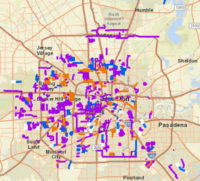 “Just collecting the tax on impermeable surfaces is valuable on its own. It makes landowners think twice about creating (or even keeping) flood-worsening pavement. Where the money goes sort of morally determines whether the fee is a form of legally-imposed direct responsibility for flood costs, or just pure financial disincentive that helps the city with flood costs or whatever else — it would be better with the spending restriction, but I’ll gladly take either one.” [Sid, commenting on City Loses Latest Appeal on 2010 Drainage Fee Election] Map of past, ongoing, and planned drainage and street projects: ReBuild Houston interactive map
Tag: Flooding
CITY LOSES LATEST APPEAL ON 2010 DRAINAGE FEE ELECTION 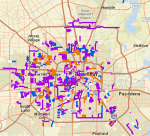 This week the state’s Fourteenth Court of Appeals upheld a 2015 ruling calling for a new election on the ReBuild Houston drainage and road-fixup fee. As in another local case involving charter invalidation and large sums of collected assessment money, the city is mulling over further appeal options, though the case’s last trip to the Texas Supreme Court didn’t go in the city’s favor. The Chronicle‘s Katherine Driessen also writes that the fund’s future is now murky: the decision doesn’t stop the city from collecting the fee for now, since that collection was authorized through another city ordinance — it may, however, remove restrictions on how the money can be used. [Houston Chronicle; previously on Swamplot] Map of past, ongoing, and planned drainage and street projects: ReBuild Houston interactive map
CITY HOPES TO CHOP A DECADE OR 2 OFF THE BRAYS BAYOU FLOOD CONTROL TIMELINE 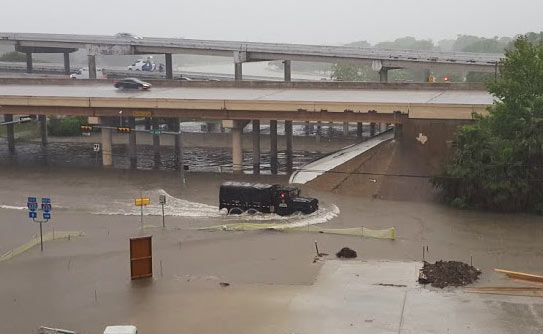 At the current rate of federal funding trickling in for the completion of the Project Brays flood control project, the work could take another 20 years or so to complete, Mike Morris writes this week — noting that the Harris County Flood Control District originally expected about $50 million in federal reimbursement every year, but has been getting an average of $11 million annually in recent years. The city is now planning to speed the project up by asking to borrow $46 million from state-level funds to give to the county, potentially helping it meet or beat a 2021 completion deadline. And “yes,” says city flood czar Steve Costello, “the city is going to be taking [a] risk because we’re going to be waiting for the money, but we’re confident that this is the start of a long-term relationship and we think it’s going to work very well.” (If it does work well, the city may do the same thing for work on White Oak and Hunting bayous.) [Houston Chronicle; previously on Swamplot] Photo of Tax Day flooding at Brays Bayou and 610: Chris Klesch
GROUP PETITIONS FOR 13-COUNTY FLOOD PLANNING 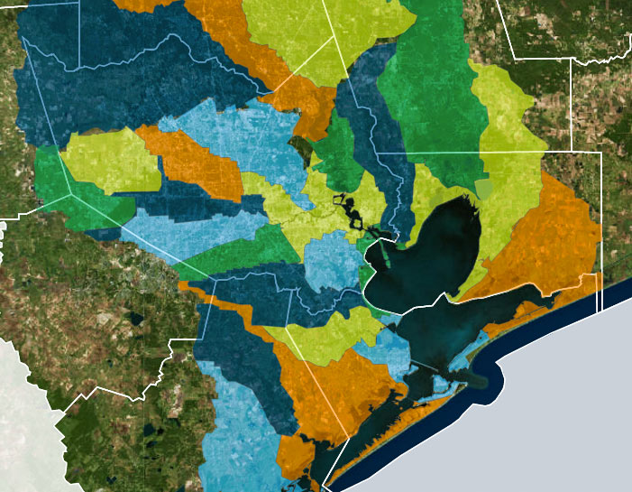 A group called Citizen Solutions to Flooding — not to be confused with the Residents Against Flooding group currently suing the city and TIRZ 17, though containing some of the same members — is circulating a petition calling for a region-wide plan to address man-made flooding issues, and an agency to oversee it. The petition lists out some of the specific technical concerns that signers want incorporated into future flood planning, including a shift from floodplain-level thinking to whole-watershed rules. The petition also calls for coordination across all 13 counties in the Houston-Galveston Area Council region; Citizen and Residents member Ed Browne tells Ed Mayberry that “flooding doesn’t know any boundaries. I mean, water doesn’t care whether you’re in Harris County or Montgomery County or Fort Bend. Unless we address the whole watershed, one area or another is going to suffer.† [Houston Public Media; previously on Swamplot] Watershed boundaries superimposed across Houston-area county boundaries: Galveston Bay Foundation and Houston Area Research Council’s Find Your Watershed map
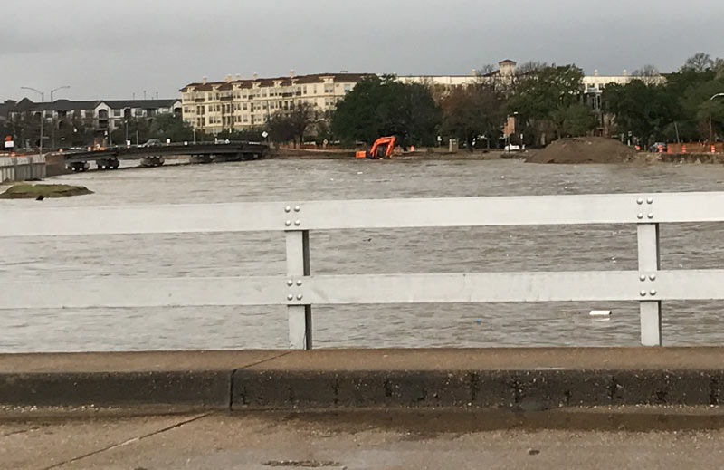
If you have information regarding the whereabouts of the cheery orange digging machine spotted yesterday morning dipping its tracks into a brimming Brays Bayou, a concerned reader would like to hear it — the shot above is his last sighting of the machine, taken from the Main St. bridge. “When I looked today, it was gone. Any idea what happened to it?” 24 hours, of course, is plenty of time for someone to have taken the excavator somewhere warm to dry off, so no reason to assume anything particularly unfortunate transpired; the photo was taken around 8:30, a little over an hour after the water had begun to recede from its early morning crest, according to the Harris County Flood Control gauge readings at the Main St. bridge:
TONIGHT’S AREA FLOODING SYMPOSIUM CANCELLED BY AREA FLOODING 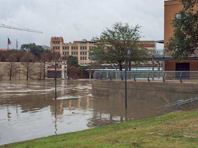 The free public Flooding and Storm Surge Symposium previously planned for this evening at the George R. Brown Convention Center is being postponed, on account of it’s flooding right now. The event would have included 2 panel discussions with flood-minded folks from a variety of public and private sectors and institutions, gathering to talk about the city’s flooding and storm surge issues and possible solutions; the Urban Design Committee of the Houston chapter of the AIA says the event will be rescheduled. [Houston AIA] Photo of this morning’s high water at Allen’s Landing: Christine Wilson

Most of the grassy banks and walking paths usually visible east of Main St. are obscured in this morning’s footage from semi-regular Allen’s Landing correspondent Christine Wilson, who captured some shots of high water (and a few street lamps shakin’ it in the current). This morning’s heavy rain has overtopped roads in some of the usual spots (check out Transtar’s list of water-related road closures here) west and north of Downtown, and the National Weather service has just issued a flood warning for parts of the city through 4:15 this afternoon (with more rain expected later today). The confluence of White Oak and Buffalo bayous, receiving much of that water as it runs toward the bay, appears to have been swept clean of trash and baby ducks for the time being, though some larger waterfowl were still spotted hanging around upslope on the southern shore:
CITY-WIDE DRAINAGE SWAT TEAM POSSIBLY BANKROLLED BY HEIGHTS WATERWORKS SALE 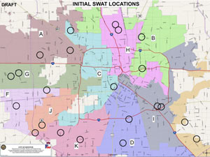 Mayor Turner announced plans for a dramatically monikered Storm Water Action Team at this week’s council meeting, along with 22 projects at the top the program’s initial list, based on metrics of urgency like frequency of 311 calls. The goal of the program is to deal with non-bayou-centric flooding issues like collapsed culverts and junk-clogged drainage ditches; flood czar Steve Costello said after the council meeting that the city wants to resolve the fixable issues at each site within 90 days of a site visit and initial drainage triage. Meagan Flynn writes this week that the $10 million currently budgeted for the program comes mostly from a one-time sale of city land; that land might well be the Heights Waterworks properties at W. 20th and Nicholson streets, which were sold to apartmenteer Alliance in mid-December for a reported $15.2 million. [Houston Press; previously on Swamplot] Draft map of 22 SWAT project locations: City of Houston SWAT program materials
COMMENT OF THE DAY: CROSSING A LINE ON FLOOD CONTROL  “You either pay for the fixes, or let residents continue to be subjected to higher insurance premiums, maintenance, and rebuild costs — slowly depriving the city of tax revenue. At some point, property values will appreciate to the point where making the fixes may have been the smart thing to do. Not saying it’s financially practical of course. What was the property damage total for the past 2 years of flooding, though?” [joel, commenting on Just How Much Flooding Is Too Much Flooding for Houston?] Illustration: Lulu
JUST HOW MUCH FLOODING IS TOO MUCH FLOODING FOR HOUSTON?  We pretty much know what we would have to do to stop most Houston flooding, writes Dylan Baddour as the calendar flips to 2017.  Potential paths to drier ground for the city include a multitude of complex region-wide tasks, including changes to waterways across the county, adding thousands of acres of detention space, and potentially addressing the cumulative impacts of seemingly minor small-scale building practices.  The cost of upgrading the whole system, including buyouts, bayou widenings, and utility rerouting, is estimated by the county flood control folks at around $27 billion — and that’s just to get protection up to so-called 100-year storm levels; Houston has had 8 such storms in the past 27 years, and the Tax Day flood was fueled by a much larger event. “What needs to be decided,” Baddour writes, “is how far taxpayers are willing to go. Cars don’t have airbags to absorb a hit from a train. Should Houston have a drainage system to contain a biblical storm? Where does the city draw the line?” City flood czar Steve Costello tells Baddour that the city has to do something, however, to avoid passing on a “potentially insurmountable problem” to future Houstonians. [Houston Chronicle] Photo of N. Braeswood Dr. at 610 on April 17, 2016: Chris Klesch
COMMENT OF THE DAY: FURTHER READING INTO YOUR HOUSTON FLOOD AND FIRE CHANCES 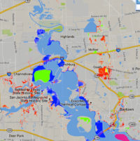 “Every home is susceptible to flooding. There are not ANY non-flood areas. There are only homes that are more likely to flood and homes that are less likely to flood. The likelihood is expressed, on flood maps, by the single-year probability of being flooded (with some other factors). This does not properly describe the likelihood of being flooded during the course of a longer time period — of, say, a 30-year mortgage. Homes eligible for NFIP preferred flood rates can have up to just less than a 1 percent chance of flooding annually. These ‘preferred areas’ are what the public thinks of, euphemistically, as non-flood areas. Assuming a .009 probability (just less than 1 percent), a home has a 20 percent chance of flooding, at least once, over the course of a 30-year mortgage (look up binomial probability). An alternative way to think about it is that 1 in 5 homes, in preferred flood zones, will flood over the course of a 30-year mortgage. [In that case,] you are actually more likely to experience a flood than a house fire in a ‘preferred flood area.'” [Jardinero1, commenting on Where Houston Floods Outside the Flood Zones] Image of recent flood map revisions: FEMA RiskMap6
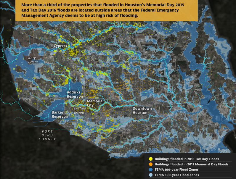
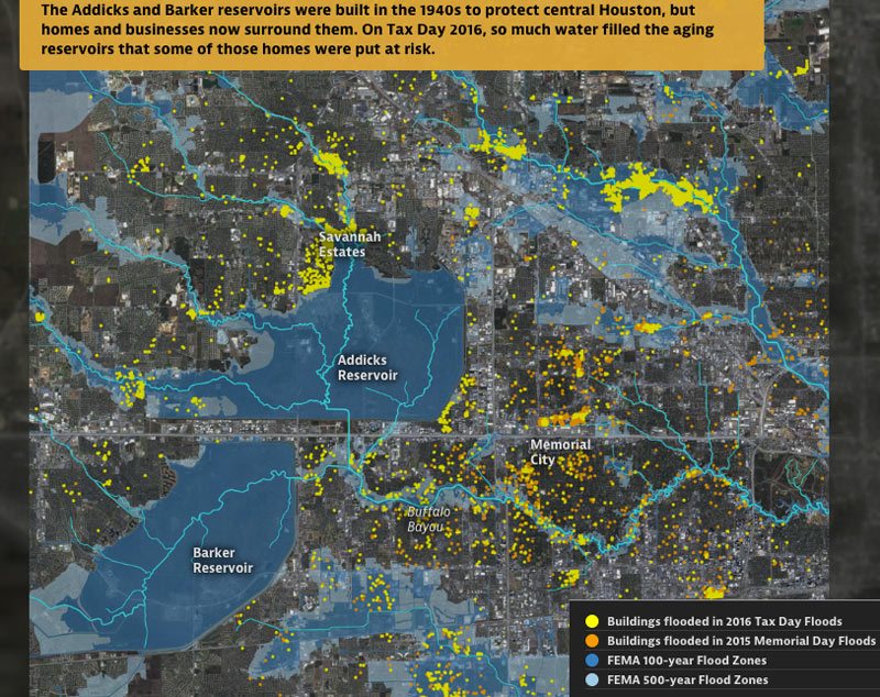
From some of the same folks who brought you those fun-with-worst-case-scenarios hurricane flood maps earlier this year —  Neena Satija and Kiah Collier of the Texas Tribune, and Al Shaw of ProPublica — comes a fresh set of animated maps of a few of Harris County’s most flooded and floodable places, along with a bit of investigation into how they got that way (and whether that might change any time soon). The new illustrated presentation shows off the spread of properties that took a dip during some of Harris County’s last few citywide submersion events (flooded properties from Tax Day 2016 are shown in yellow above, along with the Memorial Day 2015 flooded properties in orange).
Texas A&M Galveston researcher Sam Brody tells the authors that “more people die here than anywhere else from floods. More property per capita is lost here. And the problem’s getting worse.â€Â In sorting through some of the whos, whats, and hows of Harris County’s flood infrastructure and chronically soggy residents, the article juxtaposes the recent flood damage data with the likes of FEMA-mapped 100- and 500-year flood zones (shown above), a visual tally of the land area developed last decade, and a view of what’s left of Houston’s coastal prairie (as of 2010):
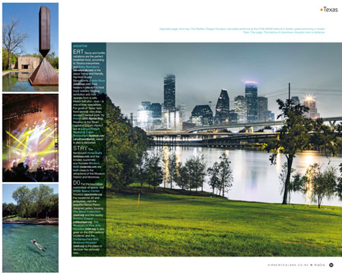
The glossed-up scene above, which shows a pushing-its-limits White Oak Bayou flirting with the lower edge of the Height Hike and Bike Trail bridge, made an appearance in this month’s edition of Kia Ora, Air New Zealand’s in-flight magazine. A sky-high peruser on Reddit noticed the article, which is currently employing the flood photo to promote Houston and several other Texas cities as tourist destinations. The original source looks to be a Getty Images contributor who captioned the shot (along with another expansively aquatic view from 2015) as stock images of Downtown Houston in the rain. For comparison with the normal scenic view of Downtown’s northernmost freeway tangle, below is a recent shot of that trail construction near the Leonel Castillo Community Center, which caught the same angle and foliage (minus the high water, but plus some heavy equipment):
REPEATED 100-YEAR FLOODING ADDS UP TO HOUSTON’S WETTEST YEAR AND A HALF ON RECORD 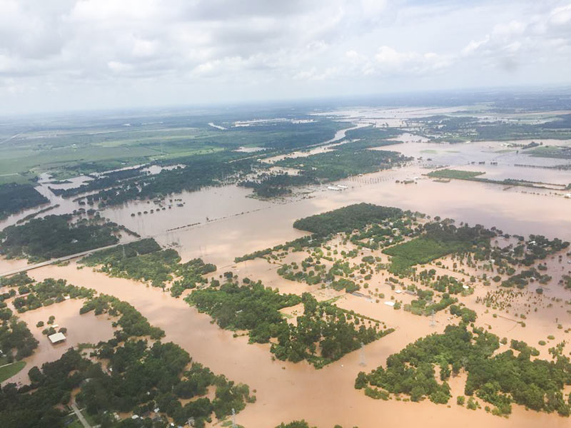 Internet weather guy Eric Berger takes a look today at 6 major flooding events in the Houston area over the past year and a half: last year’s Memorial Day flooding, the pre-Memorial Day flooding that preceded it, the Halloween flooding, the pre-Halloween flooding, this year’s Tax Day flooding, and this year’s Memorial Day weekend flooding. The 6 events, Berger writes, collectively pushed Houston’s rainfall total for the 18-month period ending with August up to more than 119 inches of rain, breaking the previous record by more than a foot. “The ultimate cause of this flooding isn’t entirely clear,” Berger writes, noting that none of the rainfall events listed were connected to tropical storms except for the late-October remnants of Pacific hurricane Patricia. But he does add that “it’s safe to say that rapid development of rural areas — converting prairies into concrete — and a warmer climate likely played some role in exacerbating what were already heavy rains.” [Space City Weather; previously on Swamplot] Photo of Brazos River flooding in June 2016: TxDOT
WAIT, DID THE 2008 RECESSION UP THE CHANCES OF A FUTURE HOUSTON CHEMICAL CATASTROPHE? 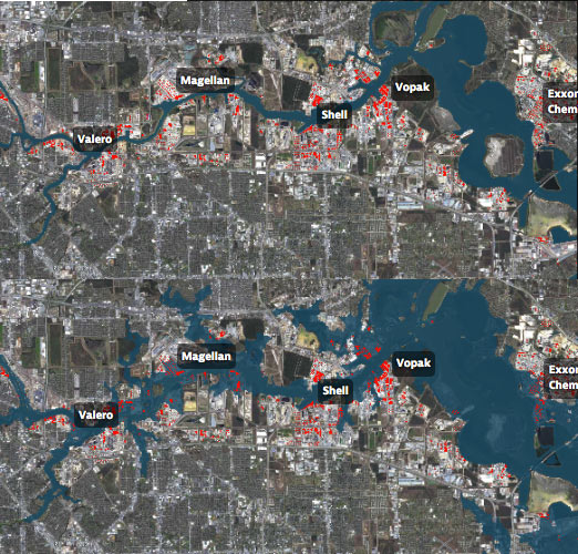 Roy Scranton imagines “a wave of water sweeping toxic waste into playgrounds, shops and houses” in Magnolia Park in his op-ed this morning, written after touring the Ship Channel and speaking with the local A&M and Rice research teams pushing for variations on a series of region-scale coastal barriers to hunker down behind whenever the next gigantic hurricane hits the Houston region, in hopes of avoiding deadly flooding and catastrophic chemical spills. But the researchers tell Scranton that pushing for federal and state funding for a response is a slow endeavor; Jim Blackburn (a main player on the Rice team) tells Scranton that he’s “heard more than one person say our plan is to wait until the next hurricane comes, then depend on guilt money from Washington to fix the problem.” Scranton writes that the best chance for that guilt money so far might have been in 2008, when Hurricane Ike landed just 30 miles northeast of the zone that modelers say could have caused thousands of deaths and irreparable ecological devastation to the area, on September 13th — 2 days before the Lehman Brothers filed for bankruptcy, pulling global attention and national funds to other issues as markets began to crash. [NY Times; previously on Swamplot] Model maps of potential storm surge flooding along the ship channel, with chemical storage marked in red: Texas Tribune

