04/27/16 10:30am

1836 Polk St., Downtown, Houston, 77002

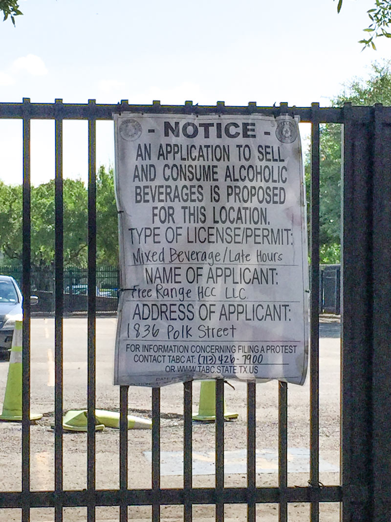
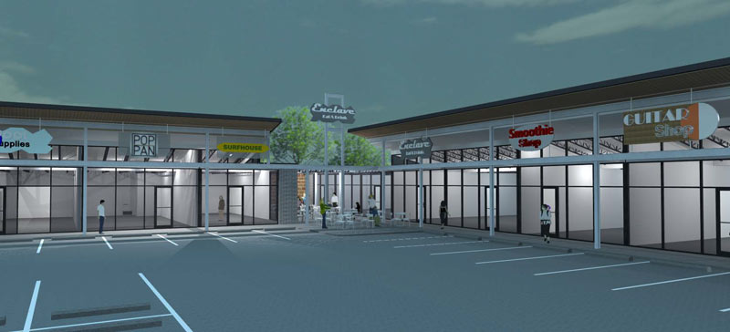
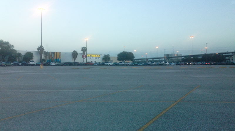
A sign zip-tied onto the fence around the parking lot at 1836 Polk St. is currently announcing an application by FreeRange Concepts to sell mixed drinks at the spot.  Up in Dallas, the company operates bar-slash-bowling alley Bowl & Barrel, bar-slash-dogpark Mutts Canine Cantina, restaurant-slash-music-venue The Rustic, and slashless restaurant The General Public. Houston locations of Bowl & Barrel and The General Public are currently under construction in CityCentre.

It’s unclear whether FreeRange has cast the Polk location for a sequel to one of its existing brands, or for something new. The TABC notice is posted on the full-block parking lot bounded by Jackson, Hamilton, and Bell streets just east of 59 and just south of the George R. Brown Convention Center. That block has previously appeared in the convention center’s 2025 Master Plan, as a site of possible future expansion:

CONTINUE READING THIS STORY

Liquoring Up by GRB
04/26/16 4:30pm

The footage above captures Ed Nelson’s high-water trek last Monday through an overflowing detention basin at the corner of Bob White Dr. and Reamer St. just north of Brays Bayou. Nelson narrates his soggy expedition through the basin (which sits at the south end of the Robindell and Braes Timbers neighborhoods, between Hillcroft Ave. and Fondren Rd.) as he attempts to document different flows of water into and out of the pond; he ultimately claims that water is flowing into the detention pond from Brays, and moving from there into the floodway easement running behind nearby houses on Reamer.

Nelson and other neighbors claim that the surrounding area did not flood prior to the detention basin’s completion in 2008, and that the detention pond was intended to collect water from the surrounding neighborhood and prevent it from flowing too quickly into Brays bayou  — whereas during the Tax Day and Memorial Day floods, the basin purportedly collected water from the bayou and channeled it into the neighborhood, causing houses to flood that neighbors believe might not have otherwise.

CONTINUE READING THIS STORY

Brays Out of Bounds
04/26/16 12:00pm

Braun's River Oak Collection, 1705 W. Gray St., North Montrose, Houston, 77019

Here’s a look at renderings of redeveloper Braun Enterprises‘s plans for some of its holdings just east of the intersection of W. Gray St. with Dunlavy down the street from the River Oaks shopping Center. The view above shows preliminary plans for the makeover of 1705 W. Gray St., which has also been collecting various light building and demo permits issued for the past few months.

The drawings currently on Braun’s leasing fliers (dubbing the center the River Oaks Collection) shows a Panera Bread settled in at the corner once occupied by Zephyr Hair and Chateau Grooming. Other potential future businesses are depicted in a more minimalist manner; the words books and boutique appear on the second floor space previously housing Passport, Photo & Visa Service Center, while salon and restaurant fill out the ground floor offerings.

Below is a site plan of the center, including the freestanding former home of International Hair Salon & Nail Spa, on the right across a driveway:

CONTINUE READING THIS STORY

Brauning on W. Gray
04/26/16 10:30am

Former Houston Chronicle Building, 801 Texas Ave., Downtown, Houston, 77002

The company developing the block across Prairie St. from the Houston Chronicle‘s downtown ex-headquarters filed a lawsuit last week over the impending demolition of the paper’s former haunt at 801 Texas Ave. Theater Square, an entity connected to Linbeck, claimed in a Wednesday night filing that the upcoming demo interferes with its plans to build a tunnel through the former newspaper building’s basement to connect its across-the-street property into the broader downtown tunnel network.

The ex-Chronicle building (actually a collection of buildings later wrapped together behind a single facade) currently sits above a tunnel segment connecting the 717 Texas Ave. building (the office building formerly known as Calpine Center) sharing a block with the Lancaster Hotel and its new parking lots) to the Chase tower (south across Texas Ave., between Milam and Travis). Theater Square’s filing alleges that news corporation Hearst agreed back in 2007 to give the company permanent access to some underground easements for the purpose of building a new tunnel segment leading to the property across Prairie (currently a surface parking lot previously slated for the International Tower project). Theater Square also claims that the easement access agreements transferred to the next owner when Hines bought up the property last year.

CONTINUE READING THIS STORY

Downtown Tunnel Tussle
04/25/16 12:30pm

Fulton at Cavalcade streets, Northside, Houston ,77009

Stare directly into the snapshot above from the corner of Fulton and Cavalcade streets, which now bears a sun-saluting mural echoing a loteria card. The painting is part of the mini mural series that began appearing on utility boxes across the southwest side of town last summer, at which time only 31 of the boxes were slated for colorful fates. The current count is closer to 60 murals (per the photo-laden interactive map available here); additional artists were recruited last fall.

While the majority of the completed projects are still concentrated between 59 and 288 inside Beltway 8, more than a dozen are now scattered north and east throughout the rest of the Inner Loop — with a few further north around Greenspoint, 1 beyond the Beltway to the west in Westchase, and another as far southwest as Missouri City. Here’s another recent addition to the collection in Aldine, next to the Shipley’s Donuts at the southwest corner of Airline and W. Dyna drives:

CONTINUE READING THIS STORY

Blazing in Near Northside
04/25/16 11:00am

C&D Scrap Metal, 815 W. 25th St., Height, Houston, 77008

The fence around the original home of of C&D Scrap Metal Recyclers at 815 W. 25th St. now hosts signs in English and Spanish announcing the scrapyard’s planned May 12th closure. The metal collectors have spent the last 28 years at the location across Durham St. from Shady Acres Church of Christ, just a few blocks away from the flurry of  redevelopment currently underway on N. Shepherd; since the mid 2000s, the business has also been using an additional lot on the opposite side of W. 25th, next door to Brothers Tire. 

Here’s a look at the company’s new out-of-the-Loop locale, already up and running at 6775 Bingle Rd. just south of Little York Rd.:

CONTINUE READING THIS STORY

Leaving the Loop
04/22/16 3:30pm

A water-watching reader sends some south-facing photos from yesterday evening (right) and last October, comparing views over the fenceline of the 400-ft.-wide diversion channel at the northern edge of the Addicks reservoir. The channel picks up most of the flow from Langham and Horsepen creeks where they join up as they flow south into Addicks. The 400-ft.-wide floodway was dug in the 1980s; the flow usually lurks down in the narrow channel seen in the shot on the left.

The scene above is less than a mile east of Bear Creek Village, where water is now moseying into neighborhoods from the western edge of the reservoir (and washing some wildife and livestock around). The Army Corps of Engineers has been releasing water from both Addicks and Barker dams to minimize the pooling (and relieve stress on the dam structures themselves) — but those releases have to be done slowly enough to avoid causing additional flooding downstream along Buffalo Bayou. Meanwhile, water is still flowing into the reservoirs from western watersheds; the measured levels behind the 2 dams topped all previous water level records and normally allowed pooling limits in the reservoir by Tuesday, and has been rising since. Here’s a shot of water gushing out through some of the gates of the Barker dam this afternoon:

CONTINUE READING THIS STORY

Drinking It In, Spitting It Out
04/22/16 11:00am

900 Commerce St., Downtown, Houston, 77002

A charrette will be held at 9AM tomorrow for anyone interested in entering the design competition for the American Institute of Architects’s new Houston chapter headquarters, to be located at 900 Commerce St. across from Spaghetti Warehouse.  After being outbid on the blue mod Christian Science church on Main St. back in January, AIA and Architecture Center Houston are instead purchasing around 8,000 sq. ft. of space in the 1906 B.A. Reisner building, adjacent to the storied Bayou Lofts occupying much of the block. Part 1 of the competition will solicit ideas only for the 5,400-sq.-ft. storefront, 2,200-sq.-ft. boiler room, and some connections between the spaces; teams making it to round 2 will win a bit of cash and be asked to create detailed designs for the storefront and the building’s facade.

The view of the Reisner building above was snapped from Commerce looking south; below is a black-and-white shot of the building from further east across Travis, taken back in the days of its early-1900s employment by Southern Rice Products Company:

CONTINUE READING THIS STORY

Rice Roaster Reimagining
04/21/16 4:45pm

Potential Flood Map, Bear Creek, Houston, 77084

The Army Corps of Engineers will begin releasing water from the Addicks and Barker dams later this evening; nonetheless, water levels in the reservoirs are still expected to rise high enough to cause street flooding in the Bear Creek subdivision north of Clay Rd. The Corps also notes that nearby residential areas should anticipate that wildlife inhabiting approximately 26,000 acres of forested land in the 2 reservoirs may flee the rising water and enter nearby neighborhoods. That wildlife may include the feral pigs previously targeted by Harris County Precinct 3’s trapping-and-foodbanking program; sightings of animals such as deer, coyotes, and bobcats have also been reported in the reservoirs.

Harris County Flood Control District has published a list of streets that could be impassible for days or weeks due to flooding, as well as a few maps (one of which is shown above). Here’s the other map below, highlighting in pink the streets south of Addicks Satsuma Rd. and Langham Creek expected to get water when the level in Addicks reaches 103 feet:

CONTINUE READING THIS STORY

Creeping Into the Neighborhood
04/21/16 12:45pm

Re:Vive redevelopment at 34th and Ella, Oak Forest, Houston, 77018

1727 W 34th St, GO/OF, Houston, 77018ReVive’s plans to redo the shopping strips at the southwest corner of 34th St. and Ella Blvd. in Oak Forest look like they may keep a few existing businesses in the center, though some shuffling about may be involved. The rendering up top comes from the redeveloper’s leasing flier for the corner, which shows a makeover of several existing buildings along with plans for a few new pad sites. The flier depicts Surfhouse surf and skate shop (currently in a building next door slated for demo) snuggled into the spot recently evacuated by T-Shirt Works. The door next to that is marked with the logo for Pop & Pan (the eventual new name of Houston Panini & Provisions, pictured above in its current location facing 34th).

The siteplan included with the renderings clarifies some of the changes that might be carried out — the 2 existing buildings that form the L-shaped center rendered above are seen below on the left:

CONTINUE READING THIS STORY

Garden Oaks/Oak Forest
04/21/16 10:30am

road-closures-4-21

Replacement work on the Yale St. bridge over White Oak Bayou now won’t start until the 25th, according to an update from TxDOT. The original planned construction start drifted past in the middle of Monday’s deluge; no changes have been mentioned yet for expected 2018 reopening date.

Meanwhile, TxDOT’s Yoakum office says it’s keeping an eye on US 59 in Wharton County to the southwest of town, though that highway is not closed at the moment according to the agency’s interactive mapping system (pictured above). The map shows areas of road closures, flooding, and construction, with written descriptions for each site clarifying which lanes are affected, by what, and how badly. Zooming in further gives a clearer picture of the extent of some of the closures — below is a view of west Houston, showing the stretch of Hwy. 6 near the Addicks reservoir that could be closed for the next 4 to 6 weeks: 

CONTINUE READING THIS STORY

What’s Under Water
04/20/16 4:45pm

April 18th drone views over Martin Circle Dr., Porter, TX 77365

A glimpse behind some northern fencelines comes by way of drone from G.A. Eblen, who took to the Porter sky by proxy to catch these shots of planned and impromptu retention ponds in action. The Monday-morning photos center east of 59 around the Briar Tree Court subdivision — up in the right hand corner of the south-facing shot above are the well-moistened sports fields of White Oak Middle School.

Rectangles of forested land are mixed in with angular subdivisions and potential subdivisions-to-be in the suite of surveying shots.  Here’s the view north over FM 1314, toward the Family Dollar Store and Executive Inn & Suites (on the left, below):

CONTINUE READING THIS STORY

59 at 1314
04/20/16 3:45pm

Sims Metal Management Proler Southwest Scrap Recycling Facility, 90 Hirsch Rd, Galena Park, Houston, 77052

Bryan Parras snagged some after-shots of Buffalo Bayou’s up-and-down number near Tony Marron Park just east of Hirsch Rd. this week, as the rain let up on Monday afternoon and again yesterday morning. Across the channel on the north bank is the Sims Metal Management’s Proler Southwest recycling facility, whose scrap piles shown above were still soaking their toes beneath the freshly-elevated water line at the time of the Monday photos.

Below is a view of both the park’s trails and the Sims facility, looking east from the Hirsch bridge across the bayou’s confluence with somewhat-redecorated Japhet Creek from the north:

CONTINUE READING THIS STORY

Piled High in Fifth Ward
04/20/16 1:00pm

12300 North Fwy, Greenspoint, Houston, 77060

From the space between Monday’s rain and today’s, here are some late-evening snaps of the scene around Greenspoint Mall, which became a staging center for flood rescue operations before dawn on Monday morning. Following the middle-of-the-night overflow of Greens Bayou, residents from several flooded apartment complexes nearby headed to the 1970s shopping center at the social media urging of city officials and rapper Bun B; flood victims were later bussed to the Campbell Educational Center on Aldine Bender Rd. west of the Hardy tollway.

The 1.4-million-sq.-ft. mall and surrounding parking lot, just northeast of the intersection of Beltway 8 and I-45, was put up for sale by Triyar Group in February, after nearly a decade of talk about redeveloping the property with the help of the Greenspoint TIRZ.  Above is the view from the north on the I-45-facing side of the complex toward Dillard’s and Fitness Connection, currently holding a food and supplies drive and offering free showers to displaced residents. On the west side, here’s the Renaissance 15 Premier Theater, from Greenspoint Dr.:

CONTINUE READING THIS STORY

I-45 at Beltway 8