COMMENT OF THE DAY: MIGHT UPSET HOUSTON’S DELICATE WATERWAY ECOSYSTEM 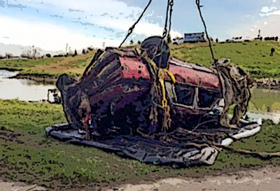 “. . . I suppose all those cars need to come out of the bayou, but I fear that will really mess up the fishing.” [Txcon, commenting on Comment of the Day: Aside from These 2 Issues, Fishing in Brays Bayou Is Enormously Appealing]
Bayous and Waterways
COMMENT OF THE DAY: ASIDE FROM THESE 2 ISSUES, FISHING IN BRAYS BAYOU IS ENORMOUSLY APPEALING 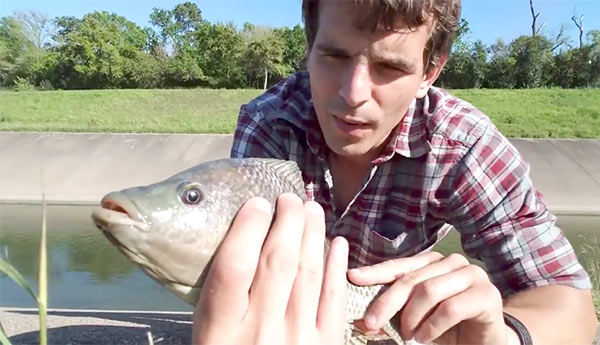 “The problem: I don’t think I would trust any of those fish to eat. Sure, you can catch and release, but I also don’t see the appeal of standing on the banks of a concrete ditch.” [Heightsresident, commenting on A Fishing Guide to Concrete-Lined Brays Bayou] Photo: Payton Moore
A FISHING GUIDE TO CONCRETE-LINED BRAYS BAYOU  What kind of fish can an enterprising angler find in the wilds of inner-loop Brays Bayou? Episcopal priest and urban fly-fishing evangelist Mark Marmon tells the Chronicle‘s Shannon Tompkins he’s caught 18 different species in Brays Bayou alone, including largemouth bass, crappie, catfish, sunfish, Rio Grande perch, longnose gar, spotted gar, and white bass. But that’s just counting the natives. The biggest draws — and what you’re most likely to find — are the alien invaders, which include mullet, the aquarium-fugitive armored catfish known as plecostomus, tilapia, and grass carp, aka “Bellaire bonefish.” But you’ve got to know where to look for them: “They, like most fish in the bayou, tend to cluster around the mouth of ‘feeder’ creeks,” Tompkins reports. “They also like structure anomalies that create accelerated current or breaks in the current; in Brays Bayou, these are created by breaks or buckles in the otherwise smooth concrete lining of the bayou or maybe an abandoned shopping cart that has found its way into the bayou. (Anglers call those shopping carts ‘Brays Bayou mangroves.’)” [Houston Chronicle] Photo: Payton Moore
WHAT’S BLOCKING THE BRAYS BAYOU TRAIL 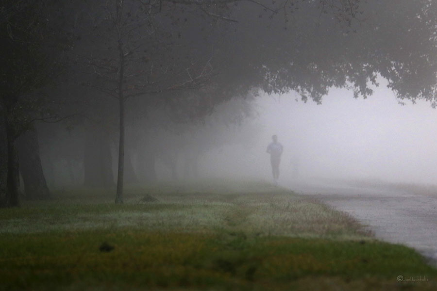 That sign posted just west of Chimney Rock declaring that the Brays Bayou trail “connects 31 miles of uninterrupted, off-street, multi-use trails and greenspace from the Ship Channel to George Bush Park and the Addicks-Barker Reservoir” is more aspirational than accurate at this point, a Houston Parks Board official admits to David Olinger. (“It got ahead of itself, let’s put it that way.”) Olinger set out to walk the supposed marathon-distance-plus continuum, but found it blocked and interrupted by construction zones, an unidentified fork to a neighboring bayou, and dead ends, including some fronting 7-miles-worth of land adjacent to Arthur Storey Park the parks board is still in the process of acquiring: “I tried walking west from Kirkwood and waded into knee-high weeds. I tried walking north on Kirkwood and found no trail. I drove up and down Kirkwood, searching in vain for Arthur Storey Park. Finally I consulted a map — and found the park about 2.5 miles northeast from the westbound Kirkwood dead end.” The Bayou Greenways trail system is expected to connect that length of Brays Bayou by 2020. [Houston Chronicle; previously on Swamplot] Photo of Brays Bayou trail: Jan Buchholtz
THE TIME MY BROTHER AND HIS FRIENDS ALMOST BLEW UP A GAS PIPELINE IN THE BAYOU  One Houston summer in the early 1960s: “My brother and his friends were playing, pretending they were WWII soldiers and they were running around shooting fake machine guns and then they would go over and jump in the bayou pretending it was a foxhole. And I went over and I heard them talking . . . they were going to build their own bomb. And I told them you know you better not do that. . . . The next thing I know I see them in the garage and they’ve got a bunch of my dad’s leftover firecrackers and they’re splitting them open and pouring them into this big prescription bottle. I tried to find my mother. And she ended up being next door. When I ran next door I was standing in the backyard and I heard this loud boom and looked at where the explosion came from and it was right where my brother and his friends had been playing. I heard sirens in the distance and a helicopter started flying real low over the pipeline. . . . Shortly after that there was a knock at the door and it was the police. . . . they said that the magnitude of this explosion had blown an almost-6-ft.-deep hole right above the Shell gas pipeline [that ran along the bayou] and it could have blown up our whole neighborhood had it been a little bit more than that.” [Texas Standard] Photo: Adam Baker [license]

A stolen Dodge Durango was the first car pulled out of Brays Bayou earlier this month as Harris County Flood Control and friends resumed work on removing some of the 100-plus sunken vehicles previously discovered gently rusting below the surface of a few of Houston’s major waterways. (The Nissan Maxima above was next in line.) Last year’s test run of the removal setup snagged a total of 20 cars out of Brays and Sims bayous; the contracts signed earlier this year for a new round of vehicle fishing budget for a catch of around 65 vehicles from the 2 bayous, depending on size and how much of a fight each one puts up. (Texas Equusearch did note back in its 2011 survey that at least one big rig is lurking somewhere in the watery depths, and some of the cars are more filled with mud and debris than others.)
The county says the new car count was up to 13 by the time work crews paused last week to let Cindy pass; a county worker also snapped photos showing off some of the haul, which has so far included a range of more and less easily identifiable makes and models including a Nissan Frontier, a Jaguar, a Ford Mustang, a Ford Bronco, an Eagle Talon, and others:
COMMENT OF THE DAY: WILL THE BAYOU CITY PLEASE START ACTING LIKE IT? 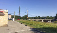 “Is the new business going to incorporate the bayou, or keep its back turned to it? Would be nice to see the trend continue of businesses along the bayous turning around and accepting the existence of a recreational green belt and trail network in its backyard, rather than using that as the side for the dumpsters.” [Superdave, commenting on Sixties Ex-Dry Cleaning Spot To Be Made Over as a Brays-Side Wine Bar] Photo of Brays Bayou at Stella Link Rd.: Frank Karbarz
Don’t feel like hopping on your bike to see how construction on that northern piece of the White Oak Bayou hike-and-bike trail is coming along? The click-and-drag-able digital map released this week by the Bayou Greenways 2020 folks may be a decent substitute for the real thing (depending on how often it ends up getting updated). Zoom in closer on the map above to check out completed trail sections (outlined in green), under construction spots (traced in dark purple), and areas planned for trail-ification at a later date (highlighted in a purple haze).
Here’s the area around Mason Park (where that double-V suspension bridge is under construction at the moment):
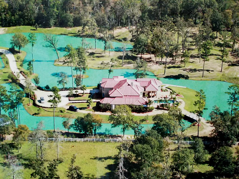
The 5.38-acre estate at 9011 Breckenridge Dr., taken up in large part by the manufactured lake wrapping 360 degrees around the property’s 6-bedroom main house, is up for sale (with $2,999,900 as the current asking price). Digging on the water feature started around late 2005 and lasted for a few years — seemingly as the large pond next door was starting to get filled in and smoothed over. (That’s the spot where the Estates Woodlands apartment complex has since been constructed, curled loosely around a new, smaller detention pond):
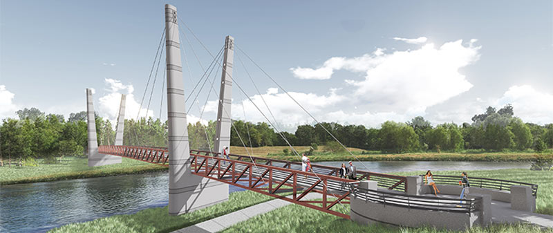
A double-V’d walkin’ and bikin’ bridge like the one shown above will be spanning Brays Bayou before too long, the Houston Parks Board says, linking together the sections of Mason Park separated by the waterway. The agency is planning a short mid-morning party for the planned structure’s construction kickoff next Tuesday, on the southern side of the park (mostly located east of the 75th St. crossing). The whole complex is just downstream of the Gus Wortham Golf Course, for which renovations finally teed off a few weeks ago (trailing much ado a few years back that culminated in the land not getting turned into a botanical garden).
The board says the other, decidedly less suspenseful pedestrian bridge announced earlier this year should be done in the fall as well; that one will will run across Brays alongside the Martin Luther King Blvd. car bridge at the downstream edge of of MacGregor Park, and look kinda like this:
HOUSTON PARKS BOARD RELEASES FLOCK OF BAYOU GREENWAY SIGHTSEEING SUGGESTIONS 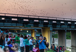 Not to be left out of the Super Bowl LI frenzy, the Houston Parks Board has been publishing weekly additions to what’s now a list of 51 “super” Bayou Greenways-accessible attractions — ranging in scope and scale from Buffalo Bayou Park to the Orange Show to a pair of nesting eagles somebody spotted near Greens Bayou. The list is broken up by watershed, with each bayou getting a separate map of sites along its existing or planned bike trails (though tour by kayak is also recommended in some places). Other entries on the list include the Watonga Blvd. bridge bat colony (on White Oak Bayou, south of Pinemont Dr., shown here), Parkwood Park in Riverside Terrance (off Brays Bayou and these days billed as Beyoncé’s childhood park), David Adickes’ Mount Rush Hour statue grouping in American Statesman Park (fringing the Downtown confluence tangle of I-10, I-45, and White Oak and Buffalo bayous), and NRG stadium itself, with a nod to the nearby Astrodome. [Houston Parks Board; previously on Swamplot] Photo of Watonga Blvd. bats: Houston Parks Board
CITY HOPES TO CHOP A DECADE OR 2 OFF THE BRAYS BAYOU FLOOD CONTROL TIMELINE 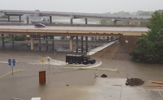 At the current rate of federal funding trickling in for the completion of the Project Brays flood control project, the work could take another 20 years or so to complete, Mike Morris writes this week — noting that the Harris County Flood Control District originally expected about $50 million in federal reimbursement every year, but has been getting an average of $11 million annually in recent years. The city is now planning to speed the project up by asking to borrow $46 million from state-level funds to give to the county, potentially helping it meet or beat a 2021 completion deadline. And “yes,” says city flood czar Steve Costello, “the city is going to be taking [a] risk because we’re going to be waiting for the money, but we’re confident that this is the start of a long-term relationship and we think it’s going to work very well.” (If it does work well, the city may do the same thing for work on White Oak and Hunting bayous.) [Houston Chronicle; previously on Swamplot] Photo of Tax Day flooding at Brays Bayou and 610: Chris Klesch
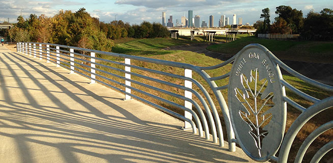
The section of bayou-hugging greenway trail running between Durham St. and Stude Park is getting the official OK tomorrow morning from Harris County Flood Control District and the Houston Parks Board. The photo above is of the pedestrian bridge across White Oak near Durham St. that previously supplanted the area’s “Bridge of Death” route; the segment opening tomorrow runs from that same bridge east along the bayou to the Studemont St. non-pedestrian bridge. The organizers are hoping would-be trail fans will use some means other than car to get to the ceremony location (off Studemont just north of I-10); if you have to drive, however, the invitation says you might be able to get a parking space across the freeway north of  Target.
Further east along the White Oak trail, here’s an updated view of how that link into Near Northside by the Leonel Castillo Community Center is coming along (taken in mid-November, once again from the same spot as that glitzed-up flood photo that made an appearance in Air New Zealand’s recent in-flight feature on Texas):
GROUP FORMS TO CLEAN UP THE UPPER SAN JACINTO BEFORE IT GETS AS BAD AS BRAYS, BUFFALO, SIMS BAYOUS 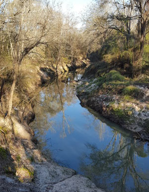 The West Fork of the San Jacinto River (implicated in much of the latest flooding between The Woodlands and Conroe) is in a bacterial “sweet spot”, environmental planner Justin Bower tells Matthew Tresaugue in the Houston Chronicle this week  — more contaminated than is acceptable, Bower says, “but not so much that we can’t do anything about it.” Tresaugue writes that E. coli levels have been trending upward since 2002, in some cases running as high as 10,000 colonies per 100 milliters of water (around 80 times higher than the 126-colony limit recommended by the state of Texas). The river’s water quality problems are multifaceted, but generally boil down to increased development in the watershed causing increased runoff that carries more junk — from human and animals waste to sediment from a nearby gravel mining operation — into the river and ultimately the Lake Houston reservoir (from which the city pulls drinking water). The newly formed West Fork Watershed Partnership has no definite plan yet (other than to work with area stakeholders to develop a plan). But Lisa Gonzalez (VP of the Houston Area Research Council) notes to Tresaugue that not doing anything could allow the West Fork’s water problems to get as bad as those of other major urban waterways in Houston. [Houston Chronicle; previously on Swamplot] Photo of West Fork of the San Jacinto: West Fork Watershed Partnership
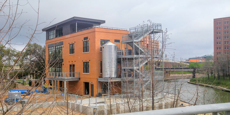
A shiny new cistern is now in place at the former Sunset Coffee building at Allen’s Landing, which Buffalo Bayou Partnership and Houston First have been redeveloping into an office-topped boat-and-bike-rental spot. The 1910 coffee roasting facility has once again donned walls after moving past a Summer 2014 minimalist phase, and is currently decked out in a muted Café du Monde orange.
The no-longer-see-through structure is back to limiting the view from the Harris County Jail across the bayou (visible on the far right, above). A set of stairs are in place alongside the new cistern, along with railings around what appears to be the planned rooftop terrace.

