ORDINANCE NOW PROTECTS THE VULNERABLE FROM PASSING CARS, PROJECTILES 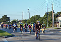 Yesterday, city council approved an ordinance requiring Houston drivers to play nicer with others. That means: No throwing things at them anymore, and no passing “vulnerable road users” without maintaining at least 3 ft. of space (or 6 ft., if you’re driving a commercial truck). And how are you supposed to know which road user is vulnerable? Maybe you can print out and keep in your car this list — not organized, presumably, by order of importance —Â from the city press release: “walkers or runners; the physically disabled, such as someone in a wheelchair; a stranded motorist or passengers; highway construction, utility or maintenance workers; tow truck operators; cyclists; moped, motor-driven cycle and scooter drivers; or horseback riders.” [City of Houston] Photo of cyclists on Fry Rd.: Flickr user josephkynguyen
Streets
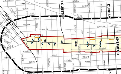
Those light-blue dots? That’s where you’ll be able to pay to park now on Washington Ave. The city’s first Parking Benefit District (or PBD) went live as of this morning, with dozens of these pay-to-stay meters installed between Westcott and Houston that will charge you about a buck an hour between 7 a.m. and 2 a.m.

This rendering of the apartment building that Hines is replacing Cafe Adobe with isn’t current, says a company rep. And details about the building are few — though the rep says that the midrise Hines is planning for the soon-to-be-former restaurant and parking lot at Westheimer and South Shepherd will contain 215 units and no retail space.
COMMENT OF THE DAY RUNNER-UP: CAMERAS ON THE STREET, BEFORE AND AFTER BOSTON “Before Boston, my attitute on red light cameras was (1) there is no expectation of privacy on the roads, in your cars or otherwise in public, (2) no person is actually monitoring these cameras, you paranoid freaks and (3) only those who were breaking the law had anything to worry about. After Boston my attitude is the same plus (4) WE NEED MORE CAMERAS and for tapes to be saved at least thirty days to aid law enforcement!” [mel, commenting on Headlines: Challenging Keystone Pipeline Challenge; Watching ExxonMobil Campus Grow]
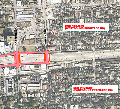
A project to improve a 2.9-mile stretch of the Southwest Fwy. feeder road between South Shepherd Dr. and Newcastle St. could get started as early as May 1, a rep from TxDOT says. And the Upper Kirby Management District contributed some funds to the $19 million project, which might give you an idea about what to expect.
PANHANDLERS IN NORTHWEST HOUSTON MIGHT HAVE TO APPLY FOR PERMITS 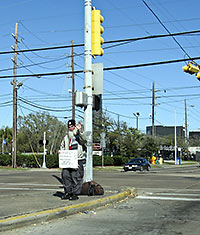 A group of residents led by Larry Lipton, public safety chair of the chamber of commerce in Northwest Houston near Cypress Creek Pkwy., is looking to implement a permit system that would require panhandlers to apply to solicit in intersections and medians, reports KHOU’s Jeremy Desel: “Many of them are criminals,” Lipton tells Desel. And a permit system, Lipton explains, “will first limit the number of people that will even do it. That will even go through it.” Desel adds that one of these solicitation permits would likely “require a fee and some form of safety training.” [KHOU] Photo of panhandler David the Sailor at Chimney Rock and Richmond: Bill Bradford
HOW TO SPOT A FAKE ‘NO PARKING’ SIGN 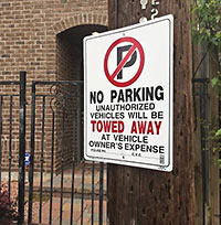 A sign like the one shown here is indicative of “a growing problem” inside the Loop, reports abc13’s Miya Shay, who claims that some homeowners and businesses are resorting to a creative way of keeping would-be parkers off the street: “If you notice,” resident Joanne Witt tells Shay, “[the sign] doesn’t have [a] police phone number and it doesn’t say where it’s going to be towed. I’m assuming it’s just put up to scare people.” And how will you know where you can park? Shay tries to clarify: “Legal parking signs by the city are uniform with a red slash across a letter ‘P.’ Signs on fences and utility poles or even physical deterrents like boulders along the street are all illegal because, like it or not, city streets are open to everyone.” [abc13; previously on Swamplot] Photo: abc13, via Facebook
A SETBACK SETBACK FOR HEIGHTS MICROBREWERY 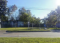 Justin Engle and Steven Macalello want to build a microbrewery at this 9,714-sq.-ft. lot that they own on Cavalcade near the intersection of Main, Studewood, and 20th St. in the Heights; Swamplot reported in November that Engle and Macalello were constructing a tap room, brewery, and beer garden from a trucked-in kit of Houston-fabricated steel parts; they told investors then that they would be open by now. So where’s the beer? The brewers write on their blog that the city rejected their plans on account of the 25-foot setback requirement from a major road like Cavalcade: “Essentially,” the brewers write, “Planning and Development staff would rather have us create a sea of concrete and asphalt in front of our building, than let us preserve green garden space inside urban Houston.” But an update yesterday suggests that the taps just might flow, after all: “In a last minute meeting with City Planning and Development staff and director, we went through all of the plans and their pros and cons,” they write. “As a result, our architects have a lot to do.” But the brewers do say they think they’ll soon have something the city will be ready to approve. [Town in City Brewing Co.; previously on Swamplot] Photo: Town in City Brewing Co.
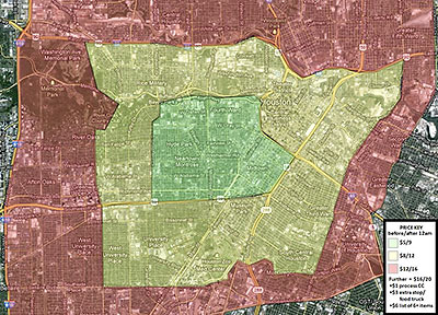
A native Houstonian has set up a one-man bicycle-messenger service, reports Culturemap’s Whitney Radley: Within an hour, Clutch Delivery’s Liam Musgrave will pedal to your place almost anything — except dry cleaning, pets, and “illicit substances.” This map shows his service area, extending west out to the Loop and east to Lockwood.
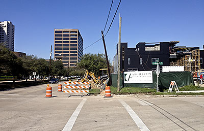
Ah, Friday: Why not take a stroll down Binz St. in the Museum District and have a look at what’s going on? Let’s head east from here: the corner of La Branch and Binz, near the Children’s Museum.
Our guide, Swamplot reader David Hollas, provides the photos and the observations:
HEY, WE’RE DRIVING HERE! 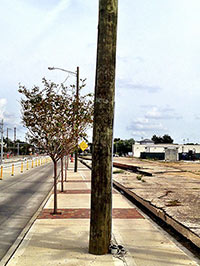 An online petition aimed at Mayor Parker’s desk has just one demand: Block off a street, once a week, for pedestrian use: “Options abound,” the petition states: “McKinney downtown (between City Hall and Discovery Green), Rice Boulevard (between Main and Kirby), or Harrisburg. Westheimer between Shepherd and Bagby . . . . After seeing such a street in Ciudad Victoria, Mexico, one Houstonian wrote, ‘Just let pedestrians take over once a week. Let a thousand Sunday night walks bloom. Just a simple avenue for families to walk a stretch in the company of others. A boost for local businesses. A reason to get out on a Sunday night no matter the time of year. A space for performance artists and musicians and writers to interact directly with a wider public.'” [Sign On; previously on Swamplot] Photo of utility pole on Harrisburg: Swamplot inbox

A ground-floor plan of the Ballpark Apartments developer Marvy Finger is set to build on 2 downtown blocks beyond Minute Maid Park’s leftfield fence shows a couple of retail spaces are planned for the southern end of the 7-story complex. They’ll face Texas Ave. between La Branch and Crawford. The larger space, on the corner of Texas and Crawford, will take the place of what are now vacant retail spaces on the ground floor of the (long-vacant) Ben Milam Hotel. (It’s at the far bottom left of the Crawford St. rendering above.) A smaller space will take up the ground floor of land now occupied by the more recently shuttered Bells & Whistles Cafe, at the corner of Texas and La Branch. The plans, leaked to HAIF earlier this week, were prepared by Atlanta architects Niles Bolton Associates.
COMMENT OF THE DAY: SELL THE STREET, SLOW THE TRAFFIC “Agreed that we need more “super blocks†about as much as an aneurysm. Why is the Galleria area traffic such a cluster? Because they took the streets out. Why does downtown usually flow pretty well? Because they left the streets in, in a nice neat grid pattern that is only confusing if you try to get too hung up on true north, south, east, and west.” [mollusk, commenting on Finger Minute Maid Apartments To Hang Low, Cut Off Leftfield Block]
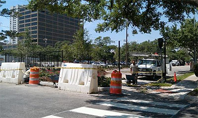
A full block of Calumet St. in the Museum District has been blocked off from traffic with a new landscaped and fenced median, notes Swamplot reader Katie White. Her photo above shows the new view from Austin St. looking towards Calumet; the street appears to have been closed between Austin and Caroline, directly south of the Holocaust Museum.
- Does the museum own the land now? [Twitter]
Photo: Katie White
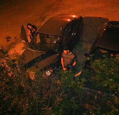
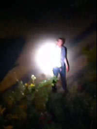
“People are always peeing on my street, so I bought a Q-Beam.” With that informative epigram, blogger Jay Rascoe takes his focus off his usual guns and tacos beat for a wee bit in his new Tumblelog, OneBlockOffWashington. There he catalogs his growing collection of caught-peeing, caught-puking, and caught-in-a-ditch videos shot from his home perch, which is, apparently, a block off Washington Ave. Rascoe’s frequent late-night interactions with would-be sidewalk urinators wandering back from club visits are frequently aided by the million candles’ worth of halogen in a pistol grip he points at perpetrators. But some of his most entertaining street-scene captures use only available light:

