SNEAKING A PEEK AT THE BIG WALLS, BIG GATES ARMY CORPS COULD PROPOSE FOR THE COAST LATER THIS MONTH 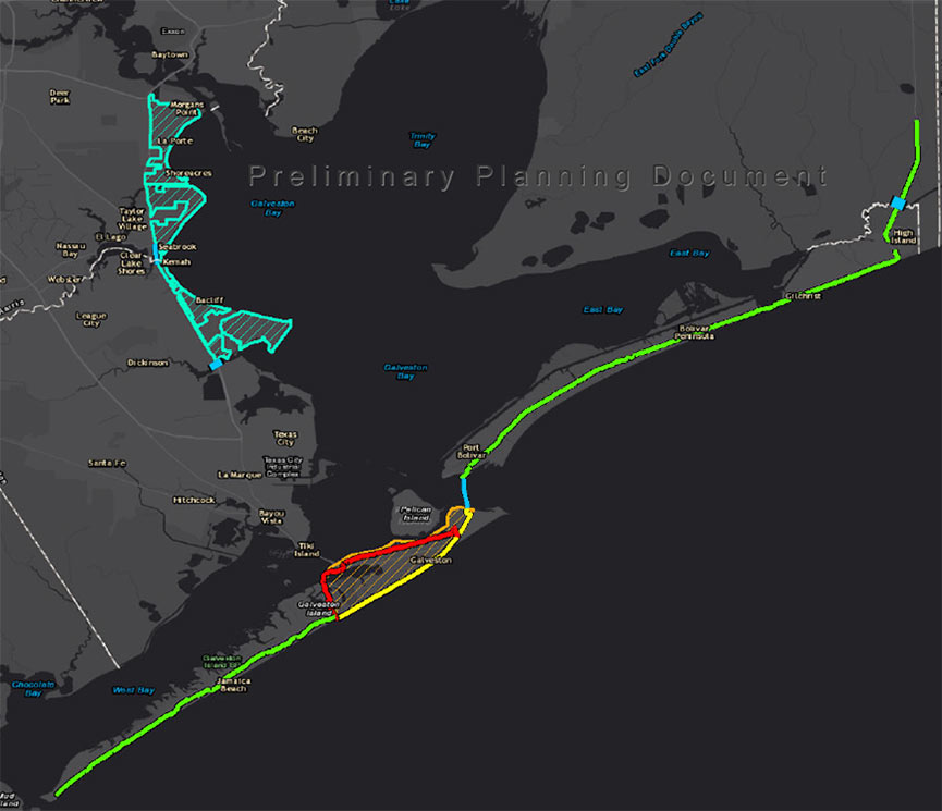 On October 26, the agency will single out one of the 4 big proposals it’s been pondering for the Texas coast as the chosen one, reports the Texas Tribune’s Kiah Collier. One of them “calls for the construction of a 17-foot-high levee along the entirety of Galveston Island,” as well as Bolivar Peninsula. Ring any bells? It’s the so-called Ike Dike (also known as the “coastal spine”) that A&M scientists dreamed up about a decade ago in response to the disaster and hypothetically-even-worse disaster that could’ve occurred if Ike had struck 30 miles further west. Another defense against that doomsday scenario that could make it into the proposal: a giant gate structure adapted from Rice’s Jim Blackburn and Philip Bedient’s 2011 idea for a mechanism that’d close before storms to block surge. (They wanted to put it just upstream from the Fred Hartman Bridge; the Corps has number of different spots in mind.) All the plans in the running include a so-called ring levee around Galveston’s bay side to protect it from reverse storm surge, a helping of smaller levees and gates, upgrades to existing flood control structures, and ecosystem restoration projects geared toward creating natural floodwater-fighting barriers. [Texas Tribune; previously on Swamplot] Map indicating proposed Alternative A plan: U.S. Army Corps of Engineers
Tag: Hurricane Ike
WAIT, DID THE 2008 RECESSION UP THE CHANCES OF A FUTURE HOUSTON CHEMICAL CATASTROPHE? 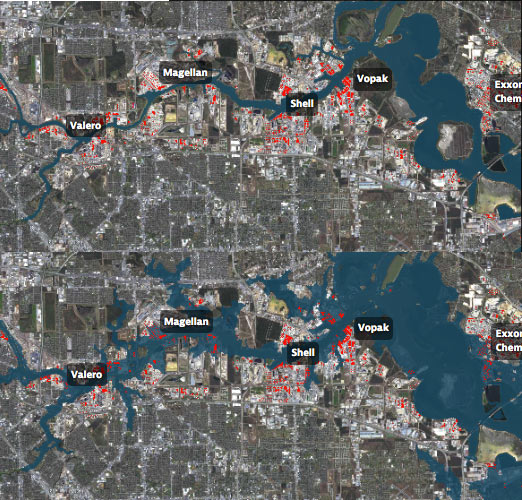 Roy Scranton imagines “a wave of water sweeping toxic waste into playgrounds, shops and houses” in Magnolia Park in his op-ed this morning, written after touring the Ship Channel and speaking with the local A&M and Rice research teams pushing for variations on a series of region-scale coastal barriers to hunker down behind whenever the next gigantic hurricane hits the Houston region, in hopes of avoiding deadly flooding and catastrophic chemical spills. But the researchers tell Scranton that pushing for federal and state funding for a response is a slow endeavor; Jim Blackburn (a main player on the Rice team) tells Scranton that he’s “heard more than one person say our plan is to wait until the next hurricane comes, then depend on guilt money from Washington to fix the problem.” Scranton writes that the best chance for that guilt money so far might have been in 2008, when Hurricane Ike landed just 30 miles northeast of the zone that modelers say could have caused thousands of deaths and irreparable ecological devastation to the area, on September 13th — 2 days before the Lehman Brothers filed for bankruptcy, pulling global attention and national funds to other issues as markets began to crash. [NY Times; previously on Swamplot] Model maps of potential storm surge flooding along the ship channel, with chemical storage marked in red: Texas Tribune
DISTRIBUTING DISASTER RELIEF FUNDS THROUGH TIRZ 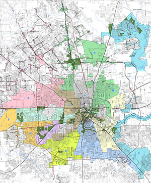 A reader has a question about a particular Tax Increment Reinvestment Zone in Houston: “In this example scenario, the city of Houston is giving [Hurricane Ike] money to a developer for infrastructure improvements on their lot (located in a TIRZ) but the requirement is that the developer must build some affordable homes on that lot.
The twist to this is that the city would give the developer money, but only if it is given through the TIRZ. Speaking with the TIRZ board, they said that they plan to distribute that money around the entire TIRZ and not just to that single development. This of course has the neighboring residents and the developer worried about how the funds will be given.
Is this the normal process for distributing Ike funding? And can a TIRZ take money away from the developing area?” Map of area Tax Increment Reinvestment Zones: City of Houston
COMMENT OF THE DAY: THAT SINKING FEELING  “At 13 seconds in, those houses across the water at the top of the frame are at the end of my street, South Burnett Drive, in the Lakewood subdivision. The street rises gradually as you travel away from the water, but the low end of the street lost over 20 houses during Hurricane Ike. Some owners have rebuilt on pilings, some have rebuilt at grade, and others have abandoned the property. (My own house is further up the street, at about 31 feet elevation.) The end of the flood debris field from Ike was about three lots south of my house. So, while the name ‘Swamplot’ is amusing, to some of us it is no joke.” [Reeseman, commenting on Flying High Over the Baytown Subdivision That Sunk] Illustration: Lulu
COMMENT OF THE DAY: HURRICANE RITAS “I know there are people who ‘go out for Margaritas’ . . . that is, they are looking for a good ’Rita and don’t care that much about the food. However, I don’t think that means a place can succeed if that’s all they’ve got. No shortage in this town of good ’Ritas or good Mexican food or places that can do both, like Hugo’s or Sylvia’s. On the other hand, I have a fond memory of the Ninfa’s on Kirby because they were open right after Ike when most of the city was still without power. Under those circumstances, I thought the food was awesome.” [toadfroggy, commenting on Out with Mama Ninfa’s, in with Maggie Rita’s]
GALVESTON ELEMENTARY STILL IN AFTER-SCHOOL DETENTION 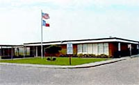 Well into Burnet Elementary School’s third year of post-Ike limbo, a school district spokesman says one idea is to fix the hurricane-ravaged property’s exterior, roof, and air conditioning so it can be used as warehouse space. There’s “a good chance” FEMA would pay for repairs, but no funds have been negotiated yet. Then there’s the other option: selling the campus. But the district doesn’t think it would get a very good price in the current market, and what if they need to open up a new school a few years later? [Galveston County Daily News] Photo: Galveston ISD
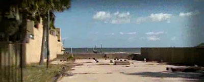
How was Seabrook homeowner Brad Gana able to wriggle out of foreclosure proceedings on his home at the last minute? By hiring a lawyer to argue that his house does not exist. And indeed, the visual evidence is compelling: All that’s left of Gana’s waterfront structure at 1910 Todville Rd., which apparently washed away 3 years ago during Hurricane Ike while Gana was working overseas, is an empty slab, protected by a front gate and littered until recently with a few of Gana’s tools and collectibles. (After the proceedings were canceled, KPRC’s Amy Davis reports, Bank of America had those items removed from the property.)
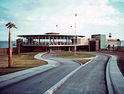
The Sylvan Beach Pavilion, a dancehall and conference hall on Harris County’s only public beach — with a 10,000-sq.-ft. glass-walled ballroom overlooking Galveston Bay — has been boarded up since its pummeling by Hurricane Ike in 2008. But thanks to a $3.6 million grant awarded last fall by the state Dept. of Rural Affairs, the modern building at Sylvan Beach Park is now headed for restoration to its original 1956 glory (above) — with a few tweaks directed by the architects at Kirksey to gussy it up for weddings, quinceañeras, local meetings, retirement parties, and other La Porte events. Construction is scheduled to start early next year and take 9 months.
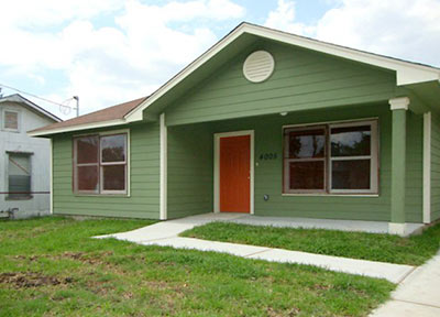
 Something was missing, it turns out, in this brand-new home Mayor Parker turned over to Mary Porras in a “housewarming” ceremony on August 4th. Built by a contractor hired by the city, the single-story replacement house at 4005 Lila St. in the Fifth Ward had no insulation, an inspector from the state’s General Land Office discovered about a week later — after Porras had already moved in.

Onlookers are reporting that large portions of Galveston’s Flagship Hotel are finding their way into the water below the 25th St. pier. The hotel’s owner, Landry’s Restaurants, is demolishing the building to make room for an amusement-park-style entertainment complex which you might reasonably assume won’t include any under-the pier attractions. The 225-room hotel closed permanently after Hurricane Ike.
Galveston real estate agent Billy Hill has posted an anonymous eyewitness account that a front-end loader operated by the Grant Mackay Demolition Co. pushed several portions of the building into the bay, including the section of framing that disappeared in the interval between these 2 photos:
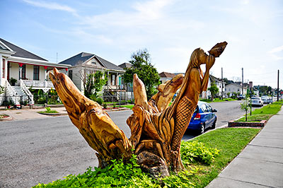
 Galveston Mayor Joe Jaworski now says he will waive the $10 annual permit fees the city had planned on charging 3 homeowners whose dead-tree sculptures stand in the public right-of-way. Homeowner Donna Leibbert started a small local-media firestorm late last week after she received a permit renewal form in the mail for the sculpture of a Geisha that artist Jim Phillips had carved out of an oak tree outside Leibbert’s home at 1717 Ball St. After the Hurricane Ike storm surge killed an estimated 30,000 trees on the island, artists turned almost 2 dozen of them into sculptures. But Leibbert’s Geisha is one of only 3 of the works that sits on city property.
City spokesperson Alice Cahill, who has helped to publicize the sculpture program as a tourist attraction, tells Amanda Casanova of the Galveston County Daily News that the license-to-use fee is normally required for any designed object that occupies a portion of the right-of-way. “A carved tree is treated the same as a cafe table.” Leibbert tells Casanova she was aware of the permit requirement at the time the Geisha was carved — getting approval for the sculpture required a formal application with the city’s planning commission. But she notes that the tree had stood in the same position for about 100 years, and for free.
Over the summer, Swamplot photographer Candace Garcia tracked down 22 of the tree sculptures, including Leibbert’s Geisha. Here’s her photo tour:
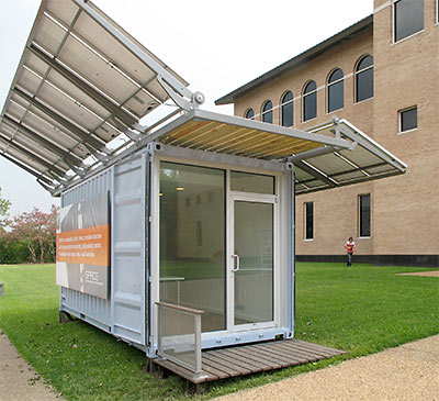
 A small fleet of modified shipping containers outfitted with adjustable solar panels will soon serve as mobile emergency power supplies for the city of Houston. City officials are currently negotiating a contract to purchase 25 of the units, which are based on a prototype originally deployed as the green-themed sales office of a Montrose condo project. The solar-powered containers, called SPACE (“Solar Powered Adaptive Container for Everyone“), were created by a joint venture of local architecture firm Metalab, Joey Romano’s Harvest Moon Development, and design firm ttweak (best known for the popular “Houston. It’s Worth It.” marketing campaign). City sustainability director Laura Spanjian announced at the opening of the University of Houston’s Green Building Components Expo last month that SPACE and energy company Ameresco had been selected through a public-application process to supply the city with the mobile “solar generators.” Spanjian now tells Swamplot the contract should be complete “in a few weeks.”

First order of business for Tilman Fertitta, now that he’s finally succeeded in turning Landry’s Restaurants back into a private company under his control (the deal closes today): announcing the demolition of Galveston’s hobbled-on-a-pier Flagship Hotel. Actually, Landry’s officials jumped the gun slightly, showing plans for a large hotel-free amusement park on the 25th St. Pier site of the shuttered hotel to Galveston’s city council yesterday. In place of the Flagship — which was built a few years after Hurricane Carla hit the island in the early sixties — yep, you guessed it: There’s gonna be a Ferris wheel. Plus: a double-decker carousel and other attractions meant to vaguely resemble the amusement park originally on the pier when it was built in 1943.
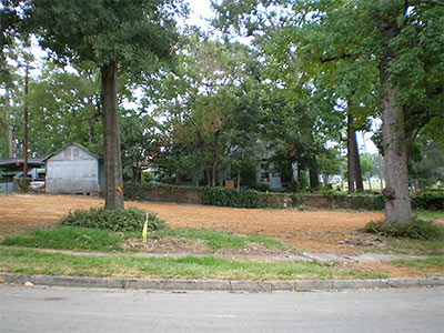
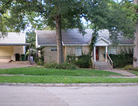 Then you saw it, now you don’t: Part 2 of FEMA’s buy it, then demolish it plan for the oft-flooded home at 1954 N. MacGregor Way in Idylwood is now complete, reports a reader. “The plants around the trees seem to be all that’s left. And, that funny knotty thing on the tree on the right.” A source scores the low-lying property as the 10th FEMA buyout of Hurricane Ike-damaged homes in the neighborhood, though more residents have turned down similar offers. Just across the street from the property: The uppity banks of Brays Bayou.
- Previously on Swamplot: Another FEMA Find Leaves the Shores of Idylwood
Photos: Swamplot inbox
EXTREME MAKEOVER: SOUTH UNION EDITION Texas Children’s Hospital pharmacy technician Eric Johnson, his wife Elaine, and their 5 daughters — all of whom live in a 720-sq.-ft. Hurricane-Ike-damaged house at 3613 Goodhope St. in South Union — learned over the weekend that they’ll be traveling to Paris this week. When they return on Saturday, they’ll find their old home gone and a new 4,500-sq.-ft. 2-story home installed in its place, designed by Studio RED Architects and the team from Extreme Makeover: Home Edition and constructed by HHN Homes and hundreds of volunteers. The Harrises run a small marriage and family counseling nonprofit they founded called Optimum Lifestyle. Host Ty Pennington and the EM:HE crew are promising an “innovative tears-free episode” of the teevee show this time (the Harrises got the news in a comedy club). And no, this home is not in the Third Ward. [Houston Chronicle; previously on Swamplot]

