COMMENT OF THE DAY: WILL THE BAYOU CITY PLEASE START ACTING LIKE IT? 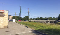 “Is the new business going to incorporate the bayou, or keep its back turned to it? Would be nice to see the trend continue of businesses along the bayous turning around and accepting the existence of a recreational green belt and trail network in its backyard, rather than using that as the side for the dumpsters.” [Superdave, commenting on Sixties Ex-Dry Cleaning Spot To Be Made Over as a Brays-Side Wine Bar] Photo of Brays Bayou at Stella Link Rd.: Frank Karbarz
Tag: Bayous and Waterways
Don’t feel like hopping on your bike to see how construction on that northern piece of the White Oak Bayou hike-and-bike trail is coming along? The click-and-drag-able digital map released this week by the Bayou Greenways 2020 folks may be a decent substitute for the real thing (depending on how often it ends up getting updated). Zoom in closer on the map above to check out completed trail sections (outlined in green), under construction spots (traced in dark purple), and areas planned for trail-ification at a later date (highlighted in a purple haze).
Here’s the area around Mason Park (where that double-V suspension bridge is under construction at the moment):
COULD HARRIS COUNTY SAVE UP SOME FLOODWATER FOR WHEN IT’S REALLY NEEDED? 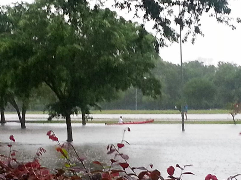 Finding a way to stockpile floodwater during years of plenty, commissioner Jack Cagle tells Mihir Zaveri this week, might not only help to make more water available for use during Houston’s drought years. It might also be a way to check the Houston region’s tendency for subsidence (that slow, permanent sinking that can happen when groundwater is pulled out of Houston’s soft clay layers too quickly). Or maybe, Zaveri adds, it could be used to help keep seawater from being sucked into aquifers as fresh water gets sucked out the other side — as long as doing so didn’t accidentally contaminate those same aquifers with junk from the surface. Who knows? Nobody, yet — but the county commissioners have given the $160,000 okay to a study team to shed light on whether it would be possible, feasible, or advisible for Harris County to pump floodwater underground for storage during major storms. [Houston Chronicle; previously on Swamplot] Photo of Meyerland flooding on Tax Day 2016: Tamara Fish
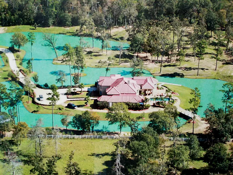
The 5.38-acre estate at 9011 Breckenridge Dr., taken up in large part by the manufactured lake wrapping 360 degrees around the property’s 6-bedroom main house, is up for sale (with $2,999,900 as the current asking price). Digging on the water feature started around late 2005 and lasted for a few years — seemingly as the large pond next door was starting to get filled in and smoothed over. (That’s the spot where the Estates Woodlands apartment complex has since been constructed, curled loosely around a new, smaller detention pond):
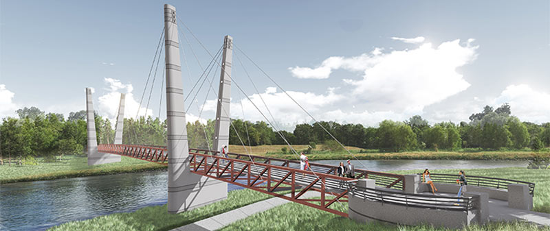
A double-V’d walkin’ and bikin’ bridge like the one shown above will be spanning Brays Bayou before too long, the Houston Parks Board says, linking together the sections of Mason Park separated by the waterway. The agency is planning a short mid-morning party for the planned structure’s construction kickoff next Tuesday, on the southern side of the park (mostly located east of the 75th St. crossing). The whole complex is just downstream of the Gus Wortham Golf Course, for which renovations finally teed off a few weeks ago (trailing much ado a few years back that culminated in the land not getting turned into a botanical garden).
The board says the other, decidedly less suspenseful pedestrian bridge announced earlier this year should be done in the fall as well; that one will will run across Brays alongside the Martin Luther King Blvd. car bridge at the downstream edge of of MacGregor Park, and look kinda like this:
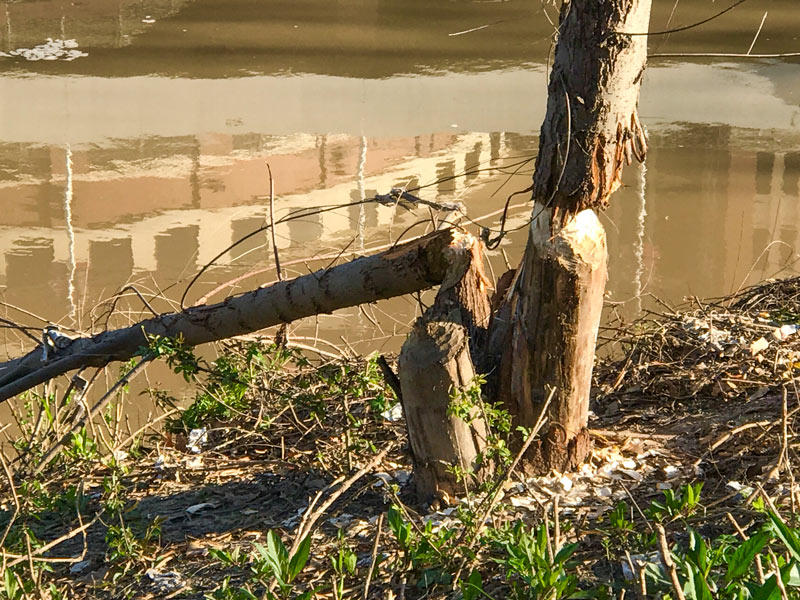
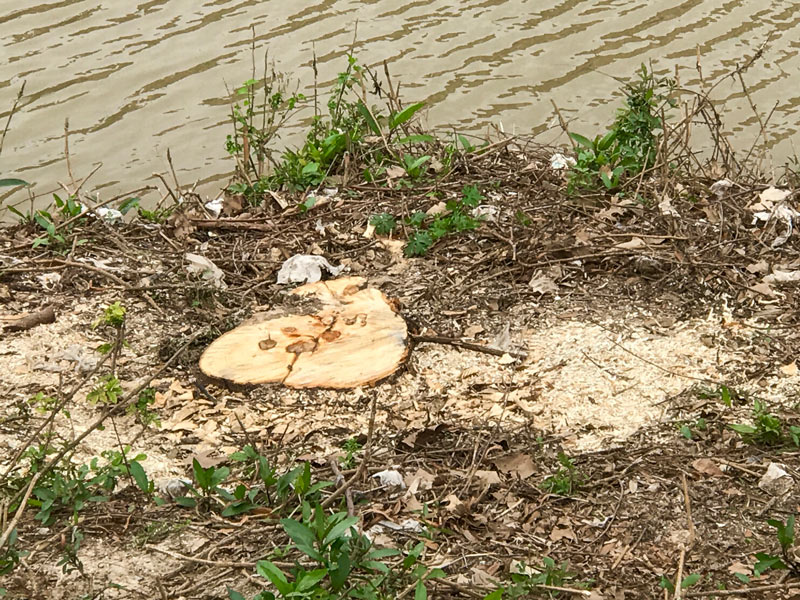
The ongoing saga of the Allen’s Landing trees coming down recently in bits and pieces — apparently the handiwork of an elusive Buffalo Bayou beaver or 2 — has come to a likely end with the non-rodent-assisted removal of the final stumps, Swamplot’s semi-regular Franklin St. correspondent and wildlife tipster notes. But life around the White Oak-Buffalo confluence goes on! Spring is here, which means the ducks have been out and about, while the cranes are busy pulling fledgling parking garage superstructures up into the air:
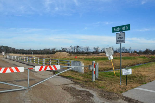
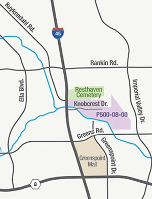 Just south of the Earthman Resthaven Funeral Home and Cemetery on I-45 — and just north of Greens Bayou — the Harris County Flood Control District is in the process of digging up more than 2 million cubic feet of soil from the Glen Forest Stormwater Detention Basin-to-be. (That’s the purple shaded area in the map shown here, right upstream from the cluster of bayou-side apartment complexes that flooded on Tax Day and helped spur the pre-dawn conversion of Greenspoint Mall into an emergency shelter.) If the name “Glen Forest†strikes you as a bit mid-century-suburban-neighborhood, that’s because it is: the 160-acre site is named after the sixties-era Glen Forest subdivision formerly constructed on the property. The neighborhood was purchased and demolished as part of HCFCD’s buyout program in the early 2000’s, but the roadways and signs had mostly stuck around, at times serving as a convenient backdrop for unsanctioned motor sports, as demonstrated in the video below:
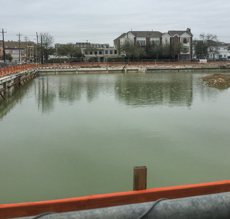
Those Swamplot commenters who’ve been taking particular and unabashed pleasure in the long, slow demise of the former city code enforcement office at 3300 Main St. may also enjoy the shot above of the flooded pit spotted recently where the Mod office building once stood. Reader Diaspora (who sent in the photo late last week) suggests the site as potential competition for the folks behind the Houston Needs a Swimming Hole campaign, which Kickstartered a feasibility study a few years ago (and also passed around an illustration of an optimistically blue-watered bayouside beachfront, shown below):
HOUSTON PARKS BOARD RELEASES FLOCK OF BAYOU GREENWAY SIGHTSEEING SUGGESTIONS 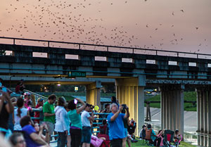 Not to be left out of the Super Bowl LI frenzy, the Houston Parks Board has been publishing weekly additions to what’s now a list of 51 “super” Bayou Greenways-accessible attractions — ranging in scope and scale from Buffalo Bayou Park to the Orange Show to a pair of nesting eagles somebody spotted near Greens Bayou. The list is broken up by watershed, with each bayou getting a separate map of sites along its existing or planned bike trails (though tour by kayak is also recommended in some places). Other entries on the list include the Watonga Blvd. bridge bat colony (on White Oak Bayou, south of Pinemont Dr., shown here), Parkwood Park in Riverside Terrance (off Brays Bayou and these days billed as Beyoncé’s childhood park), David Adickes’ Mount Rush Hour statue grouping in American Statesman Park (fringing the Downtown confluence tangle of I-10, I-45, and White Oak and Buffalo bayous), and NRG stadium itself, with a nod to the nearby Astrodome. [Houston Parks Board; previously on Swamplot] Photo of Watonga Blvd. bats: Houston Parks Board
COMMENT OF THE DAY: WATER BORDER PROS AND CONS 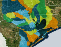 “Abolishing arbitrarily-bounded entities with taxing powers like the HCFCD and instead creating entities that are specific to individual watersheds seems like it might make some sense. I do worry that certain areas, especially less affluent ones, would suffer from poor or corrupt leadership; and you can’t simply merge watersheds as the T.E.A. would merge school districts. However, that’d certainly be more democratic and accountable. That’s a trade-off which might be worth making.” [TheNiche, commenting on Group Petitions for 13-County Flood Planning] Watershed boundaries superimposed across Houston-area county boundaries: Galveston Bay Foundation and Houston Area Research Council’s Find Your Watershed map
CITY HOPES TO CHOP A DECADE OR 2 OFF THE BRAYS BAYOU FLOOD CONTROL TIMELINE 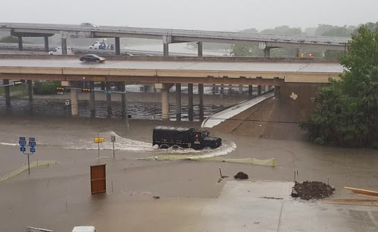 At the current rate of federal funding trickling in for the completion of the Project Brays flood control project, the work could take another 20 years or so to complete, Mike Morris writes this week — noting that the Harris County Flood Control District originally expected about $50 million in federal reimbursement every year, but has been getting an average of $11 million annually in recent years. The city is now planning to speed the project up by asking to borrow $46 million from state-level funds to give to the county, potentially helping it meet or beat a 2021 completion deadline. And “yes,” says city flood czar Steve Costello, “the city is going to be taking [a] risk because we’re going to be waiting for the money, but we’re confident that this is the start of a long-term relationship and we think it’s going to work very well.” (If it does work well, the city may do the same thing for work on White Oak and Hunting bayous.) [Houston Chronicle; previously on Swamplot] Photo of Tax Day flooding at Brays Bayou and 610: Chris Klesch
GROUP PETITIONS FOR 13-COUNTY FLOOD PLANNING 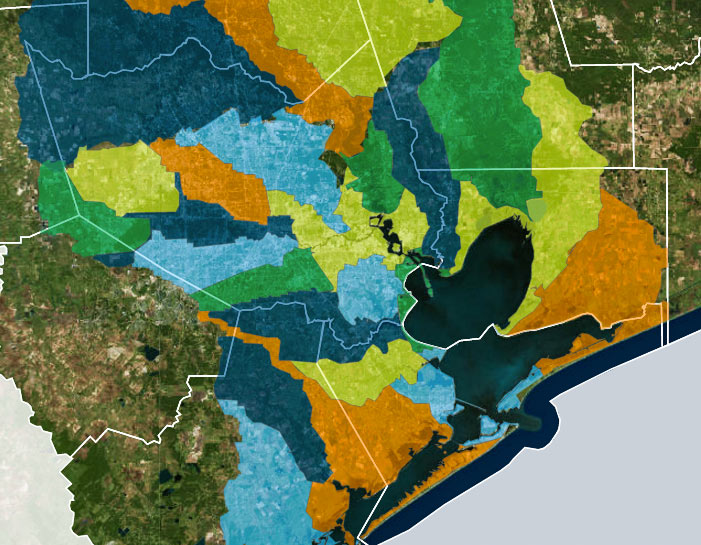 A group called Citizen Solutions to Flooding — not to be confused with the Residents Against Flooding group currently suing the city and TIRZ 17, though containing some of the same members — is circulating a petition calling for a region-wide plan to address man-made flooding issues, and an agency to oversee it. The petition lists out some of the specific technical concerns that signers want incorporated into future flood planning, including a shift from floodplain-level thinking to whole-watershed rules. The petition also calls for coordination across all 13 counties in the Houston-Galveston Area Council region; Citizen and Residents member Ed Browne tells Ed Mayberry that “flooding doesn’t know any boundaries. I mean, water doesn’t care whether you’re in Harris County or Montgomery County or Fort Bend. Unless we address the whole watershed, one area or another is going to suffer.† [Houston Public Media; previously on Swamplot] Watershed boundaries superimposed across Houston-area county boundaries: Galveston Bay Foundation and Houston Area Research Council’s Find Your Watershed map
TERRY HERSHEY, 1922-2017 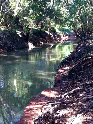 The stretch of Buffalo Bayou running between the Addicks and Barker reservoirs and Shepherd Dr. looks the way it does today in large part because Terry Hershey and some friends spotted the unannounced work to pave and reroute the bayou — and raised some hell about it with the county, the Corps of Engineers, and others. The early actions of Hershey and her associates stopped the pave-over, led to the founding of what became the Bayou Preservation Association, aided the passage of the National Environmental Policy Act (which requires public involvement in projects that could impact the environment), and helped to catalyze Houston’s environmental movement. Hershey’s legacy includes founding, laying groundwork for, and participating in many other organizations to protect green space and environmental quality in Houston and throughout the state, many of which are still active today; the 6-mile park along Buffalo Bayou between Hwy. 6 and Beltway 8 is named for her. Hershey passed away today at age 94. [Houston History, Houston Chronicle] Photo of Terry Hershey Park: Save Buffalo Bayou
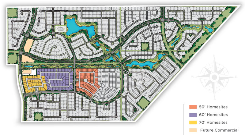
 Land Tejas’s Scottish-castle-themed Balmoral development in Humble (sketched out above) is 1 of 2 currently planned Houston-area locations for fake lake maker Crystal Lagoons’s giant outdoor pools, Candace Carlisle reports. The sand-bottomed water feature will be around 1.5 acres, and a similar 8.5-acre pool is planned for a different Land Tejas development (though the actual location of that one hasn’t yet been announced). As it does in the demo lake shown here, the lagoon company plans to keep the water in the pools much clearer than is typical of the area’s bayous and beaches (or even of the stormwater-detaining landscaping lakes typically accompanying such developments) by using a soundwave- and flocculation-based filtration system. Bacteria and algae would also be kept at swimmable levels with a set of sensor-and-Internet-controlled disinfectant injectors.
Urban wildlife cellphone videographer Christine Wilson sends some footage captured from Allen’s Landing documenting the eons-old nature vs. civilization struggle, which played out earlier this week in the form of tiny ducks dodging their way through the floating trash field where White Oak and Buffalo bayous join up. Wilson caught sight (and sound) of a duck and 4 ducklings struggling across the White Oak outflow toward the Buffalo side of the confluence, which she notes is significantly less debris-spangled. That’s the Harris County Jail in the background for most of the shot, across White Oak from the main building of the University of Houston Downtown. (The footage cuts out mid-scene, but Wilson says the ducks did eventually make it across.)
Video: Christine Wilson

