COMMENT OF THE DAY: BACK TO NATURE  “Cities with a ‘home flood rate’ of over 25 percent — like Bellaire — should really consider mandatory green space, meaning some property owners simply cannot rebuild. Tough in the short term but the city can front good money to buy them out . . . because all that park land, trails, fishing, sports fields will pay back multi-fold when these communities are Edens in the midst of a major city.” [movocelot, commenting on Bellaire’s Flooded Home Count; Chicken Salad Chain Making Houston Debut] Illustration: Lulu
Tag: Parks
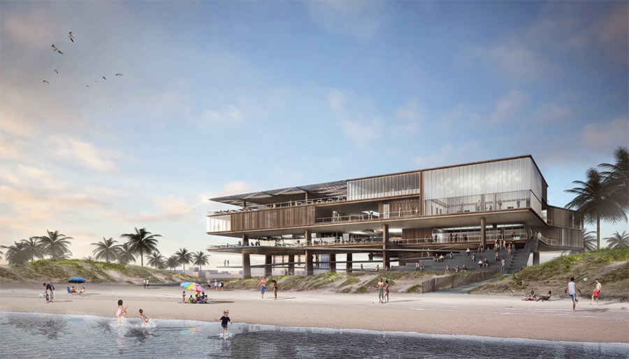
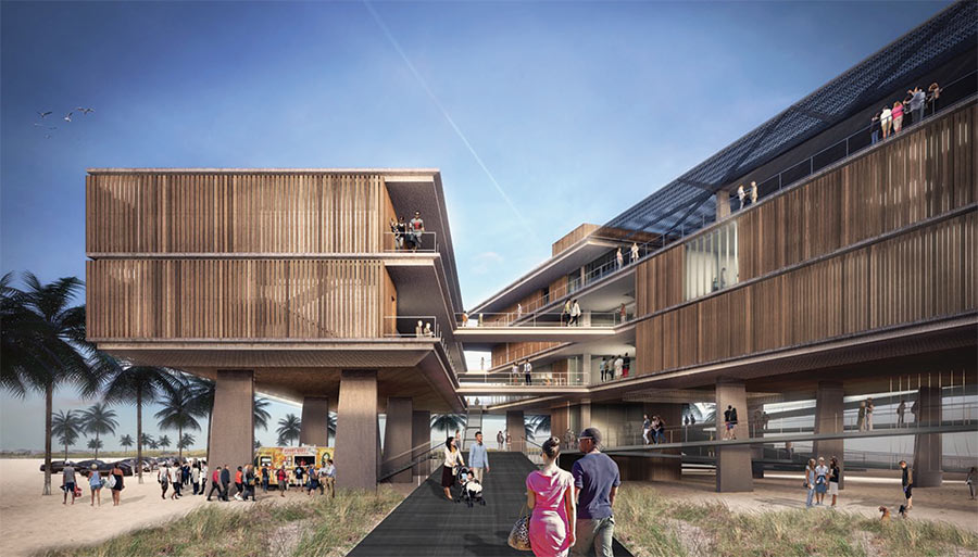
The new pavilion shown in the renderings at top is what Galveston’s Park Board of Trustees want to plant on Stewart Beach, near the end of Broadway and Seawall Blvd. The structure would reorganize the mix of concessions, patrol facilities, parks offices, storage, restrooms, and community meeting space that comprise an existing beach house into 2 adjacent structures suspended above a series of promenades and linked by overhead walkways.
A site plan of the beach from New York architects Rogers Partners shows where the new complex — along with a separate garage and welcome center would go relative to the existing structures that are set to be demolished:
WHAT THE HARVEY FLOODING DID TO BUFFALO BAYOU PARK 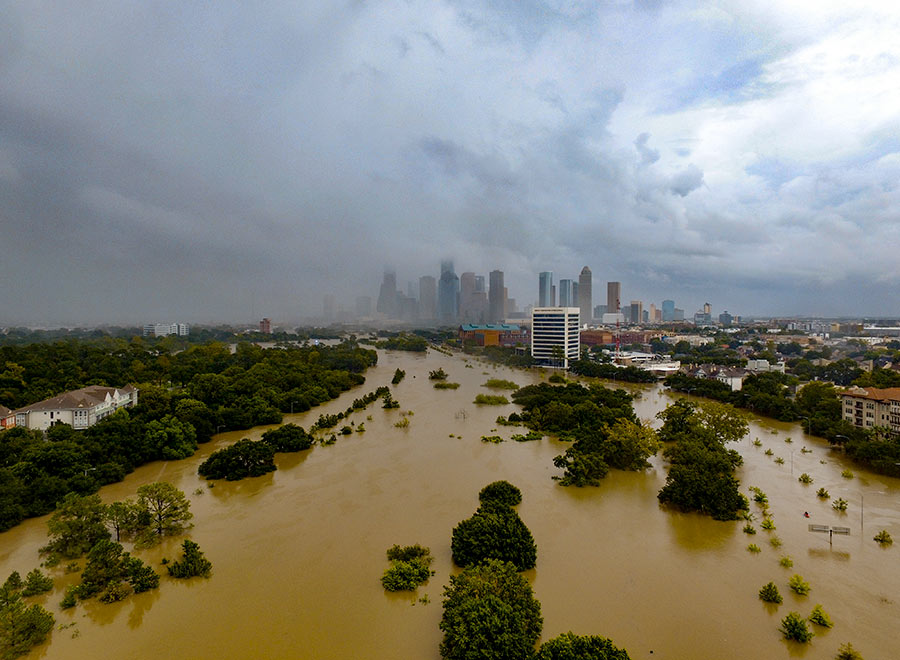 “Please know that Buffalo Bayou Park was designed to flood, although we did not anticipate three historic flooding events in 1-1/2 years,” Buffalo Bayou Partnership president Anne Olson remarks drily in an email update this afternoon. So what’s the damage? “The bottom two thirds of the park are still under water, and we expect that they will remain so for several more weeks as water is released from the Addicks and Barker reservoirs. Due to these circumstances, it is difficult for our staff to assess the impact the flowing water has had on the footpaths and landscape in these areas. We do know that the Johnny Steele Dog Park, which is still submerged, will be closed for two or three months.” Water and sediment that flooded the Buffalo Bayou Cistern is still draining, slowly, but the electrical system installed when the long-hidden underground space was made available for tours and art installations appears to be working. The Wortham Fountain and the trail lighting system have been damaged, Olson reports. The Bayou City Adventures kayak kiosk at Lost Lake
 and the Bike Barn at Sabine St. has been shut down for the remainder of the year at least; areas east of the Sabine St. bridge are mostly still underwater. But Olson reports landscaped areas in the upper areas of the park, where trails have already reopened, survived with only a small amount of damage: “We are extremely fortunate that the Lost Lake and Wortham Insurance Visitor Centers did not take on water. Both facilities are open and the Kitchen at The Dunlavy is operating with normal hours. Food trucks also are back in the entry court at Sabine Street from Thursday-Sunday.” Update: The Bike Barn at Sabine St. has resumed normal hours as of September 9. [Buffalo Bayou Partnership] Photo: Adam Brackman.
THESE ARE THE SALAD DAYS FOR EMANCIPATION PARK 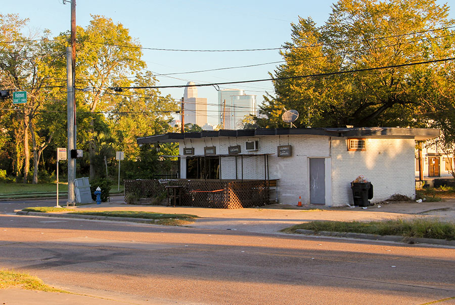 Covering the reopening of Emancipation Park, on Elgin St. east of 59, Michael Hardy surveys the adjacent eats: “Even before the park reopened, a number of businesses catering to the neighborhood’s newest residents had appeared. Across the street from the park, below the old Eldorado Ballroom, are the Crumbville, TX bakery, which sells vegan cookies and brownies, and the NuWaters food co-op. A few blocks down Emancipation Avenue, Doshi House serves sustainably sourced coffee and vegetarian meals. (Emancipation Avenue used to be called Dowling Street, after a local Confederate officer; the Houston City Council voted in January to change the name.)
The latest business to open on the park periphery is the Rustic Oak Seafood Boiler Shack, which serves coastal Cajun cuisine. The owner and chef, Wendell Price, grew up on MacGregor Way, a more affluent part of Third Ward, and remembers the area around Emancipation Park as a food desert. ‘When I came down to hang in this area, you literally couldn’t get a salad,’ he said.
Mr. Price, who previously operated a restaurant in Houston’s trendy Montrose neighborhood, said he would never have considered setting up shop in Third Ward if not for the Emancipation Park renovation.” [New York Times; previously on Swamplot] Photo of Doshi House: OffCite/Raj Mankad
THE PIERCE ELEVATED SKYPARK PLAN ISN’T DEAD YET 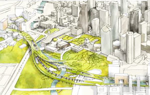 “You can’t just wait until the day that TxDOT asks you what to do with it,†Tami Merrick tells Stephen Paulsen in the Houston Press this morning, in reference to her involvement with the small group working toward publishing an economic study some time next year of those speculative plans to turn the Pierce Elevated into the Pierce Skypark. The segment of I-45 may ultimately be torn down so the right-of-way can be sold, once the planned spaghetti-riffic Downtown freeway reroute wraps up in a decade or so. But Paulsen writes that the planning group is nonetheless optimistic about getting a foot in the door when the moment is right: “At some point, the Pierce Elevated will stop serving cars. And when it does, the group argues, why wouldn’t the city want an innovative, prearranged plan for the abandoned stretch of freeway?” [Houston Press; previously on Swamplot] Rendering of Pierce Elevated as a park: Page/Marcus Martinez via Pierce Skypark
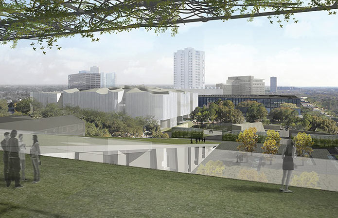
Construction started yesterday on the Nancy and Rich Kinder Building, going up in the Museum of Fine Arts Houston’s former parking lot north of Bissonnet St. at Main. That’s the curvy-roofed structure itself visible in the rendering above — the drawing shows the expected view of the building from the rooftop garden of the already-under-construction nearby replacement for the formerly glass-covered Glassell School (whose underground parking garage opened up when the surface lot closed last week). Both of the new buildings were designed by Steven Holl Architects — here’s where they fall on the map, along some of the other big changes in the works for the Museum’s campus:
NICE PARK IF YOU CAN GET TO IT, AND OTHER HOUSTON ENCAPSULATIONS 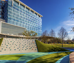 George Ristow’s take for OffCite on the recently unveiled public-private redo of Levy Park? It’s become “one of Houston’s best outdoor public spaces” — as long as you can get yourself there: “The park is tucked away from view, dwarfed by the Kirby Grove building, which undermines its connection [to] Richmond Ave. (bringing visitors from Upper Kirby). Although there are sidewalks immediately surrounding the park, no sidewalk exists on either side of Eastside St. between the park and Richmond. Just one block south of the park, the Southwest Freeway, with a right-of-way as wide as the park itself, walls off West University’s upper reaches as if it were an international border crossing. Consider the Olive Garden restaurant, surrounded by a typical suburban parking lot, built within the same time period as the Levy Park facelift just on the other side of the freeway. Here we have Houston in a nutshell: a state-of-the-art destination public park next to a 19-lane freeway next to a chain restaurant, with no way to walk between them.” [OffCite; previously on Swamplot] Photo: Levy Park Conservancy
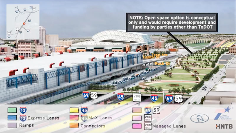
In between showing off various multicolored interchange tangles, the new flyover preview video of the huge changes proposed for I-45 North and the downtown freeway circuit glides viewers by a handful of areas where freeways will dive underground — while splicing in some new renderings of the tops of those tunnels-to-be as they could look, if somebody wanted to pay up to turn them into a park. (The animation is careful to emphasize once again that said parks would have to be developed and funded by a source other than TxDOT — and so far, there are no signs that anyone has stepped up.)
The rendering up top shows the would-be-parallel sections of 45, 59, and SH 288, running behind the convention district where 59 sits now — the whole bundle would be pulled down below flood grade and covered up, evidently with concrete if the park thing doesn’t work out. (A clip of just that section of the 10-minute animation is included above; a tiny rendered version of the Cheek Neal Coffee building can be spied along the edge of the freeway, though SEARCH Homeless Service’s new building one block north isn’t specifically drawn in next to it.)
The video also gives the section of 59 from Main to San Jacinto streets the same burial and dressup treatment:
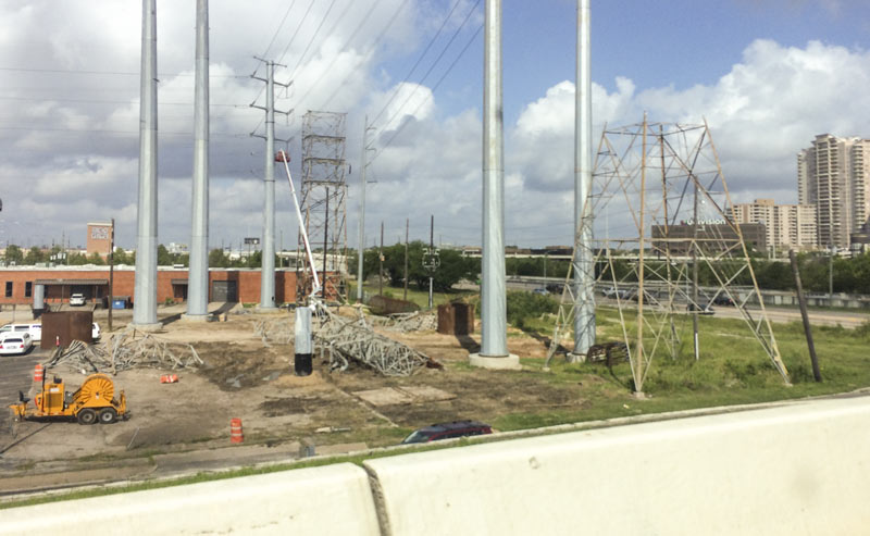
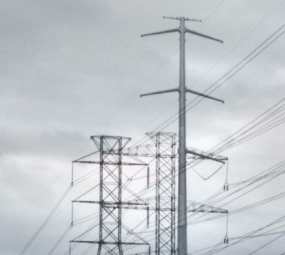 Bits and pieces of the electrical towers formerly stringing CenterPoint’s transmission lines between 59 and Westpark Dr. were spotted laying around just west of West Loop 610 this weekend, though the feet of at least one of the structures were still standing at the ready. The old towers appear to have been fully relieved of their duties at this point, 3 months or so after the taller, sleeker towers started going skyward. Here’s one of the last full-length portraits featuring both kinds of towers, taken in the final days before the changeover began in earnest:
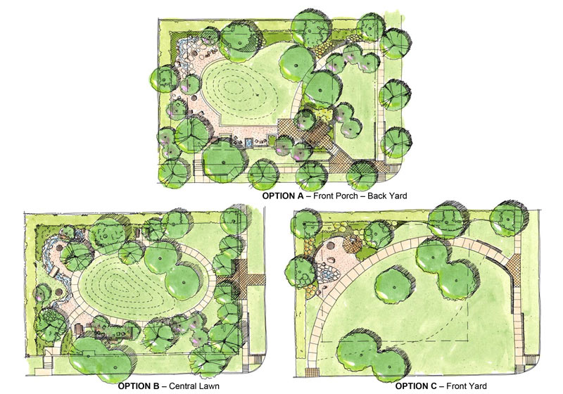
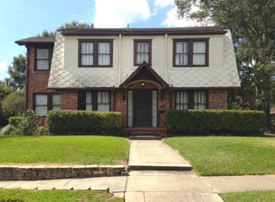 Sunday’s the deadline for giving the city of West University some honest feedback on which of 3 proposed park layouts you think would best flatter this residential lot at 6446 Sewanee Ave. — along with any specific details you like about the other 2 options. The home’s former owner, architect James M. Hughes, passed away just over a year ago; Hughes bequeathed the property and some funds to West University for conversion into Jennie Elizabeth Hughes Park (named after his mother, who bought the empty lot back in 1928).
Option A of the choices highlights the corner lot’s time as a residence by adding a rocking-chaired, freestanding front porch as an entryway (though of a totally different design from the existing front porch). That option would also include a partial outline of the house’s foundation:
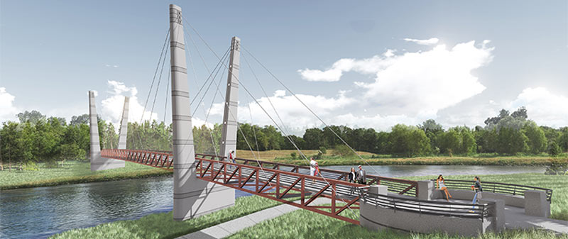
A double-V’d walkin’ and bikin’ bridge like the one shown above will be spanning Brays Bayou before too long, the Houston Parks Board says, linking together the sections of Mason Park separated by the waterway. The agency is planning a short mid-morning party for the planned structure’s construction kickoff next Tuesday, on the southern side of the park (mostly located east of the 75th St. crossing). The whole complex is just downstream of the Gus Wortham Golf Course, for which renovations finally teed off a few weeks ago (trailing much ado a few years back that culminated in the land not getting turned into a botanical garden).
The board says the other, decidedly less suspenseful pedestrian bridge announced earlier this year should be done in the fall as well; that one will will run across Brays alongside the Martin Luther King Blvd. car bridge at the downstream edge of of MacGregor Park, and look kinda like this:
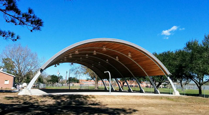
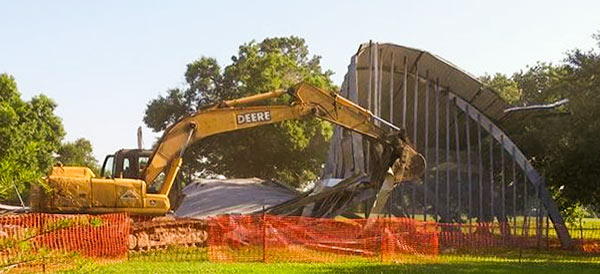 The arched pavilion in Meadowcreek Park that was knocked down in 2015 has officially been replaced, after a few years of neighborhood-city back-and-forth to push for the new structure’s design to look a lot more like the old one. The court, pictured up top complete except for the addition of the hoops and backboards to the posts at the opposing ends, got a ceremonial fabric snipping yesterday evening, Lauren Meyers tells Swamplot. This version of the structure appears to lack the thin vertical bars that closed off one side of the original, as visible both in the mid-act demolition portrait above and in this shot from the 1970s:Â
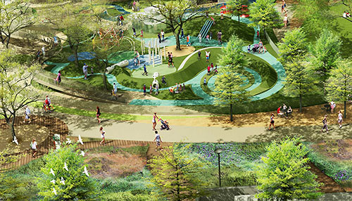
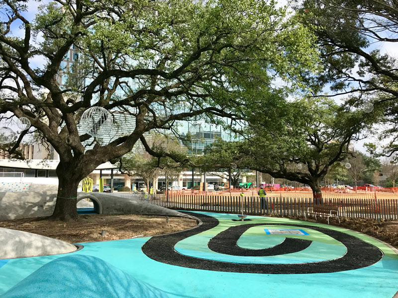
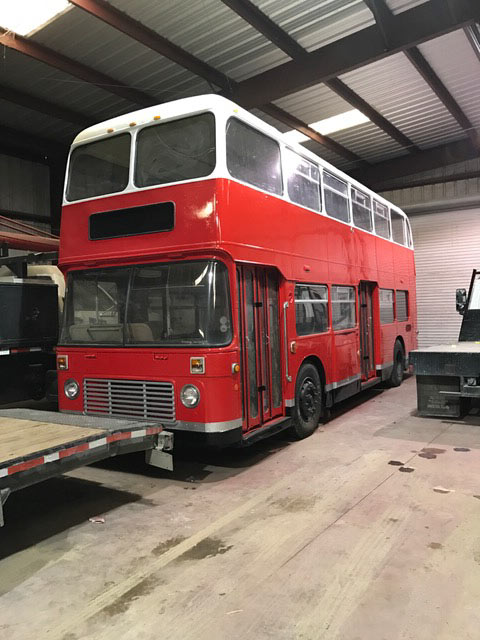 The new swirls and swoops around Levy Park are starting to look more like those previously released renderings of the space’s total facelift, as a planned February 25th reopening date draws near. The Levy Park Conservancy is throwing an opening party that day, including art performances, workshops, gardening demos, and piano music (presumably from the moveable park piano.) The group sends along some photos of the increasingly colorful construction site, from the spiraling walking path both pictured and rendered above, to the repurposed double-decker bus that’ll eventually sit alongside the park’s main open greenspace to tend a beer garden. The bus previously made an appearance in this rendering of the lumpy triangular dog park:
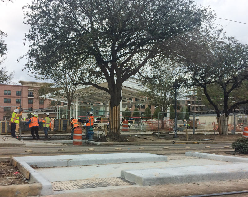
A spokesperson from ESPN confirms to Swamplot that the network will not be using underground-parking-garaged Midtown Park as the main set for its Super Bowl week teevee shows after all, contrary to that October announcement. Workers were on the scene on Monday (as shown here), and the main pavilion structure appears to have been undergoing glow tests in the last few weeks by the same lighting design company that designed the new US59 bridge LEDs. The scaffolding-covered Camden apartments structure, however, appears to be missing some more significant finishing touches:
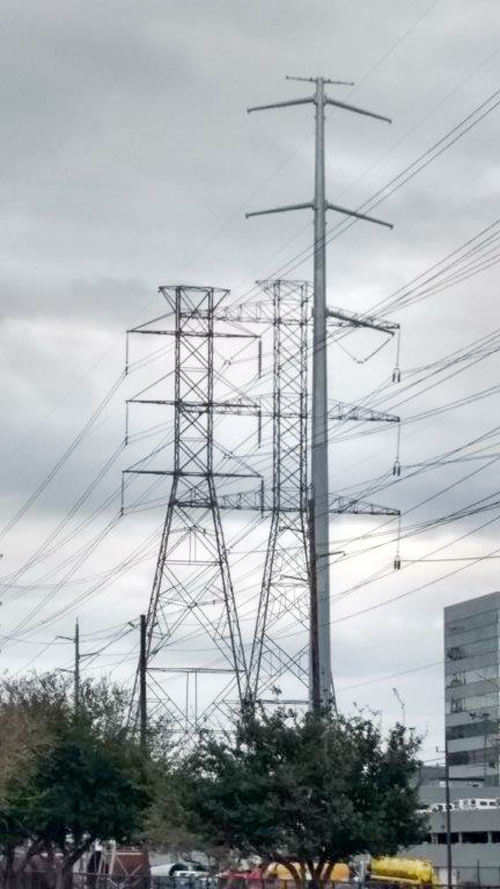
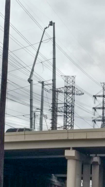 The view this week around Westpark Dr. at the West Loop includes both the old lattice towers currently holding CenterPoint’s electrical transmission lines and the taller, skinnier single pole models that will be taking over the gig. A reader captured some side-by-side portraits of the old towers and their replacements, which CenterPoint is deploying to raise the lines out of the way of TxDOT’s proposed future edits to the 610-59 interchange tangle. The cherry picker above is shown tethered to one of the new towers in the easement just west of 610; the top shot shows a pole up on the east side of the freeway between the Loop Central office midrises and the Danny Jackson Family Bark Park (which closed down last summer so CenterPoint could work on the land the county had been using as the park’s parking lot).
Here’s a ground-level shot at the base of an old-and-new tower pair just outside the dog park, with some Houston Garden Center inventory in the background for scale:

