06/24/10 8:34am

Note: Story updated below.

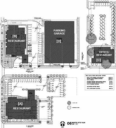
The owners of the original Carrabba’s Italian Grill on Kirby between West Main and Branard plan to demolish the restaurant, rebuild it, and construct 2 more restaurants on adjacent blocks. First step: building a new 275-car parking garage one block to the north, at the northwest corner of Branard and Argonne. Next, a new and larger Carrabba’s (marked [A] in the site plan above) would go up directly south of the existing building, which would remain open during construction. Once the new digs are complete, they’ll tear down the existing restaurant and put in a parking lot and porte-cochere in its place. Two more restaurants — one possibly named Grace’s, and one with office space upstairs — are planned for blocks north of Branard, one facing Kirby and the other at Argonne.

The Kirby Carrabba’s is one of 2 still owned by the family of co-founder Johnny Carrabba. All other Carrabba’s Italian Grills — more than 200 in 27 states — are owned by OSI Restaurant Partners, the same company that runs Outback Steakhouse and Fleming’s.

The new Kirby restaurant complex may be the first in the city to take advantage of the “transit corridor” incentives passed by city council last year. In return for building a 15-ft.-wide pedestrian area and street-front entrance along Kirby, designers get to push 2 of the buildings close to the street, well into the normal 25-ft. setback. The planning commission approved the site plan earlier this month — along with several related parking variances — even though the transit corridor itself (the University Line on Richmond) hasn’t even started construction yet.

CONTINUE READING THIS STORY

04/26/10 9:32am

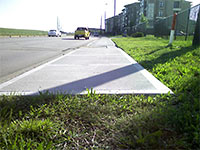
WHERE THE WESTHEIMER SIDEWALK ENDS Following in the footsteps of groundbreaking Houston Press adventurers John Nova Lomax and David Beebe, an acolyte named Brent Zius has chosen today as the day he’s gonna walk the entire length of Westheimer, starting a full 3 miles west of West Oaks Mall and ending in Midtown, where the road gives up its name to Elgin. Zius, who claims he’s made “no real training or preparation” for the trek, is at least bringing his Twitter account with him: Already, he’s checked in with this photo showing the western limit of Westheimer’s pedestrian paving. [Twitter; details on Hair Balls; previously on Swamplot] Photo: Brent Zius
04/14/10 12:47pm

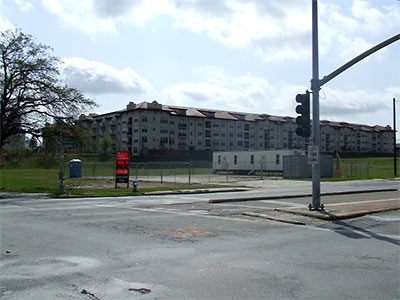
A number of readers have been asking what’s up with the new construction office set up on the former site of the Robinson’s Warehouse at the southeast corner of Montrose and Allen Parkway. The Aga Khan Foundation bought the low-lying property in 2006 with plans to build another of its Ismaili Centers on it — featuring lecture, conference, and recital facilities, a prayer hall and a social hall, and offices and gardens. Is that building ready to go up?

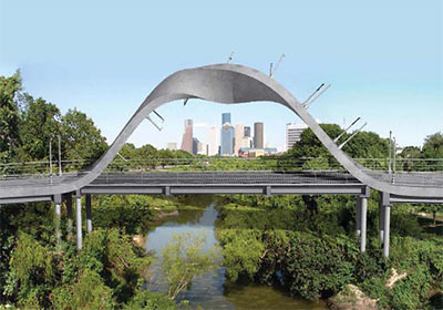
It doesn’t look like it. In the meantime, the construction office was parked on the property for a different project entirely, across the street: The new Rosemont Bridge, meant to connect the north and south sides of Buffalo Bayou Park. When Mayor White first announced the bridge project in late 2008, it had a different name and a different design. Called Tolerance Bridge, it a featured Moebius-strip-like superstructure that was meant to appear impassable from a distance:

CONTINUE READING THIS STORY

12/11/09 3:43pm

COMMENT OF THE DAY: PAY AS YOU GO “I don’t want greater density, walkable neighborhoods and I sure don’t care about my carbon footprint. I’m not one of the mass of zombie manbearpig believers. None of these things is going to improve my quality of life. Having more money in my pocket through lower taxes will improve my quality of life. If you want high density walkable neighborhoods I suggest you build them with your own money. . . . Do you just assume that everyone wants to live in some kind of high density urban la la land. Maybe you want to but I don’t want to pay for your lifestyle. Pay for your own.” [jgriff, commenting on John Culberson to Metro: Stop This Train!]

11/11/09 10:45pm

COMMENT OF THE DAY: BRING YOUR MUD BOOTS “There are too many high-speed arterials, especially outside the Loop, with no sidewalks. I was taking the bus to work for about a month earlier this year (I work in an office on the North beltway). There are bus stops there but no sidewalks. Speeds on the feeder road tend to be 45 to 50 mph. There are few pedestrians (for obvious reasons) but there are some; bus commuters like me, kids walking to school every day, etc. They will walk on muddy paths to avoid walking in the street. And bus riders with wheelchairs or strollers are simply SOL. I liked riding the bus, but not the sidewalk-free walk at the end of the ride.” [RWB, commenting on Where the Sidewalks End]

11/10/09 1:36pm

WHERE THE SIDEWALKS END “On Airline Drive, for example, up to 40,000 people arrive every weekend to visit flea markets that line both sides of the road. The neighborhood’s management district is gearing up to spend $2.9 million on pedestrian improvements, including two new, signalized crosswalks on Airline, as well as sidewalks on nearby streets that are heavily used by local residents. . . . [Harris County] has a policy of not installing sidewalks when it builds a new road, unless a group or city provides the extra money. ‘It’s an expense that doesn’t have to do with transportation,’ said Mark Seegers, a spokesman for Harris County Commissioner Sylvia Garcia. ‘The county does not do sidewalks; it’s not what gets cars from point A to point B.’ . . . In the eight-county region that includes Houston, an average of 100 pedestrians died every year between 2003 and 2008, and an average of 1,175 were injured, mostly within Harris County, according to statistics compiled by the Texas Department of Transportation. More than half of all pedestrian deaths occur on [high-capacity, high-speed roads called ‘arterials’], often as people are trying to cross to reach retail shops or bus stops.” [Houston Chronicle]

12/04/08 1:52pm

The newly revealed design for that $7 million pedestrian bridge over Buffalo Bayou near Montrose makes a brilliant metaphor for the appeal of this city, no? From a distance, it doesn’t seem like Houston is really . . . “passable,” either! But once you’re looking at it up close . . . sure, it’s all right: You can make it through. An excellent message to send prospective Houston tourists! Plus: Wasn’t that how the Houston Ship Channel got started too?

Official name of this Memorial Heights TIRZ project: The Tolerance Bridge. Perfect!

CONTINUE READING THIS STORY

11/14/08 11:41am

COSTCO SIDEWALK MAZE: BETTER FOR THE TREES Lee McGuire gets to the bottom of the wacky sidewalk screwup at Trammell Crow’s Greenway Commons, on the corner of Weslayan and Richmond: “It turns out the city actually required the new sidewalk to run right through the utility poles to save a row of trees. The developer said the project meets federal guidelines — except perhaps the blocked handicap ramp. The final inspection won’t take place until the shopping center is finished. If it’s in violation, the developer promises to fix it.” [11 News, via BlogHouston; previously]

South Post Oak
08/12/08 11:37am

South Post Oak Blvd. at W. Bellfort, Houston

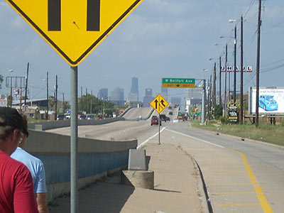
Veteran Houston hoofers John Nova Lomax and David Beebe and a guest suffer a vehicle breakdown on their latest walking tour — from West Fuqua up South Post Oak to W. Bellfort. The trip, says Lomax,

ended up as little more than a Bataan death pub crawl, taking in three unjustly obscure near southwest side strip mall taverns.

But . . . oh, the sights!

CONTINUE READING THIS STORY

05/07/08 4:30pm

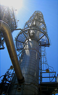
Fractionation TowerFinding it hard to stay healthy in Houston? Do you find yourself wheezing and coughing . . . maybe because you’re uh, so out of shape? Blogger and chemical-plant worker Baytown Bert has come up with a solution: Industrial Trekking.

Industrial Trekking (IndyTrek) is a planned path consisting of climbing/walking obstacles or evolutions inside a refinery, chemical plant, factory, water treatment plant or even a large office building whereby a person can use stairs and ladders to promote fitness. An IndyTrek typically consists of 8-10 evolutions, usually requiring an hour to complete.

What a great way to get out, lose some weight, and get some fresh air, too! But how can anyone find the time?

I do it on the clock, as I can do it while strolling through the Chemical Plant I work in, but it can be done anywhere stairs are and in time-frame sections, throughout the day until all the evolutions are completed. It can be incorporated into your daily schedule (while on the clock or on break).

After the jump: A Baytown Bert photo shows an IndyTrekker in action!

CONTINUE READING THIS STORY

05/01/08 3:41pm

Corner of Richmond and Fountainview, Houston

Pedestrian scribe John Lomax and Marfa City Council candidate David Beebe have, by this time, earned the right to make a few sweeping statements about various Houston neighborhoods. And Lomax exercises that right in his chronicle of the pair’s latest adventure on foot, along Richmond Avenue from Mission Bend to Midtown:

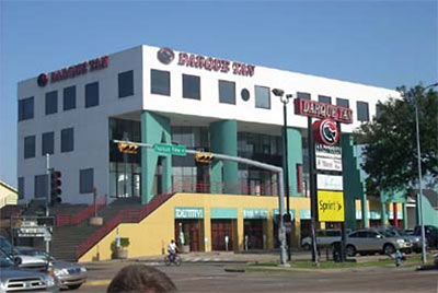
. . . the epicenter of H-Town cheese is the corner of Fountainview and Richmond. A four-story, day-glo, red, white, turquoise, and tan building looms over the southeastern corner there, and it houses a Sprint shop, a little downstairs bar with the godawful name Identity, a scalper’s office, a massage therapist, and a huge Darque Tan outlet.

Sure, Westheimer’s got some cheese, and is a little tattered around the edges in spots, but there’s a veneer of gentility as expressed by old-line businesses like Christie’s Seafood. Richmond, by contrast, used to have that sub-Landry’s fried seafood emporium King Fish Market, which despite the incessant awful commercials that polluted local airwaves circa 1999, is now out of business and practically in ruins. The whole lot of it is a great vat of rancid Velveeta.

As is much of the Richmond Strip. That giant sax outside of Billy Blues is looking more and more like the torch sticking out of the sand at the end of Planet of the Apes.

After the jump: how’s the nightlife?

CONTINUE READING THIS STORY

03/31/08 11:52am

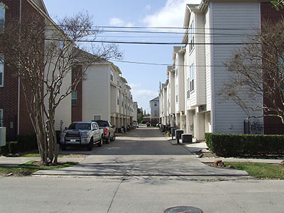
Alley Behind Townhomes Between Clay and W. Dallas, Houston

If you’re curious what the upper reaches of Montrose Blvd. look like from the viewpoint of an actual pedestrian, you’ll want to see blogger Charles Kuffner’s recent annotated photo walking tour of the area. Kuffner, who lived on Van Buren St. in the nineties, describes more recent developments on and around Montrose and Studemontfrom West Gray north to Washington:

I did this partly to document what it looks like now – if you used to live there but haven’t seen it in awhile, you’ll be amazed – and partly to point out what I think can be done to make the eventual finished product better. . . .

My thesis is simple. This is already an incredibly densely developed corridor, and it’s going to get more so as the new high rise is built [see Swamplot’s story here] and several parcels of now-empty land get sold and turned into something else. It’s already fairly pedestrian-friendly, but that needs to be improved. And for all the housing in that mile-long stretch of road, there’s not enough to do.

Kuffner’s guide is a Flickr photo set. You’ll get the most out of it if you view it as a slideshow with the captions turned on (on the link, click on Options in the lower right corner, then make sure Always Show Title and Description is checked).

After the jump: A few more photos from Kuffner’s tour, plus an ID on those new condos behind Pronto!

CONTINUE READING THIS STORY

01/31/08 5:38pm

Hillendahl Cemetery, Long Point, Spring Branch, Houston

There’s just too much to take in from the latest rambling, illustrated walking tour by David Beebe and John Nova Lomax, narrated in harmony from their two separate corners of the Texan blogosphere. The pair’s latest venture — appropriately enough — runs along Long Point, through the heart of Spring Branch:

. . . primarily Long Point is a binary street combining Mexico and Korea. In contrast to the multi-ethnic riot that is Bissonnet, or the Pan-Asian explosion that is Bellaire, Long Point is binary. Some businesses fuse into MexiKorea. The Koryo Bakery, right next door to the only Korean bookstore in Houston, touts its pan dulce y pastels, for example, and it seems that many of the Korean-owned businesses aim at Spanish-speakers more than Anglos. (Someone should open a restaurant out here called Jose Cho’s TaKorea.)

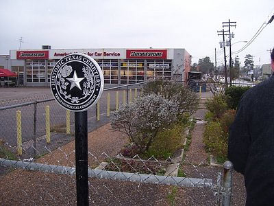
The camera-and-tequila-toting duo guide us through a shady thrift-store nirvana they declare to be drab but safe, pointing out salient features along the way: cans of silkworm pupae in a former Kroger turned Korean supermarket, and the historic Hillendahl Cemetery (pictured above) carved out of one corner of a Bridgestone tire barn parking lot.

After the jump, more Spring Branch walking-tour highlights!

CONTINUE READING THIS STORY

12/31/07 11:01am

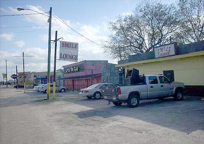
Smile Lounge, 4348 Telephone Rd., Houston

Telephone Road south of I-45 has changed forever, declares John Nova Lomax:

Gone is the Mexican Catholic blue-collar neighborhood to the north around Queen of Peace church, its place taken by a string of hot sheet motels, clip joints, massage parlors and other such venues of vice. This is what’s left of the Telephone Road Mark May, Steve Earle, Rodney Crowell, Culturcide and others have written songs about.

But it’s all impossibly sadder. The Telephone Road that Earle and Crowell sang about in the rollicking songs of that name is long gone. Crowell’s version is set in the ’50s and early ’60s, and Earle’s in the early ’70s. Today’s Telephone Road far better fits Earle’s “The Other Side of Town.”

There’s more street-level reporting in Lomax and David Beebe’s latest narrated and well-lubricated walking tour, which starts Downtown and heads east along Leeland, through a neighborhood called Edmondson Addition:

Boarded-up hovels line some streets, awaiting inevitable transformation into the (mostly shoddy) condos that are springing up like dandelions here. Other streets reminded us of some of Galveston’s less opulent older districts – one and two-story wood frame houses standing on bricks, interspersed with brick warehouses and workshops.

The story includes Lomax’s encounters with Golfcrest’s underground shopping-cart economy and his retelling of a Telephone Rd. crack-and-hookers tale too uh . . . racy to fit into a song lyric.

After the jump, a very different portrait of Telephone Rd. from an earlier era.

CONTINUE READING THIS STORY

09/17/07 10:33am

House at Southern End of Fifth Ward, HoustonJohn Nova Lomax chronicles another pedestrian adventure with drummer pal David Beebe in Houstoned—this time through desolate pockets of Houston’s East Side. Their potion-and-perspiration-soaked journey begins at the southern end of the Fifth Ward.

There, on the corner of Lyons Avenue and McKee, a dry-heaving stray dog in its death throes welcomed us to central Houston’s Chernobyl, a cursed warren of rusty train tracks, crumbling warehouses, and whole blocks that have reverted to wild coastal prairie.

Ruins of an entire neighborhood molder back here – unpainted shotgun shacks collapsing in on themselves scattered around a blocky brick building that looked like it was once a bar or liquor store. It had been stripped of all metal fixtures by street urchins and cut off from the electrical grid, but a sign in the window indicated it was for sale. “Call Bob,” it said. And evidently it was not so long ago a place of some importance, as a street teamer for a rapper named Marcelo had plastered a few promo posters on its door.

Next stop: Clinton Dr., where the “rank stench” of the 69th Street Wastewater Treatment Plant guides their path.

Lord have mercy on Clinton Drive. Save for a couple of islands of activity like the huge fenced-in KBR headquarters (which is rumored to be for sale), Clinton is now little more than a decrepit strip of ruined factories, warehouses fast crumbling into rubble, and decaying 1950s office buildings with broken windows and mold-stained walls.

It reminded me of 19th Century British gadfly William Cobbett’s description of the village of Deal, Sussex: “Deal is a most villainous place. It is full of filthy looking people. Great desolation of abomination has been going on here; tremendous barracks, partly pulled down and partly tumbling down and partly occupied by soldiers. Everything seems upon the perish. I was glad to hurry along through it…”

It wasn’t always such. From the Ship Channel’s opening until the advent of containerized shipping in the early ‘80s, Clinton and surrounding streets were bustling by day and by night, dotted with rice beer-soaked bars with names like the Cesspool, the Worker’s Bar, the Seafarer’s Retreat, the Mermaid Café, Tater’s Last Chance and Dottie’s Snug Harbor.

In those days, it could take a week to unload a cargo ship, and for much of that time, sailors were free to roam the port, dine in the restaurants, carouse in the bars, and find companionship where they may. The same went for the thousands of shore-based workers – the mechanics, channel pilots, stevedores, and tug boat crews.

Neighborhood on the waterfront: Coulda been a contender.

Photo: David Beebe and John Nova Lomax