10/22/13 3:45pm

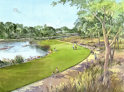
So the city has agreed to hand over maintenance of all the new bayou trails ’n’ stuff to the Houston Parks Board — it was the one condition that the Kinder Foundation stipulated before it would agree to donate $50 million to the Bayou Greenways project. That donation became a done deal earlier today. This dough, says the Parks Board, is going to allow construction to begin before the end of 2014 on as many as 14 new sections of trail — including even more work along Brays Bayou in Mason Park in the East End, shown in this rendering from SWA Group.

CONTINUE READING THIS STORY

10/22/13 11:35am

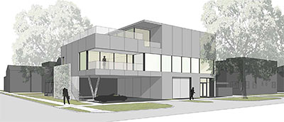
A variance to reduce the setback from Caroline and Truxillo was recently approved, clearing the way for this 2-story film studio to go up in Midtown. Dubbed Buffalo Studios, the CONTENT-designed building will sit on a 5,630-sq.-ft. lot at the southeast corner of Caroline and Truxillo, which appears to be currently occupied by a warehouse. The proposed site is catty-corner from the former Houston Light Guard Armory, now open as the Buffalo Soldiers National Museum, a block south of HCC and just around the corner from the proposed site of Retrospect Coffee, the cafe and wine bar being built out at that abandoned gas station on La Branch.

CONTINUE READING THIS STORY

10/18/13 10:00am

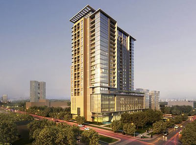
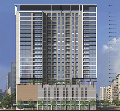
Here’s a rendering of that 25-story residential highrise Hines says it plans to start building in the Museum District in July. Designed by Munoz + Albin, the 259-unit, 301,000-sq.-ft. apartment building and parking garage will stand next to the Asia Society Texas Center on most of the block bound by Caroline, Oakdale, Southmore, and San Jacinto.

What’s missing from this rendering is that historic home on the corner of Caroline and Southmore whose owners chose not to sell. It appears that the property immediately west of the holdouts’ and next to the light rail line will become a 10,000-sq.-ft. “public-access park,” reports the Houston Business Journal: “In addition, there is potential for small retail space adjacent to the park, such as a café or light food services.”

Rendering: Hines

10/17/13 10:05am

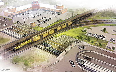
That no-tracks land along Harrisburg Blvd. between 66th and Cowling on the East End Line is supposed to look something like the underpass that these new renderings depict. Right now, though, Harrisburg isn’t passing under anything — but lying in wait instead between the nearly completed eastern and western sections of the line that stop here dead in their tracks. Though Mayor Parker announced more than 2 years ago that the East End Line would get $20.6 million in diverted funds to build the Hughes Underpass below the Union Pacific East Belt freight rail line, construction hasn’t started. Why? Well, it appears that Metro hasn’t selected a company yet.

CONTINUE READING THIS STORY

10/11/13 12:00pm

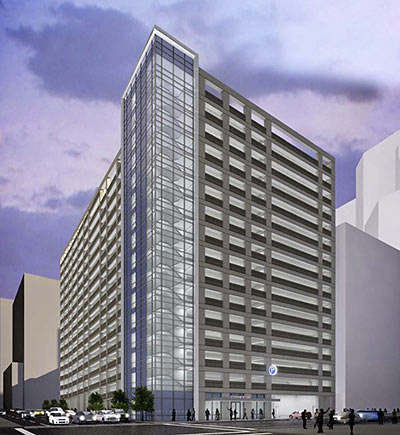
It appears that Gensler has submitted for review by the city planning commission this rendering of a 1,600-space, 16-story parking garage. Maps included in the agenda for the October 3 commission meeting show that the garage would stand Downtown at 1311 Louisiana, now a surface lot, and share the block bound by Louisiana, Polk, Milam, and Clay with the 12-story garage for the WEDGE International Tower.

CONTINUE READING THIS STORY

10/11/13 10:00am

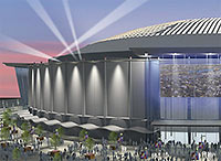
VOTE FOR NEW DOME, SAYS MAYOR PARKER As the demolition — or, as Judge Ed Emmett might call it, the improvement — of some of the exterior features of the Astrodome begins, Mayor Parker has declared her support of the seeming this-or-nothing $217 million bond measure that would pay for a slimming down and cleaning up of the aging icon to make it ready for convention and exhibition space. Says the incumbent about the so-called New Dome: “This plan will bring jobs, a positive economic impact and a renewed sense of pride in the Dome for all Houstonians.” [Preservation Houston; previously on Swamplot] Rendering: Harris County Sports and Convention Corporation

10/10/13 3:35pm

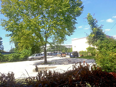
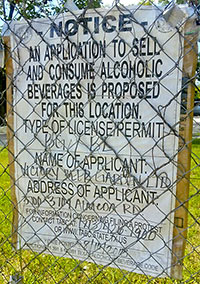
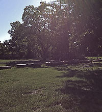
Here’s one more place where you will be able to drink some beer in Midtown: A reader sends these photos that show one of those TABC signs and peek over the weed-draped chain-link fence that surrounds this property next to Luigi’s Pizzeria on the 3700 block of Almeda, just around the corner from HCC and the Station Museum. It appears that something called the Victory Beer Garden is intended for this site, which county records show is owned by an entity controlled by Urban Deal’s Adam Brackman. As it happens, Urban Deal owns several parcels of land in the surrounding area. And a marketing flyer for one such parcel reveals an early version of a site plan for this garden of drinking . . .

CONTINUE READING THIS STORY

10/10/13 11:45am

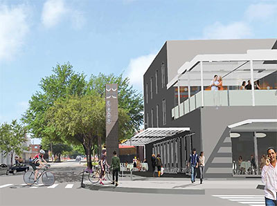
Here are some drawings of an apartment building that appears to be aimed for an empty lot in East Downtown. As drawn, the concept shows the 216-unit EaDo Place standing on the block bound by Bell, Clay, Chartres, and St. Emanuel — that’s right beside the former Meridian Club, where the food trucks idle and generators hum at the Houston Food Park. And it’s just 2 blocks from Bastrop St., where that pedestrian promenade leading to BBVA Compass Stadium is to be put into place. If built, the apartments would stand at 2616 Clay, just on the other side of the Southwest Fwy. from the George R. Brown Convention Center, and would top off some ground-floor retail, with a 30,938-sq.-ft. grocery store facing Bell and St. Emanuel.

CONTINUE READING THIS STORY

10/10/13 10:35am

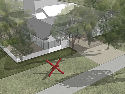
Architecture firm Stern and Bucek has come up with this rendering of the Menil Collection’s new cafe, part of the free museum’s long-planned expansion of its Montrose campus. The design for the cafe — which is yet to be named but will be run by Greg Martin (of Cafés Annie and Express and Taco Milagro) — appears to adapt and elaborate upon the gray bungalow at 1512 Sul Ross St., on the other side of that path from the Menil Bookstore; this is the same site, says a press release from the Menil Collection, that architect Renzo Piano originally had in mind for a similar amenity. So there’s that. Whatever it’ll be called, the cafe, it appears, will split the difference between the museum’s main entrance and the parking lot off W. Alabama.

CONTINUE READING THIS STORY

10/09/13 4:05pm

Here are a pair of early drawings and the site plan for that apartment tower Hines has said it’s considering putting up across the street from the Asia Society Texas Center in the Museum District. Previous reports and rumors pegged the building at 20 or 22 stories, but these elevations appear to show a 25-story structure, with 19 floors of apartments perched atop a 6-level parking garage. This drawing shows the north façade. The block Hines has in mind is bound by Caroline, Oakdale, Southmore, and San Jacinto, where the light rail runs. But it appears that the building won’t take up that whole block: The site plan shows that the tower has been drawn around that home on the corner of Southmore and Caroline, whose owners have been rumored to have refused to sell.

CONTINUE READING THIS STORY

10/08/13 10:15am

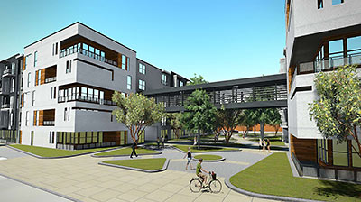
Here are the renderings of the apartments that Mill Creek wants to build right across the street from the gameday roar and glare and incessant rhythmic drumming that goes on at BBVA Compass Stadium. Dubbed EaDo Station, the 5-story, 315-unit complex will sit at the corner of Dowling and Texas. Mill Creek tells the Houston Chronicle that the goal is to have these apartments ready to go to coincide with the running of the light rail, still under construction itself, next August.

CONTINUE READING THIS STORY

10/07/13 1:15pm

FOOD TRUCKS AMONG THE TREES IN SPRING BRANCH EAST Another parcel of Houston real estate is being given over to food trucks: The Mangum Food Park is set to open in Spring Branch East in about 2 weeks, reports the Leader. The new park will be located at 2924 Mangum Rd., pictured here, just east of Hwy. 290. And unlike the busted concrete, street art, and for-lease signs that lend the Houston Food Park in East Downtown an urban grit, this spot outside the Loop would seem to have more of a rural feel: “The property . . . has been in [co-owner Paige] Hughes’ family since the early 1900s and has been a dairy farm and residence. The main work so far has been clearing ‘lots of dead trees’ . . . Enviably, there’s a row of large trees still standing along the south side of the land, which, along with canopied areas and plenty of tables, will provide shaded eating . . . .” [The Leader; previously on Swamplot] Photo of 2924 Mangum Rd.: Mangum Food Park
10/07/13 12:00pm

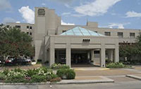
A NEW MIXTURE OF USES FOR THE OLD SPRING BRANCH MED CENTER The proud new owners of the 300,000-sq.-ft. Spring Branch Medical Center say they plan to flip the 18-acre property on Long Point Rd. into a residential and retail development. Investor Bruce Phillips tells the Houston Chronicle that the old medical buildings, most of which were built in the ’80s, might not have to come down to make the change happen and could be repurposed. The purchase was led by BlackSwan, which is also developing with Stream Realty that 25-story office tower near Washington on Waugh and Barnes. [Houston Chronicle ($); previously on Swamplot] Photo: MAM Jobs Network

10/07/13 11:00am

BUILDING A MONUMENT TO GATED FLOOD CONTROL AND TOURISM Protecting the Ship Channel during an Ike-like (or worse) storm surge has led some to propose a big dike, others a big gate. But UH professor of urban planning Tom Colbert doesn’t see why we couldn’t trouble ourselves to make such protection a real sight to see too: “Colbert likes the idea of . . . connecting the Centennial Gate and its levees to the proposed Lone Star National Recreation Area, undeveloped land that would both attract ecotourists and slow floodwaters,” reports the Houston Chronicle’s Lisa Gray: “I remembered one drawing I’d seen in [Colbert’s] PowerPoint show: Happy tourists, paddling kayaks past the Hartman Bridge, on one of the byways out of the big ships’ path, waterbirds and wetlands all around. Colbert motioned southeast, toward the Ship Channel’s mouth, toward Barbours Cut, the other possible location for the floodgate. There, he said, the levees would cross the channel’s water, connecting the Ship Channel’s artificial islands — made from dirt dredged from the channel — to the shore. Enough room could be left on top of the levee for a hiking path or even for car access; for the first time, it would be possible for people to get to the Atkinson Island Wildlife Management Area — a bird mecca on manmade land — without a boat. You could even, he notes, build a tourist destination atop one of those islands: He proposes a monument to Houston, the gateway to North America, the place where nature meets industry. In some drawings, just to give people the idea, he plunks the Statue of Liberty atop a Ship Channel island.” [Houston Chronicle ($); previously on Swamplot] Photo of Fred Hartman Bridge: Chuck Wilkson

10/07/13 10:00am

Construction should begin by the end of October to transform a chopped-up industrial street in East Downtown into something like the pedestrian promenade rendered here. Anton Sinkewich, the director of the East Downtown Management District, explains that 5 blocks of Bastrop St., between Bell and McKinney, running near the Houston Food Truck Park and leading toward BBVA Compass Stadium on Walker, will be regraded. A pedestrian-only crushed granite path will be installed and dozens of trees planted. This first part of the project is modest, says Sinkewich, though there are plans in place to include more amenities if and when the ’hood continues to grow.

CONTINUE READING THIS STORY