
05/21/18 4:30pm

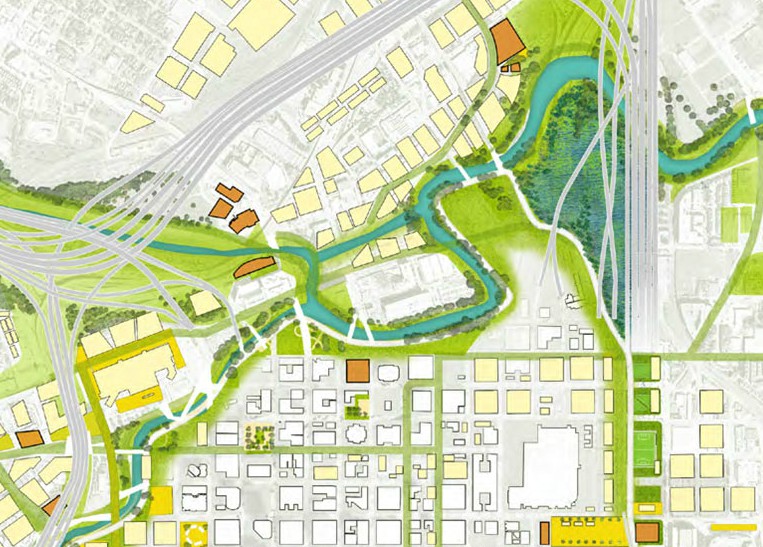
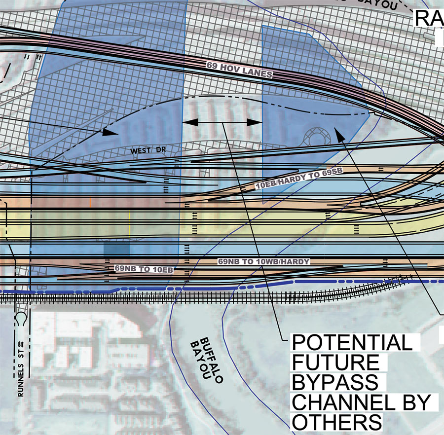
Remember that North Canal that showed up in Plan Downtown’s maps and drawing last year and included a island in Buffalo Bayou? Well, TxDOT’s latest schematics for its planned I-45 reroute include a bypass and island as well — but in an entirely different location. The highway agency’s map above — with west facing up — indicates a new waterway draining into Buffalo Bayou right underneath the section of I-45 it plans to build in place of a portion of the Houston Housing Authority’s Clayton Homes neighborhood. How the canal gets there is obscured, but a straight course northwest appears to shoot the gap between 2 planned detention ponds and cross under the existing section of 59 (shaded gray), before linking up with the bayou again east of Elysian St. Marooned on TxDOT’s version of the make-believe, bayou-banked island the canal would create: a few of the houses in Clayton Homes.

As TxDOT’s caption makes clear, it’d be up to someone else to actually build the waterway. Doing so wouldn’t preclude the previously proposed North Canal from being dug further upstream. Plan Downtown’s less technical map at top shows that waterway beginning at White Oak Bayou and emptying into a bend of Buffalo Bayou just west of Elysian. In doing so, its course creates an exclusive new landmass home to the Harris County jail.

Road map: TxDOT. Downtown map: Plan Downtown

Offshored
03/07/17 11:00am

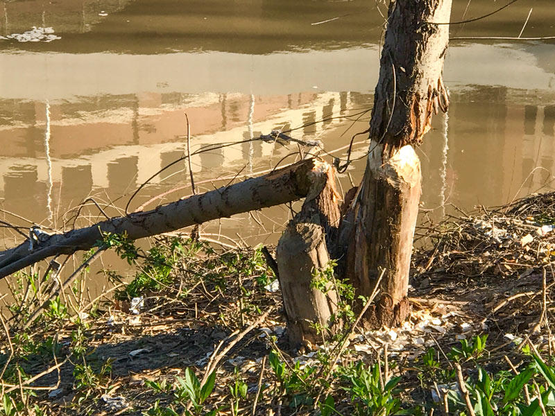
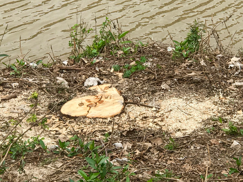
Tree drama at Allen's Landing, Downtown, Houston, 77002Tree drama at Allen's Landing, Downtown, Houston, 77002

The ongoing saga of the Allen’s Landing trees coming down recently in bits and pieces — apparently the handiwork of an elusive Buffalo Bayou beaver or 2 — has come to a likely end with the non-rodent-assisted removal of the final stumps, Swamplot’s semi-regular Franklin St. correspondent and wildlife tipster notes. But life around the White Oak-Buffalo confluence goes on! Spring is here, which means the ducks have been out and about, while the cranes are busy pulling fledgling parking garage superstructures up into the air:

CONTINUE READING THIS STORY

Didn’t Leave It To Beavers
01/24/17 12:30pm

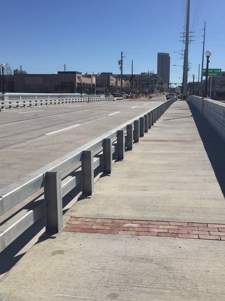
Yale St. at I-10, Heights, Houston, 77007

The crossing of Yale St. over White Oak Bayou is open again as of yesterday, beating that initially announced estimated reopening date by close to a year. The new structure should reduce the chronic weight anxieties of those using the crossing, which has been subject to various pounds-per-axle limits for years.

And what of the original 1931 Yale St. bridge bricks, and their fundraising Friend group?  The online component of the crowdfunded save-the-bricks campaign launched last year fell short of that $100,000 goal by more than a bit, but the organization says that pretty much all of the bricks are still being preserved — most of them were just bought by someone else, for incorporation into a not-yet-officially-announced “art-centered mixed use project in First Ward.” Boulevard Realty, headed by Bricks and Fountain Friend and instigator Bill Baldwin, also recently posted a photo purportedly showing the incorporation of some of the bricks into new segments of the White Oak Bayou greenway trail, something the crowdfunding effort helped pay for:

CONTINUE READING THIS STORY

White Oak Crossing
01/19/17 1:00pm

WHERE YESTERDAY’S SEWAGE OVERFLOWS FLOWED 69th St. Wastewater Treatment Plant, Magnolia Park, Houston, 77011Yesterday’s floodwater caused diluted sewage releases from the 69th St. Wastewater Treatment Plant, located near the crossing of 69th St. over Buffalo Bayou (just upstream from the new Buffalo Bend Nature Park and the Port of Houston Turning Basin). Houston Public Media notes the city’s rundown on where and how much: “The estimated volume of released wastewater as of 6 p.m. Wednesday was approximately 500,000 gallons at Halls Bayou at US 59 at Parker Rd.; approximately 160,000 gallons at White Oak Bayou Near Interstate 45 N. at Wrightwood St.; and approximately 500,000 gallons at Buffalo Bayou near the University of Houston Downtown, officials said.” The city also says anybody using their own private water wells in those areas should get them checked out (and boil water in the meanwhile). The 69th St. plant is the city’s largest wastewater facility, as well as a production site of Hou-Actinite fertilizer. [Houston Public Media; previously on Swamplot] Photo of 69th St. Wastewater Treatment Plant: Webber
10/21/16 1:30pm

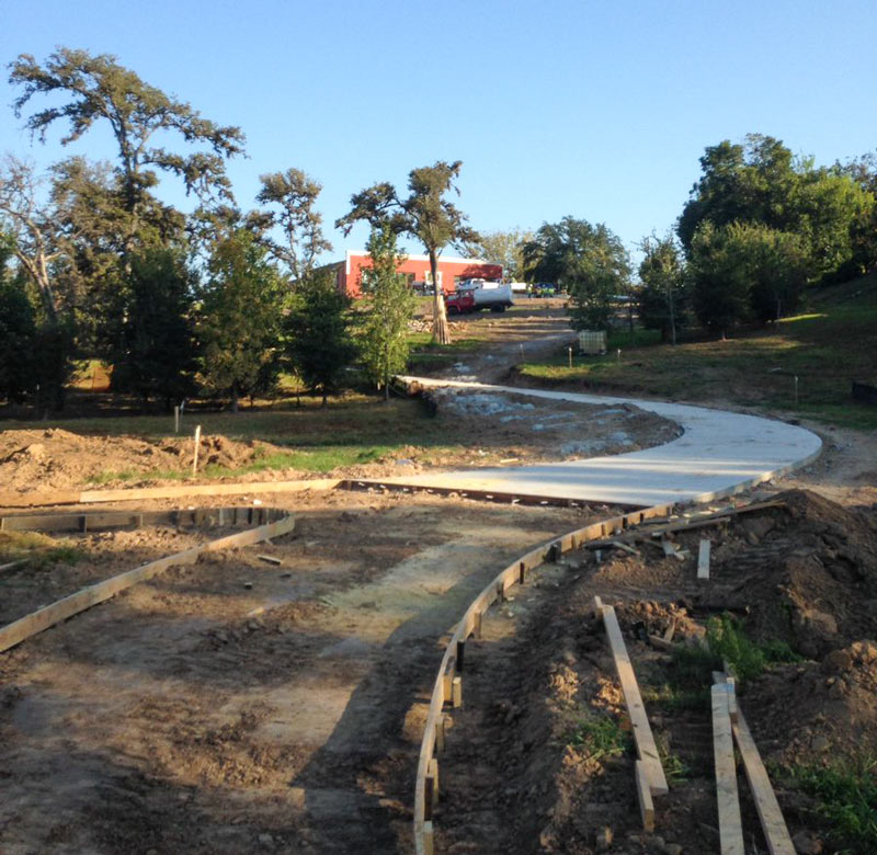
Trail construction along White Oak Bayou near Leonel Castillo Community Center, 2101 South St, Near Northside, Houston, 77009

A reader caught some shots last week of the current trailblazing going on between the Leonel Castillo Community Center and the White Oak Bayou greenway trail in Near Northside. The new connector should hit the path roughly between the south end of the building and the nearby Thomas Street Health Center HIV-slash-AIDS service building, just north of where the Heights hike-and-bike trail crosses over the bayou and under the Hogan St. bridge to merge with the White Oak trail on the way into Downtown:

CONTINUE READING THIS STORY

Closing Distance to Downtown
07/13/16 5:15pm

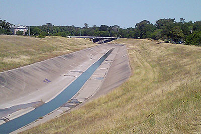
MIGHT WHITE OAK BAYOU DITCH ITS CONCRETE? white-oak-bayouThe Harris County Flood Control District is looking at removing the concrete lining from sections of the White Oak Bayou channel, writes Mihir Zaveri. The agency is conducting a study on redeveloping parts of the waterway along with the Memorial-Heights Redevelopment Authority (a.k.a. TIRZ 5); any future projects to come from the study would be within the TIRZ 5 boundaries, along sections of White Oak between roughly N. 610 and Houston St. Zaveri writes that the push “in part reflects the idea that waterways where flooding must be controlled don’t have to be eyesores, and in fact can become more natural settings for residents to bike, walk and gather. It follows decades-old conversations about how to shape waterways in a flood-prone region like Houston, where the rapidly growing population has increasingly come to demand improvements in quality of life.” With respect to balancing aesthetics against effective flood control practices, TIRZ 5 chairwoman Ann Lents tells Zaveri that “pretty is never going to trump functional . . . But because of new techniques, if we can find a way to do both better, I think that will be a great thing.” [Houston Chronicle] Photo of White Oak Bayou: Swamplot inbox
06/20/16 11:00am

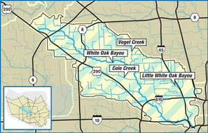
TEXAS SUPREME COURT: FLOOD CONTROL AGENCY DIDN’T CAUSE WHITE OAK FLOODING BY NOT CONTROLLING IT Harris County Flood Control District map of White Oak Bayou watershedOn Friday the state’s highest court reversed course on a class-action lawsuit filed by White Oak Bayou-adjacent homeowners flooded by turn-of-the-century storms including Allison, writes Mike Morris. Gabrielle Banks previously reported that some 200-plus families living along the upper reaches of bayou between Jersey Village and Houston Rosslyn Rd. had been asking for a collective $85 million or so to make up for flood damage and property devaluation they say was caused by the agency not completing some planned detention projects that haven’t gotten expected federal funding. The court decided last fall that the plaintiff’s case was strong enough to warrant a juried trial — at which point more than a dozen city and state government bodies filed letters asking it to please reconsider. Friday’s ruling came down in favor of the flood control agency, though the 4 dissenting judges wrote that the organization knew approved upstream development would lead to flooding without the planned projects, and therefore caused flooding by not requiring enough mitigation. The ruling could impact the similar lawsuit recently filed by a group of Memorial-area homeowners against the city and TIRZ 17, though in that case the group Residents Against Flooding is asking for flood control-related action rather than money. [Houston Chronicle; previously on Swamplot] Map of White Oak Bayou watershed: Harris County Flood Control District
04/18/16 1:00pm

1031 Stude St, Woodland Heights, Houston, 77007

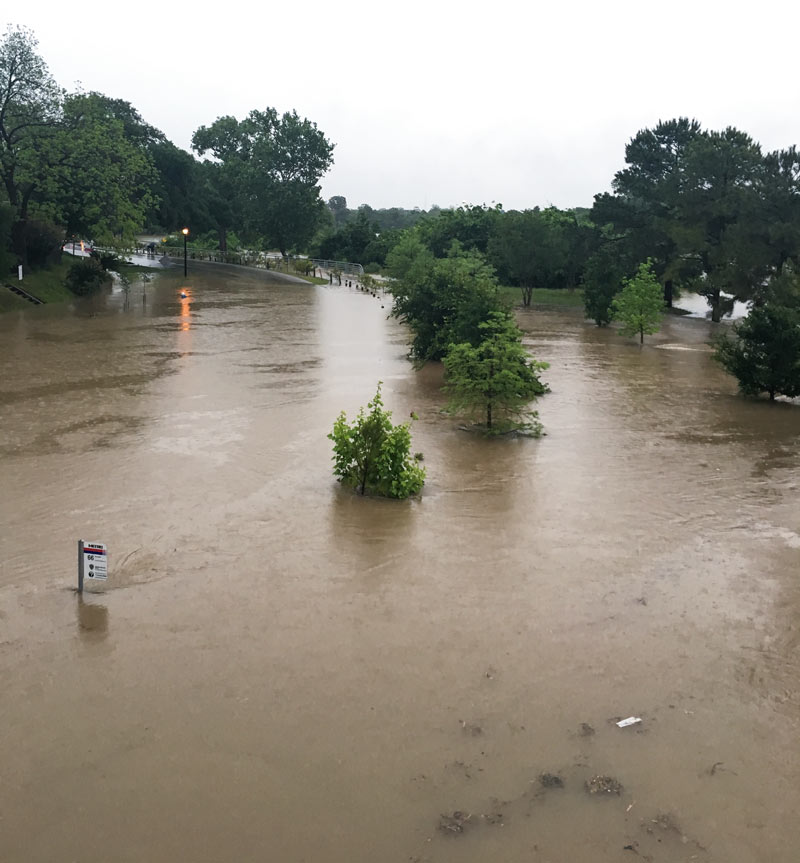
While all bus and rail service is currently on hold due to widespread flooding, the route 66 bus stop sign on White Oak Dr. is still bravely performing its signaling duties (lower left above) as water from White Oak Bayou rushes past. A reader sends several studies of the area around Stude Park at the Taylor St. bridge at the southern edge of the Woodland Heights area; here’s a few more shots of the White Oak Bayou greenways gone brown this morning, with I-10 in the background to the south:

CONTINUE READING THIS STORY

Woodland Heights
03/07/16 12:15pm

Proposed White Oak Bayou Village redevelopment, Antoine Dr. at W. Little York Rd., Near Northwest, Houston, 77088Livable Centers plan, Near Northwest, Houston, 77088

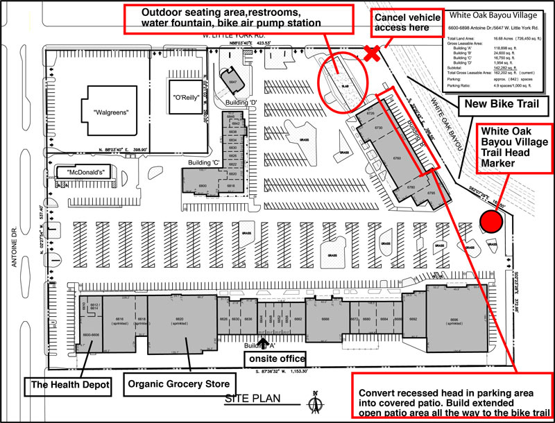
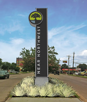
Plans are in the works to give the shopping center at the southwest corner of Antoine Dr. and W. Little York Rd. a thorough redesign and rebranding as White Oak Bayou Village. A spokesperson for Nankani Development tells Swamplot that the group is seeking both tenants and ideas for the center’s redevelopment, which will be geared toward drawing bicycle traffic. So far, plans include an about-face for the bayou-side building in the back of the shopping center (labeled Building B above) by way of new glassy storefronts opening toward the White Oak Bayou greenway now running behind it; the developers claim the center would become the first private development to cater explicitly to the expanding bayou trail system.

Per preliminary plans, car access to the back of the shopping center would be blocked off. Former parking spaces along the back Building B (currently home to Northwest Beauty School) would be made over into a covered patio leading to the bayou trail. For the pad site of the burned-down former restaurant next door, the development group is considering a park-like events plaza that could host a bi-monthly farmer’s market — along with a giant chess board, maybe, or even a bayou-side zip lining station. “We are open to anything at this point,” writes the Nankani rep.

Hoped-for tenants for the center currently include a coffee shop-slash-electric bike rental joint, an ice house-style music venue, and an outdoor obstacle course and adult gym — possibly from Sam Sann of American Ninja Warrior fame, who trains contestants at his Iron Sports gym in Cypress.

CONTINUE READING THIS STORY

Bayou Turnaround
04/24/14 12:00pm

800-booth-16

800-booth-01

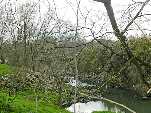
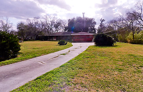
Little White Oak Bayou meanders by the back of a property (and so do a couple of uh, hikers in the background of the top photo) located east of N. Main St. and about 3 sidewalk-lined blocks from the Metro rail station at Fulton St. Is the Northside property located in De Noyles, as indicated in the listing, or is it Booth North Main, as recorded by HCAD for all addresses on the block? The listing’s all-cap message is all about redeveloping the acre-plus lot of land, not the 1960 home that sits on it at the end of a long driveway (above). A month ago, the asking price dropped to $1.1 million. Since January (and in a previous listing dating back to September 2013) it had been sitting at $1.6 million. But even that was down a bit from someone’s expectations: In 2008, a six-month listing’s asking price kicked off at $2 million.

CONTINUE READING THIS STORY

Mind the Gap
12/06/13 10:30am

Retention Pond Along White Oak Bayou Between Shepherd and Yale, Houston Heights

A reader sends in pics showing how construction is progressing on the 3 retention ponds along White Oak Bayou TxDOT is building between Yale and Shepherd — and hoping to trade them for any available updates about plans for the adjacent segment of the planned bayou-side path: “Looks like they are making progress with tree planting and installation of pavers on the slopes. They have left a wide swath of level ground around the entire perimeter. They are still doing earthwork on the north end, and it looks like they still need to excavate more soil from the center pond, but you can make your way around all three detention ponds.”

The photo at top shows the center pond (south of the bayou), looking northeast, with White Oak Bayou barely visible off to the lower right. Below, a view of the northernmost piece, Rutland Pond, a portion of which interrupts 6th St. (where the orange construction fencing is visible):

CONTINUE READING THIS STORY

On Rutland Pond
10/03/13 3:30pm

Construction began yesterday on a new 1.35-mile segment of hike and bike trail on White Oak Bayou, the first of 5 planned sections that will more or less formalize the route that some trail users have taken it upon themselves to blaze. Eventually, the $3.4 million that the Bayou Greenways project will spend here will create about 11 miles of off-street passage from Hollister Rd. in Spring Branch to Downtown.

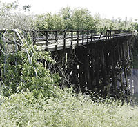
But first things first: This new segment will span Shepherd and Durham and W. 11th St., where, as this rendering from SWA Group shows, that charred MKT railroad trestle will be replaced with a snazzy new one — somewhat to the chagrin of John Nova Lomax, you’ll remember, who’s on the record lamenting the yoga dads and their ilk that that char might have once scared off.

Rendering: SWA Group

08/21/13 4:15pm

FEARING THE YOGA DADS THE NEW HEIGHTS HIKE AND BIKE LINK WILL BRING The Houston Chronicle reports that the Bayou Greenways project is paying for a new 1.35-mile section hooking up the existing White Oak Bayou and Heights hike and bike trails. Part of completing this stretch will require replacing the bridge shown here, a burned-out trestle that butts up to the former Eureka Railyard. Psyched about this new link that, when completed in 2014, will get cyclists from Downtown all the way out to Antoine Dr., Houstonia’s John Nova Lomax still seems more than a little ambivalent about losing the blackened thing: “The eastern foot of that bridge has been a meditation zone / power spot of mine for the last few years, my own trash-strewn bayou-pungent pre- and post-work Eden. No more — soon it will teem with with yoga dads and crossfit maniacs and their occasionally ill-behaved pooches.” [Ultimate Heights; Houstonia; previously on Swamplot] Photo: Patrick Feller [license]

05/13/13 11:00am

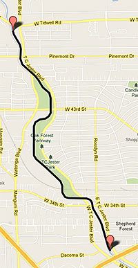
THE ART GUYS TO START UNRAVELING This is the route the Art Guys say they will be taking tomorrow morning when they stage the 5th of the yearlong series of monthly celebratory stunts they’re calling “12 Events:” Titling this one “A Length of String,” Jack Massing and Michael Galbreth will unwind a spool of thread they’ve had sitting around since 1983 while walking along White Oak Bayou between W. Tidwell and T.C. Jester, just north of the Loop, and then they’ll turn around . . . and wind it back up. Last month, you’ll remember, they donned tuxedos and conducted the sounds of the Ship Channel from the Santa Anna Capture Site in Pasadena. [Art Guys; previously on Swamplot] Map: Art Guys

04/05/13 2:00pm

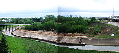
A reader sends this stitched-together panorama of the Heights bike trail spanning White Oak Bayou and wonders what’s going on with all the denuding: “This is kitty corner from where the proposed Emes Place condos will go. Mother nature swamped their work in the bayou with the recent rains. They appear to be taking revenge by bulldozing the nearby clump of forest. This is a larger piece of bird/homeless person sanctuary than the tract Emes Place is to be on, so I wonder what the story is. Harris County Flood Control comes by the site all the time, but I can’t find any mention of it on their website, or anywhere.”

Photo: Swamplot inbox